Moreton Bay is a locality split between the City of Brisbane and the City of Redland, both in Queensland, Australia. The locality includes all of the bay Moreton Bay between the mainland of the City of Brisbane and the City of Redland across to the western coast of Moreton Island and the western coast of North Stradbroke Island. In the 2021 census, Moreton Bay had a population of 0 people.

Mount Nebo is a rural locality in the City of Moreton Bay, Queensland, Australia. In the 2016 census, Mount Nebo had a population of 424 people.
Mount Pleasant is a rural locality in the City of Moreton Bay, Queensland, Australia. In the 2016 census, Mount Pleasant had a population of 332 people.
Ningi is a town and locality in the City of Moreton Bay, Queensland, Australia. In the 2016 census, the locality of Ningi had a population of 4,675 people. It is near Caboolture.

Fig Tree Pocket is a riverside western suburb in the City of Brisbane, Queensland, Australia. In the 2021 census, Fig Tree Pocket had a population of 4,345 people.
Donnybrook is a coastal town and locality in the City of Moreton Bay, Queensland, Australia. In the 2016 census, the locality of Donnybrook had a population of 617 people.

The City of Moreton Bay, known until July 2023 as the Moreton Bay Region, is a local government area in the north of the Brisbane metropolitan city in South East Queensland, Australia. Established in 2008, it replaced three established local government areas, the City of Redcliffe and the Shires of Pine Rivers and Caboolture.

Beachmere is a coastal rural town and locality in the City of Moreton Bay, Queensland, Australia. In the 2021 census, the locality of Beachmere had a population of 4,782 people.

Joyner is a suburb in the City of Moreton Bay, Queensland, Australia. It is part of the Brisbane metropolitan area. In the 2016 census, Joyner had a population of 2,833 people.

Samsonvale is a rural locality in the City of Moreton Bay, Queensland, Australia. In the 2016 census, Samsonvale had a population of 590 people.
Cowan Cowan is an island town and locality in the City of Brisbane, Queensland, Australia. In the 2016 census, the locality of Cowan Cowan had a population of 28 people.

Draper is a rural residential locality in the City of Moreton Bay, Queensland, Australia. In the 2016 census, Draper had a population of 676 people.

Booroobin is a rural locality split between the City of Moreton Bay and the Sunshine Coast Region in Queensland, Australia. In the 2021 census, Booroobin had a population of 258 people.
Laceys Creek is a rural locality in the City of Moreton Bay, Queensland, Australia. In the 2016 census, Laceys Creek had a population of 278 people.
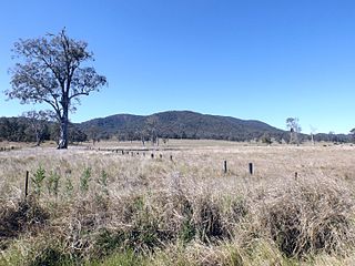
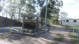
Neurum is a rural town and locality in the City of Moreton Bay, Queensland, Australia. In the 2016 census, the locality of Neurum had a population of 142 people.

Rocksberg is a rural locality in the City of Moreton Bay, Queensland, Australia. In the 2016 census, Rocksberg had a population of 300 people.

Toorbul is a coastal town and a locality in the City of Moreton Bay, Queensland, Australia. In the 2016 census, Toorbul had a population of 930 people.

Steiglitz is a rural coastal town and locality in the City of Gold Coast, Queensland, Australia. In the 2016 census the locality of Steiglitz had a population of 705 people.

Southern Moreton Bay Islands is an island group locality in the north-east of the City of Gold Coast, Queensland, Australia. In the 2021 census, Southern Moreton Bay Islands had no people.
Kooringal is a coastal town and locality on the south-west coast of Moreton Island within the City of Brisbane, Queensland, Australia. In the 2016 census the locality of Kooringal had a population of 45 people.

