
Mount Nebo is a rural locality in the City of Moreton Bay, Queensland, Australia. In the 2016 census, Mount Nebo had a population of 424 people.
Mount Pleasant is a rural locality in the City of Moreton Bay, Queensland, Australia. In the 2016 census, Mount Pleasant had a population of 332 people.

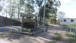
Mount Glorious is a rural locality in the City of Moreton Bay, Queensland, Australia. In the 2016 census, Mount Glorious had a population of 296 people.

Kilcoy is a rural town and locality in the Somerset Region, Queensland, Australia. In the 2021 census, the locality of Kilcoy had a population of 1,996 people.

Woodford is a rural town and locality in the City of Moreton Bay, Queensland, Australia. In the 2016 census, the locality of Woodford had a population of 3,458 people.
Ocean View is a rural locality in the City of Moreton Bay, Queensland, Australia. In the 2016 census, Ocean View had a population of 936 people.

Mount Mee is a rural town and locality in the City of Moreton Bay, Queensland, Australia. In the 2021 census, Mount Mee had a population of 519 people.

D'Aguilar is a rural town and locality in the City of Moreton Bay, Queensland, Australia. In the 2016 census, the locality of D'Aguilar had a population of 1,207 people.
King Scrub is a rural locality in the City of Moreton Bay, Queensland, Australia. In the 2016 census, King Scrub had a population of 348 people. It is located on the northern outskirts of Dayboro.

Rocksberg is a rural locality in the City of Moreton Bay, Queensland, Australia. In the 2016 census, Rocksberg had a population of 300 people.
Stanmore is a rural locality in the City of Moreton Bay, Queensland, Australia. In the 2021 census, Stanmore had a population of 454 people.
Stony Creek is a rural locality in the City of Moreton Bay in Queensland, Australia. In the 2016 census Stony Creek had a population of 262 people.

Villeneuve is a rural town and locality in the Somerset Region, Queensland, Australia. In the 2021 census, the locality of Villeneuve had a population of 193 people.

Mount Delaney is a rural locality in the City of Moreton Bay, Queensland, Australia. In the 2016 census Mount Delaney had a population of 85 people.

Rush Creek is a rural locality in the City of Moreton Bay, Queensland, Australia. In the 2016 census, Rush Creek had a population of 157 people.

Glenfern is a rural locality in the Somerset Region, Queensland, Australia. In the 2016 census Glenfern had a population of 10 people.
Sandy Creek is a rural locality in the Somerset Region, Queensland, Australia. In the 2016 census, Sandy Creek had a population of 567 people.

Mount Kilcoy is a rural locality in the Somerset Region, Queensland, Australia. In the 2021 census, Mount Kilcoy had a population of 277 people.
Winya is a rural locality in the Somerset Region, Queensland, Australia. In the 2016 census, Winya had a population of 72 people.

Woolmar is a rural locality in the Somerset Region, Queensland, Australia. In the 2021 census, Woolmar had a population of 565 people.


