Wights Mountain, Queensland

Last updated

Wights Mountain
Queensland
Samford Bora Grounds 2023.jpg
Samford Bora Grounds, 2023
Australia Queensland location map.svg
Red pog.svg
Wights Mountain
Wights Mountain, Queensland
Coordinates 27°23′47″S152°50′51″E / 27.3963°S 152.8475°E / -27.3963; 152.8475 (Wights Mountain (centre of locality))
Population793 (2016 census) [1]
 • Density87.1/km2 (225.7/sq mi)
Postcode(s) 4520
Area9.1 km2 (3.5 sq mi)
Time zone AEST (UTC+10:00)
Location
LGA(s) City of Moreton Bay
State electorate(s) Pine Rivers
Federal division(s) Dickson
Suburbs around Wights Mountain:
Highvale Samford Valley Samford Valley
Highvale Wights Mountain Camp Mountain
Jollys Lookout Jollys Lookout Jollys Lookout

Wights Mountain is a rural locality in the City of Moreton Bay, Queensland, Australia. [2] In the 2016 census, Wights Mountain had a population of 793 people. [1]

Contents

Geography

Wights Mountain is 27.8 kilometres (17.3 mi) by road from the Brisbane CBD. [3]

History

The locality was named after selector George Wight who settled in the area in the late 1860s. [2]

Samford Valley Steiner School opened on 18 February 1987. [4]

Demographics

In the 2011 census, Wights Mountain had a population of 725 people, 50.3% female and 49.7% male. [5] The median age of the Wights Mountain population was 41 years, 4 years above the national median of 37. 75.2% of people living in Wights Mountain were born in Australia. The other top responses for country of birth were England 8.6%, New Zealand 2.5%, Canada 1.2%, United States of America 1.1%, Switzerland 1.1%. 93.5% of people spoke only English at home; the next most common languages were 1.8% German, 0.6% Hindi, 0.4% French, 0.4% Cantonese, 0.4% Italian. [5]

In the 2016 census, Wights Mountain had a population of 793 people. [1]

Education

Samford Valley Steiner School is a private primary and secondary (Prep-12) school for boys and girls at Narrawa Drive ( 27°23′33″S152°51′30″E / 27.3924°S 152.8583°E / -27.3924; 152.8583 (Samford Valley Steiner School) ). [6] [7] In 2017, the school had an enrolment of 339 students with 29 teachers (26 full-time equivalent) and 29 non-teaching staff (21 full-time equivalent). [8]

Amenities

There are a number of parks in the locality:

Related Research Articles

<span class="mw-page-title-main">Mount Glorious</span> Suburb of City of Moreton Bay, Queensland, Australia

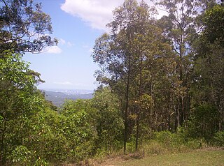
Mount Glorious is a rural locality in the City of Moreton Bay, Queensland, Australia. In the 2016 census, Mount Glorious had a population of 296 people.

Bunya is a suburb in the City of Moreton Bay, Queensland, Australia. In the 2016 census, Bunya had a population of 1,916 people.

<span class="mw-page-title-main">Camp Mountain, Queensland</span> Suburb of City of Moreton Bay, Queensland, Australia

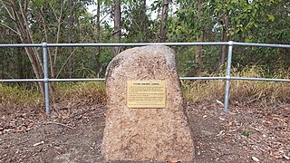
Camp Mountain is a rural locality in the City of Moreton Bay, Queensland, Australia. In the 2016 census, Camp Mountain had a population of 1,416 people.

<span class="mw-page-title-main">Closeburn, Queensland</span> Suburb of City of Moreton Bay, Queensland, Australia

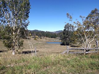
Closeburn is a rural locality in the City of Moreton Bay, Queensland, Australia. In the 2016 census, Closeburn had a population of 594 people.

Kawungan is a suburb of Hervey Bay in the Fraser Coast Region, Queensland, Australia. In the 2016 census Kawungan had a population of 4,816 people.

<span class="mw-page-title-main">Draper, Queensland</span> Suburb of City of Moreton Bay, Queensland, Australia

Draper is a rural residential locality in the City of Moreton Bay, Queensland, Australia. In the 2016 census, Draper had a population of 676 people.

<span class="mw-page-title-main">Highvale, Queensland</span> Suburb of Moreton Bay City, Queensland, Australia

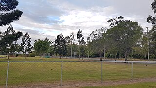
Highvale is a rural residential locality in the City of Moreton Bay, Queensland, Australia. In the 2016 census, Highvale had a population of 1,766 people.

<span class="mw-page-title-main">Yugar, Queensland</span> Suburb of City of Moreton Bay, Queensland, Australia

Yugar is a rural locality in the City of Moreton Bay, Queensland, Australia. In the 2021 census, Yugar had a population of 406 people.

<span class="mw-page-title-main">Undullah, Queensland</span> Suburb of City of Logan, Queensland, Australia

Undullah is a rural locality split between the City of Logan and the Scenic Rim Region, Queensland, Australia. In the 2016 census, Undullah had a population of 45 people.

<span class="mw-page-title-main">Palen Creek, Queensland</span> Suburb of Scenic Rim Region, Queensland, Australia

Palen Creek is a rural locality in the Scenic Rim Region, Queensland, Australia. It borders New South Wales. In the 2016 census, Palen Creek had a population of 280 people.

<span class="mw-page-title-main">Mount Mort, Queensland</span> Suburb of Ipswich, Queensland, Australia

Mount Mort is a rural locality in the City of Ipswich, Queensland, Australia. In the 2021 census, Mount Mort had a population of 78 people.

<span class="mw-page-title-main">Sandy Creek, Queensland</span> Suburb of Somerset Region, Queensland, Australia

Sandy Creek is a rural locality in the Somerset Region, Queensland, Australia. In the 2016 census, Sandy Creek had a population of 567 people.

<span class="mw-page-title-main">Hazeldean, Queensland</span> Suburb of Somerset Region, Queensland, Australia

Hazeldean is a rural locality in the Somerset Region, Queensland, Australia. In the 2016 census, Hazeldean had a population of 262 people.

<span class="mw-page-title-main">Knapp Creek, Queensland</span> Suburb of Scenic Rim Region, Queensland, Australia

Knapp Creek is a rural locality in the Scenic Rim Region, Queensland, Australia. In the 2016 census, Knapp Creek had a population of 59 people.

Cooeeimbardi is a rural locality in the Somerset Region, Queensland, Australia. In the 2016 census Cooeeimbardi had a population of 7 people.

Townson is a rural locality in the Lockyer Valley Region, Queensland, Australia. In the 2016 census, Townson had a population of 38 people.

<span class="mw-page-title-main">Clintonvale, Queensland</span> Suburb of Southern Downs Region, Queensland, Australia

Clintonvale is a rural locality in the Southern Downs Region, Queensland, Australia. In the 2016 census, Clintonvale had a population of 74 people.

<span class="mw-page-title-main">Moorang, Queensland</span> Suburb of Scenic Rim Region, Queensland, Australia

Moorang is a rural locality in the Scenic Rim Region, Queensland, Australia. In the 2016 census, Moorang had a population of 46 people.

Eskdale is a rural locality in the Somerset Region, Queensland, Australia. In the 2021 census, Eskdale had a population of 34 people.

Doongul is a rural locality in the Fraser Coast Region, Queensland, Australia. In the 2021 census, Doongul had a population of 35 people.

References

  1. 1 2 3 Australian Bureau of Statistics (27 June 2017). "Wights Mountain (SSC)". 2016 Census QuickStats. Retrieved 20 October 2018. OOjs UI icon edit-ltr-progressive.svg
  2. 1 2 "Wights Mountain – locality in Moreton Bay Region (entry 50233)". Queensland Place Names. Queensland Government . Retrieved 16 November 2019.
  3. Google (29 May 2022). "Brisbane CBD to Wights Mountain" (Map). Google Maps . Google. Retrieved 29 May 2022.
  4. Queensland Family History Society (2010), Queensland schools past and present (Version 1.01 ed.), Queensland Family History Society, ISBN   978-1-921171-26-0
  5. 1 2 Australian Bureau of Statistics (31 October 2012). "Wights Mountain (State Suburb)". 2011 Census QuickStats. Retrieved 16 February 2014. OOjs UI icon edit-ltr-progressive.svg
  6. "State and non-state school details". Queensland Government. 9 July 2018. Archived from the original on 21 November 2018. Retrieved 21 November 2018.
  7. "Samford Valley Steiner School". Archived from the original on 28 January 2019. Retrieved 21 November 2018.
  8. "ACARA School Profile 2017". Archived from the original on 22 November 2018. Retrieved 22 November 2018.
  9. 1 2 3 4 "Land for public recreation - Queensland". Queensland Open Data. Queensland Government. 20 November 2020. Archived from the original on 22 November 2020. Retrieved 22 November 2020.