Wamuran, Queensland

Last updated

Wamuran
Queensland
Kilcoy railway at Wamuran Queensland.jpg
Australia Queensland location map.svg
Red pog.svg
Wamuran
Wamuran, Queensland
Coordinates 27°02′25″S152°51′41″E / 27.0402°S 152.8613°E / -27.0402; 152.8613 (Wamuran (town centre))
Population3,196 (2016 census) [1]
 • Density46.93/km2 (121.55/sq mi)
Postcode(s) 4512
Area68.1 km2 (26.3 sq mi)
Time zone AEST (UTC+10:00)
Location
LGA(s) City of Moreton Bay
State electorate(s) Glass House
Federal division(s) Longman
Localities around Wamuran:
Bracalba Woodford Elimbah
Wamuran Basin
Wamuran Caboolture
Moodlu
Campbells Pocket
Rocksberg
Corymbia
Waraba
Bellmere

Wamuran is a rural town and locality in the City of Moreton Bay, Queensland, Australia. [2] [3] In the 2021 census, the locality of Wamuran had a population of 4,228 people. [4]

Contents

Wamuran is known for its roadside stalls selling the local produce including strawberries and pineapples. [5]

In April 2023, the Queensland Government decided to reflect the growing population of the region by creating five new localities named Corymbia, Greenstone, Lilywood, Wagtail Grove, and Waraba by excising parts of the existing localities of Bellmere, Rocksberg, Upper Caboolture, and Wamuran. [6] [7] [8] Prior to land redistribution, Waraba was part of Wamuran. [3]

Geography

Pineapples, Gamgee Road, 2015 Pineapples Wamuran Queensland.jpg
Pineapples, Gamgee Road, 2015

Wamuran is located west of the larger centre of Caboolture, and southeast of D'Aguilar.

In the north of Wamuran are several small sections of Beerburrum West State Forest. [9] Part of the south west boundary is marked by the Caboolture River.

History

The locality takes its name from its railway station, which was named after a local Aboriginal man, Menvil Wanmaurn (also known as Jacky Delaney). [5]

Newlands Provisional School opened in 1915 and closed in 1927. [10] [11]

Wamuran Provisional School opened on 17 October 1921. It later became Wamuran State School, possibly in 1925 when it moved into a new school building which had formerly been the Twin View State School near Elimbah. [12] [13]

St Martin's Anglican Church was dedicated on 7 November 1871 by Coadjutor Bishop John Hudson. Its closure was approved in August 1992. [14]

Wamuran Baptist Church opened in 1921. [15] [16] [17] It was built on land described as a "magnificent site" donated by Mr H. Behrens. [18]

In April 2023, the Queensland Government decided to reflect the growing population of the region by creating five new localities named Corymbia, Greenstone, Lilywood, Wagtail Grove, and Waraba by excising parts of the existing localities of Bellmere, Rocksberg, Upper Caboolture, and Wamuran. [6] [7] [8] Wamuran lost land to Waraba. [3]

Demographics

In the 2011 census, the locality of Wamuran recorded a population of 2,850 people. [19]

In the 2016 census, the locality of Wamuran had a population of 3,196 people. [1]

In the 2021 census, the locality of Wamuran recorded a population of 4,228 people, 49.0% female and 51.0% male. [4] The median age of the Wamuran population was 43 years, 5 years above the national median of 38. 80.1% of people living in Wamuran were born in Australia, 13.2% above the national average of 66.9%. The other top responses for country of birth were England (3.9%), New Zealand (3.3%), South Africa (0.9%), Vietnam (0.6%), Philippines (0.5%). 90.7% of people spoke only English at home; the next most common languages were Vietnamese (0.8%), Italian (0.4%), Mandarin (0.3%), Spanish (0.3%), Urdu (0.2%). [4]

Education

Wamuran State School is a government primary (Prep-6) school for boys and girls at 1066-1086 D'Aguilar Highway ( 27°02′27″S152°51′42″E / 27.0407°S 152.8618°E / -27.0407; 152.8618 (Wamuran State School) ). [20] [21] In 2017, the school had an enrolment of 300 students with 23 teachers (18 full-time equivalent) and 19 non-teaching staff (11 full-time equivalent). [22]

There are no secondary schools in Wamuran. The nearest government secondary schools are Tullawong State High School and Caboolture State High School, both in neighbouring Caboolture to the east. [23]

Related Research Articles

<span class="mw-page-title-main">Caboolture, Queensland</span> Suburb of Brisbane, Queensland, Australia

Caboolture is a town and suburb in the City of Moreton Bay, Queensland, Australia. In the 2021 census, the suburb of Caboolture had a population of 29,534 people. It is located on the northern side of the Caboolture River.

<span class="mw-page-title-main">D'Aguilar Highway</span> Highway in Queensland, Australia

The D'Aguilar Highway is a two-lane highway linking the Bruce Highway near Caboolture with the Bunya Highway in Kingaroy in the state of Queensland, Australia. Major towns along the route include Woodford, Kilcoy, Blackbutt, Yarraman, and Nanango. The highway is approximately 164 km (102 mi) in length. The D'Aguilar Highway's highest elevation along its length is 527 m just north of Yarraman, and the lowest point is at 26.8 m just west of Caboolture.

<span class="mw-page-title-main">Woodford, Queensland</span> Town in Queensland, Australia

Woodford is a rural town and locality in the City of Moreton Bay, Queensland, Australia. In the 2016 census, the locality of Woodford had a population of 3,458 people.

<span class="mw-page-title-main">Morayfield, Queensland</span> Suburb of Moreton Bay, Queensland, Australia

Morayfield is a town and suburb in the City of Moreton Bay, Queensland, Australia. In the 2016 census, the suburb of Morayfield had a population of 21,394 people.

<span class="mw-page-title-main">City of Moreton Bay</span> Local government area in Queensland, Australia

The City of Moreton Bay, known until July 2023 as the Moreton Bay Region, is a local government area in the north of the Brisbane metropolitan city in South East Queensland, Australia. Established in 2008, it replaced three established local government areas, the City of Redcliffe and the Shires of Pine Rivers and Caboolture.

<span class="mw-page-title-main">Beachmere, Queensland</span> Town in Queensland, Australia

Beachmere is a coastal rural town and locality in the City of Moreton Bay, Queensland, Australia. In the 2021 census, the locality of Beachmere had a population of 4,782 people.

<span class="mw-page-title-main">Caboolture South, Queensland</span> Suburb of Moreton Bay, Queensland, Australia

Caboolture South is a suburb in the City of Moreton Bay, Queensland, Australia. In the 2016 census, Caboolture South had a population of 5,300 people.

<span class="mw-page-title-main">D'Aguilar, Queensland</span> Suburb of City of Moreton Bay, Queensland, Australia

D'Aguilar is a rural town and locality in the City of Moreton Bay, Queensland, Australia. In the 2016 census, the locality of D'Aguilar had a population of 1,207 people.

<span class="mw-page-title-main">Delaneys Creek, Queensland</span> Suburb of City of Moreton Bay, Queensland, Australia

Delaneys Creek is a rural locality in the City of Moreton Bay, Queensland, Australia. In the 2016 census, Delaneys Creek had a population of 1,061 people.

Bellmere is a rural locality in the City of Moreton Bay, Queensland, Australia. In the 2016 census, Bellmere had a population of 5,863 people.

Elimbah is a rural town and locality in the City of Moreton Bay, Queensland, Australia. In the 2021 census, the locality of Elimbah had a population of 4,290 people.

<span class="mw-page-title-main">Upper Caboolture, Queensland</span> Suburb of City of Moreton Bay, Queensland, Australia

Upper Caboolture is a rural locality in the City of Moreton Bay, Queensland, Australia. In the 2016 census, Upper Caboolture had a population of 4214 people. Formerly a rural area on the fringe of the town of Caboolture, since the 1990s the suburb has become increasingly urbanised.

<span class="mw-page-title-main">Moodlu, Queensland</span> Suburb of City of Moreton Bay, Queensland, Australia

Moodlu is a rural locality in the City of Moreton Bay, Queensland, Australia. In the 2016 census, Moodlu had a population of 318 people.

<span class="mw-page-title-main">Rocksberg</span> Suburb of City of Moreton Bay, Queensland, Australia

Rocksberg is a rural locality in the City of Moreton Bay, Queensland, Australia. In the 2016 census, Rocksberg had a population of 300 people.

Corymbia is a rural locality in the City of Moreton Bay, Queensland, Australia.

Greenstone is a rural locality in the City of Moreton Bay, Queensland, Australia.

Lilywood is a rural locality in the City of Moreton Bay, Queensland, Australia.

Wagtail Grove is a rural locality in the City of Moreton Bay, Queensland, Australia.

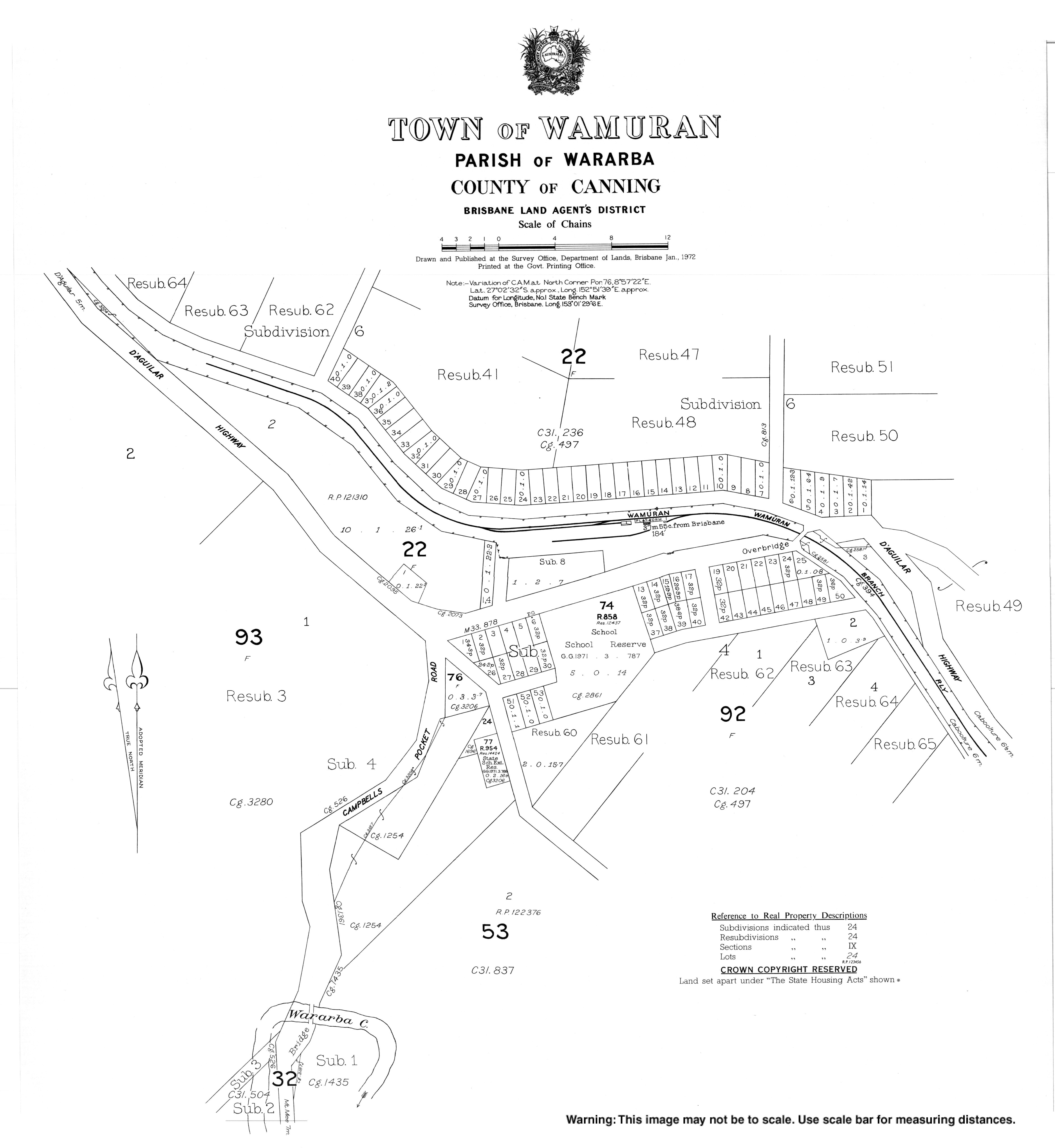
Waraba is a rural locality in the City of Moreton Bay, Queensland, Australia.

References

  1. 1 2 Australian Bureau of Statistics (27 June 2017). "Wamuran (SSC)". 2016 Census QuickStats. Retrieved 20 October 2018. OOjs UI icon edit-ltr-progressive.svg
  2. "Wamuran – town in Moreton Bay Region (entry 36412)". Queensland Place Names. Queensland Government . Retrieved 7 March 2022.
  3. 1 2 3 "Wamuran – locality in Moreton Bay Region (entry 52229)". Queensland Place Names. Queensland Government . Retrieved 15 July 2023.
  4. 1 2 3 "Wamuran 2021 Census All persons QuickStats". Australian Bureau of Statistics. 15 October 2021. Retrieved 17 May 2024.
  5. 1 2 "Wamuran history". Moreton Bay Region Libraries. 17 May 2024. Retrieved 17 May 2024.
  6. 1 2 "Current proposals and decisions". Place Names. Queensland Government. Archived from the original on 21 June 2023. Retrieved 12 July 2023.
  7. 1 2 "Proposed Locality Names and Boundaries: Bellmere / Corymbia / Greenstone / Lilywood / Rocksberg / Upper Caboolture / Wagtail Grove / Wamuran / Waraba" (PDF) (Map). Queensland Government. 2 December 2022. Archived (PDF) from the original on 21 June 2023. Retrieved 12 July 2023.
  8. 1 2 "Locality Names and Boundaries: Bellmere / Corymbia / Greenstone / Lilywood / Rocksberg / Upper Caboolture / Wagtail Grove / Wamuran / Waraba" (PDF) (Map). Queensland Government. 14 April 2023. Archived (PDF) from the original on 21 June 2023. Retrieved 12 July 2023.
  9. "Caboolture (Healthy Land and Water) report card". Queensland Government WetlandInfo. 2019.
  10. Queensland Family History Society (2010), Queensland schools past and present (Version 1.01 ed.), Queensland Family History Society, ISBN   978-1-921171-26-0
  11. "SOCIAL". The Brisbane Courier . No. 19, 501. Queensland, Australia. 21 July 1920. p. 11. Archived from the original on 30 November 2021. Retrieved 27 November 2019 via National Library of Australia.
  12. Queensland Family History Society (2010), Queensland schools past and present (Version 1.01 ed.), Queensland Family History Society, ISBN   978-1-921171-26-0
  13. "WAMURAN SCHOOL". The Brisbane Courier . No. 20, 972. Queensland, Australia. 13 April 1925. p. 9. Archived from the original on 30 November 2021. Retrieved 27 November 2019 via National Library of Australia.
  14. "Closed Anglican Churches". Anglican Church South Queensland. Archived from the original on 3 April 2019. Retrieved 29 June 2020.
  15. "Queensland Baptist churches by date of erection/opening". Baptist Church Archives Queensland. Archived from the original on 26 November 2021. Retrieved 29 November 2021.
  16. "1921 Wamuran". Baptist Church Archives Queensland. Archived from the original on 26 November 2021. Retrieved 29 November 2021.
  17. "HOME MISSIONS". Daily Mail . No. 6014. Queensland, Australia. 17 September 1921. p. 8. Archived from the original on 30 November 2021. Retrieved 30 November 2021 via National Library of Australia.
  18. "Baptist Association". The Telegraph . No. 14, 906. Queensland, Australia. 4 September 1920. p. 8. Archived from the original on 30 November 2021. Retrieved 30 November 2021 via National Library of Australia.
  19. Australian Bureau of Statistics (31 October 2012). "Wamuran (Caboolture Shire) (State Suburb)". 2011 Census QuickStats. Retrieved 17 May 2008. OOjs UI icon edit-ltr-progressive.svg
  20. "State and non-state school details". Queensland Government. 9 July 2018. Archived from the original on 21 November 2018. Retrieved 21 November 2018.
  21. "Wamuran State School". Archived from the original on 15 March 2020. Retrieved 21 November 2018.
  22. "ACARA School Profile 2017". Archived from the original on 22 November 2018. Retrieved 22 November 2018.
  23. "Queensland Globe". State of Queensland . Retrieved 25 May 2022.