Navassa, North Carolina

Last updated

Navassa, North Carolina
Navassa, NC Town Seal.jpg
Motto: 
"People Working For People"
USA North Carolina location map.svg
Red pog.svg
Navassa
Location within the state of North Carolina
Coordinates: 34°15′51″N77°59′39″W / 34.26417°N 77.99417°W / 34.26417; -77.99417
Country United States
State North Carolina
County Brunswick
Area
[1]
  Total13.79 sq mi (35.71 km2)
  Land13.33 sq mi (34.52 km2)
  Water0.46 sq mi (1.19 km2)
Elevation
[2]
23 ft (7 m)
Population
 (2020)
  Total1,367
  Density102.57/sq mi (39.60/km2)
Time zone UTC-5 (Eastern (EST))
  Summer (DST) UTC-4 (EDT)
ZIP code
28451
Area codes 910, 472
FIPS code 37-46060 [3]
GNIS feature ID2406968 [2]
Website townofnavassa.org

Navassa is a town in Brunswick County, North Carolina, United States. The population was 1,505 at the 2010 census, [4] up from 479 in 2000.

Contents

Navassa is part of the Wilmington, NC Metropolitan Statistical Area.

History

A post office called Navassa was established in 1903. [5] The community was named after Navassa Island. [6] Navassa was incorporated as a town in 1977. [6]

Geography

Navassa is located along the Brunswick and Cape Fear rivers.

According to the United States Census Bureau, the town has a total area of 13.8 square miles (35.8 km2), of which 13.3 square miles (34.5 km2) is land and 0.50 square miles (1.3 km2) (3.50%) is water. [4]

Environment and biodiversity

The Navassa and Cape Fear region in southeastern North Carolina is considered an exceptionally rich biodiverse area in the United States. This region hosts 50 different habitat types supporting 300 species of plants and animals. Twenty-two of these species are considered "endemic", meaning they are found nowhere else in the world. An assessment of biodiversity was completed by the State and prioritized terrestrial habitats based on the presence and quality of significant natural areas, rare species, important bird areas, high quality wildlife habitat, and wetlands. Aquatic habitats were assessed based on aquatic significant natural heritage areas, native trout waters, anadromous fish spawning areas, high quality benthic communities, high quality waters, outstanding resource waters, oyster sanctuaries, shellfish harvest areas, fish nursery areas, submerged aquatic vegetation, and stream buffers. Anadromous means that fish are born in fresh water nurseries of Navassa's creeks and rivers, spend most of their life in the sea (Atlantic Ocean) and return to the town's fresh waters to spawn.

The Cape Fear River and Brunswick River marshes along Navassa's eastern limits are an extensive 330 acres (130 ha) of tidal marshes upstream of saltwater influence. This tidal freshwater marsh is characterized by tall herbs, grasses and wildflowers. This site supports the only known population of Carolina Bishop Weed in North Carolina. The natural area has been altered by human influences of ditching, diking and roadbed construction. Sturgeon Creek, along Navassa's southern limits, is a tributary of the Brunswick River and supports the same uncommon natural community type of Tidal Freshwater Marsh. The 154-acre (62 ha) marsh contains a population of Cypress Knee Sedge, a rare plant species.

Demographics

Historical population
CensusPop.Note
1980 439
1990 4451.4%
2000 4797.6%
2010 1,505214.2%
2020 1,367−9.2%
2023 (est.)1,737 [7] 27.1%
U.S. Decennial Census [8]

2020 census

Navassa racial composition [9]
RaceNumberPercentage
White (non-Hispanic)38127.87%
Black or African American (non-Hispanic)78857.64%
Native American 20.15%
Asian 40.29%
Pacific Islander 40.29%
Other/Mixed 493.58%
Hispanic or Latino 13910.17%

As of the 2020 United States census, there were 1,367 people, 704 households, and 385 families residing in the town.

2010 census

As of the census [3] of 2010, there were 1,505 people living in the town. The racial makeup of the town was 27.1% White, 63.6% African American, 0.5% Native American, and 3.8% from two or more races. Hispanic or Latino of any race were 3.8% of the population.

There were 177 households, out of which 28.8% had children under the age of 18 living with them, 38.4% were married couples living together, 23.7% had a female householder with no husband present, and 30.5% were non-families. 26.0% of all households were made up of individuals, and 11.3% had someone living alone who was 65 years of age or older. The average household size was 2.71 and the average family size was 3.27.

In the town, the population was spread out, with 27.3% under the age of 18, 7.9% from 18 to 24, 26.9% from 25 to 44, 23.6% from 45 to 64, and 14.2% who were 65 years of age or older. The median age was 37 years. For every 100 females, there were 107.4 males. For every 100 females age 18 and over, there were 93.3 males.

The median income for a household in the town was $35,607, and the median income for a family was $35,179. Males had a median income of $21,875 versus $18,529 for females. The per capita income for the town was $11,328. About 24.8% of families and 27.1% of the population were below the poverty line, including 44.6% of those under age 18 and 14.5% of those age 65 or over.

Culture

The town of Navassa has a rich cultural heritage supported by strong roots in the Gullah-Geeche culture. Gullah describes a group of African Americans along the southeast coast of the United States from Jacksonville, North Carolina, to Jacksonville, Florida. They have a distinct culture, language, and lifestyle that have been preserved since the early 1700s. In the southeastern North Carolina area, the Gullah people of today are direct descendants of slaves who worked in the rice and peanut plantations of the Cape Fear River valley. Residents of Navassa have a direct link to this culture. At one time there were five different rice plantations in what is today Navassa. As the plantation system came to a close, the slaves who worked these plantations eventually resettled the area.

In 2006, the US Congress established the east coast Gullah-Geeche Cultural Heritage Corridor to help preserve and educated the public on the importance of this culture in our history. The corridor is preserved with the assistance of an executive committee, of which the Mayor of Navassa is vice-chairman.

Related Research Articles

<span class="mw-page-title-main">Georgetown County, South Carolina</span> County in South Carolina, United States

Georgetown County is a county located in the U.S. state of South Carolina. As of the 2020 census, the population was 63,404. Its county seat is Georgetown. The county was founded in 1769. It is named for George III of the United Kingdom.

<span class="mw-page-title-main">Pender County, North Carolina</span> County in North Carolina, United States

Pender County is a county located in the U.S. state of North Carolina. As of the 2020 census, the population was 60,203. Its county seat is Burgaw. Pender County is part of the Wilmington, NC Metropolitan Statistical Area.

<span class="mw-page-title-main">Dare County, North Carolina</span> County in North Carolina, United States

Dare County is the easternmost county in the U.S. state of North Carolina. As of the 2020 census, the population was 36,915. Its county seat is Manteo.

<span class="mw-page-title-main">Brunswick County, North Carolina</span> County in North Carolina, United States

Brunswick County is a county located in the U.S. state of North Carolina. It is the southernmost county in the state. As of the 2020 census, the population was 136,693. Its population was only 73,143 in 2000, making it one of the fastest-growing counties in the state. With a nominal growth rate of approximately 47% in ten years, much of the growth is centered in the eastern section of the county in the suburbs of Wilmington such as Leland, Belville and Southport. The county seat is Bolivia, which at a population of around 150 people is among the least populous county seats in the state.

<span class="mw-page-title-main">Ormond-by-the-Sea, Florida</span> CDP in Florida, United States

Ormond-by-the-Sea is a census-designated place and an unincorporated town in Volusia County, Florida, United States. The population was 7,312 as of the 2020 census, a decrease from 7,406 in the 2010 census.

<span class="mw-page-title-main">Monomoscoy Island, Massachusetts</span> Census-designated place in Massachusetts, United States

Monomoscoy Island is a census-designated place (CDP) in the town of Mashpee in Barnstable County, Massachusetts, United States. At the 2010 census, the CDP had a total population of 147.

<span class="mw-page-title-main">Clarkton, North Carolina</span> Town in North Carolina, United States

Clarkton is a town in Bladen County, North Carolina, United States. The population was 837 at the 2010 census.

Belville is a town in Brunswick County, North Carolina, United States. The population was 1,936 at the 2010 census, up from 285 in 2000. It is part of the Wilmington, NC metropolitan area.

Calabash is a small fishing town in Brunswick County, North Carolina, United States. As of the 2020 census, the population of the town was 2,011. It is known as the "Seafood Capital of the World" because of the town's seafood restaurants.
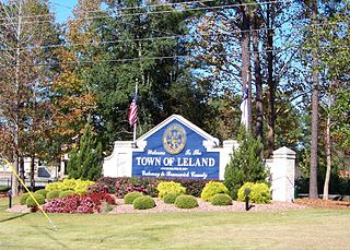
<span class="mw-page-title-main">Leland, North Carolina</span> Town in North Carolina, United States

Leland is the most populous town in Brunswick County, North Carolina, United States. The population was 23,504 at the 2020 census, up from 13,527 in 2010. As of 2020, it is considered to be one of the fastest growing towns in North Carolina. It is part of the Wilmington, NC Metropolitan Statistical Area. and the Cape Fear Council of Governments. The town of Leland is in the northeastern part of Brunswick County, with the town of Navassa to the north, Belville to east, and Boiling Spring Lakes to the south. It is part of the Town Creek township, and Cape Fear region of North Carolina, a short distance north of the South Carolina state line. Leland is located five miles (8.0 km) west of Wilmington, 71 miles (114 km) north of Myrtle Beach, 84 miles (135 km) southeast of Fayetteville, and 135 miles (217 km) southeast of Raleigh.

<span class="mw-page-title-main">Southport, North Carolina</span> City in North Carolina, United States

Southport is a city in Brunswick County, North Carolina, United States, near the mouth of the Cape Fear River. Its population was 3,828 as of the 2018 census. The current mayor, Rich Alt, was elected to a two-year term in November 2023.

Varnamtown is a town in Brunswick County, North Carolina, United States situated on the banks of the Lockwood Folly River. The population was 541 at the 2010 census. It is part of the Wilmington, NC Metropolitan Statistical Area.

<span class="mw-page-title-main">Beaufort, North Carolina</span> Town in North Carolina, United States

Beaufort is a town in and the county seat of Carteret County, North Carolina, United States. Established in 1713 and incorporated in 1723, Beaufort is the fourth oldest town in North Carolina . On February 1, 2012, Beaufort was ranked as "America's Coolest Small Town" by readers of Budget Travel Magazine.
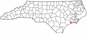
<span class="mw-page-title-main">Cedar Point, North Carolina</span> Town in North Carolina, United States

Cedar Point is a town in Carteret County, North Carolina, United States. The population was 1,297 in 2010.

<span class="mw-page-title-main">McClellanville, South Carolina</span> Town in South Carolina, United States

McClellanville is a small fishing town in rural Charleston County, South Carolina, United States. The population was 605 at the 2020 census. It is situated on the Atlantic coast, on land surrounded by Francis Marion National Forest, and has traditionally derived its livelihood from the Atlantic Ocean and coastal marshes by fishing, shrimping and oystering. McClellanville is part of the Charleston-North Charleston-Summerville metropolitan area and the Charleston-North Charleston Urbanized Area.

<span class="mw-page-title-main">Rockville, South Carolina</span> Town in South Carolina, United States

Rockville is a town in Charleston County, South Carolina, United States, that was founded in 1784. The population was 134 at the 2010 census. Rockville is part of the Charleston-North Charleston-Summerville metropolitan area.
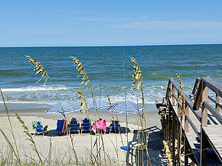
<span class="mw-page-title-main">Pawleys Island, South Carolina</span> Town in South Carolina, United States

Pawleys Island is a town in Georgetown County, South Carolina, United States, and the Atlantic coast barrier island on which the town is located.

Atlantic Beach is a town in Horry County, South Carolina, United States, part of the Grand Strand tourist region. The population was 334 at the 2010 census. Most of the land around the town is annexed into the city of North Myrtle Beach.

<span class="mw-page-title-main">Saxis, Virginia</span> Town in Virginia, United States

Saxis is a town in Accomack County, Virginia, United States. The population was 241 at the 2010 census.
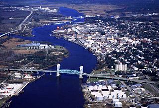
<span class="mw-page-title-main">Cape Fear (region)</span> Wilmington metropolitan area

Cape Fear is a coastal plain and Tidewater region of North Carolina centered about the city of Wilmington. The region takes its name from the adjacent Cape Fear headland, as does the Cape Fear River which flows through the region and empties into the Atlantic Ocean near the cape. Much of the region's populated areas are found along the Atlantic beaches and the Atlantic Intracoastal Waterway, while the rural areas are dominated by farms and swampland like that of the Green Swamp. The general area can be also identified by the titles "Lower Cape Fear", "Wilmington, NC Metropolitan Statistical Area", "Southeastern North Carolina", and "Azalea Coast". The latter name is derived from the North Carolina Azalea Festival held annually in Wilmington. Municipalities in the area belong to the Cape Fear Council of Governments.

References

  1. "ArcGIS REST Services Directory". United States Census Bureau. Retrieved September 20, 2022.
  2. 1 2 U.S. Geological Survey Geographic Names Information System: Navassa, North Carolina
  3. 1 2 "U.S. Census website". United States Census Bureau . Retrieved January 31, 2008.
  4. 1 2 "Geographic Identifiers: 2010 Demographic Profile Data (G001): Navassa town, North Carolina". U.S. Census Bureau, American Factfinder. Archived from the original on February 12, 2020. Retrieved February 11, 2014.
  5. "Brunswick County". Jim Forte Postal History. Retrieved November 1, 2015.
  6. 1 2 "Navassa". Star-News. May 24, 1998. p. 41. Retrieved November 1, 2015.
  7. "City and Town Population Totals: 2020-2023". United States Census Bureau. May 16, 2024. Retrieved May 16, 2024.
  8. "Census of Population and Housing". Census.gov. Retrieved June 4, 2015.
  9. "Explore Census Data". data.census.gov. Retrieved December 22, 2021.