St. James, North Carolina

Last updated

St. James, North Carolina
St. James, NC Town Flag.jpg
Seal of St. James, North Carolina.png
USA North Carolina location map.svg
Red pog.svg
St. James
Location within the state of North Carolina
Coordinates: 33°56′48″N78°06′47″W / 33.94667°N 78.11306°W / 33.94667; -78.11306
Country United States
State North Carolina
County Brunswick
Area
[1]
  Total9.20 sq mi (23.83 km2)
  Land9.11 sq mi (23.60 km2)
  Water0.09 sq mi (0.22 km2)
Elevation
[2]
56 ft (17 m)
Population
 (2020)
  Total6,529
  Density716.37/sq mi (276.60/km2)
Time zone UTC-5 (Eastern (EST))
  Summer (DST) UTC-4 (EDT)
FIPS code 37-58630 [3]
GNIS feature ID2407392 [2]
Website www.townofstjamesnc.org

St. James or Saint James [2] is a town in Brunswick County, North Carolina, United States. The population was 3,165 at the 2010 census, [4] up from 804 in 2000. It is part of the Wilmington, NC Metropolitan Statistical Area.

Contents

Geography

St. James is located in southern Brunswick County, it is bordered to the south, west, and north by the town of Oak Island. North Carolina Highway 211 forms part of the northern border of the town, leading east 5 miles (8 km) to Southport and west 11 miles (18 km) to U.S. Route 17 at Supply.

According to the United States Census Bureau, the town of St. James has a total area of 8.3 square miles (21.5 km2), of which 8.3 square miles (21.4 km2) is land and 0.04 square miles (0.1 km2), or 0.46%, is water. [4]

Demographics

Historical population
CensusPop.Note
2000 804
2010 3,165293.7%
2020 6,529106.3%
U.S. Decennial Census [5]

2020 census

St. James racial composition [6]
RaceNumberPercentage
White (non-Hispanic)6,25895.85%
Black or African American (non-Hispanic)270.41%
Native American 50.08%
Asian 510.78%
Pacific Islander 10.02%
Other/Mixed 1111.7%
Hispanic or Latino 761.16%

As of the 2020 United States census, there were 6,529 people, 2,713 households, and 2,458 families residing in the town.

2010 census

As of the census [3] of 2010, there were 3,165 people, 1,575 households, and 1,386 families residing in the town. The population density was 383 inhabitants per square mile (148/km2). There were 2,263 housing units at an average density of 272.7 per square mile (105.3/km2). The racial makeup of the town was 97.8% White, 1.0% African American, 0.1% American Indian, 0.6% Asian, 0.2% some other race, and 0.3% from two or more races. Hispanic or Latino of any race were 0.9% of the population. [7]

There were 1,575 households, out of which 3.0% had children under the age of 18 living with them, 86.3% were headed by married couples living together, 1.3% had a female householder with no husband present, and 12.0% were non-families. 10.4% of all households were made up of individuals, and 6.0% were someone living alone who was 65 years of age or older. The average household size was 2.01 and the average family size was 2.12. [7]

In the town, the population was spread out, with 2.5% under the age of 18, 0.9% from 18 to 24, 3.7% from 25 to 44, 43.4% from 45 to 64, and 49.8% who were 65 years of age or older. The median age was 65.0 years. For every 100 females, there were 96.7 males. For every 100 females age 18 and over, there were 96.7 males. [7]

For the period 2008–2012, the estimated median annual income for a household in the town was $82,476, and the median income for a family was $83,750. Male full-time workers had a median income of $46,094 versus $50,833 for females. The per capita income for the town was $67,796. 1.2% of the population and 0.9% of families were below the poverty line. [8]

Government

Saint James's council–manager form of government has 5 elected councilors. Councilors are elected for four-year staggered terms. The mayor and mayor pro tem are appointed by the town council. The town's attorney and manager serve at the pleasure of the council. All the other staff report to the town manager and manage the town's day-to-day business.

The town is led by Mayor Jean Toner, elected in 2019. The other council members are: Dave DeLong (2021), Jim Board (2021), Lynn Dutney (2019) and David Morgan (2021). [9]

In the North Carolina House of Representatives, St. James is represented by Charlie Miller (District 19). In the North Carolina Senate, St. James is represented by Bill Rabon (District 8). In the United States House of Representatives St. James is represented by David Rouzer (NC-7). [10]

Related Research Articles

<span class="mw-page-title-main">Vincent, Alabama</span> City in Alabama, United States

Vincent, originally known as Propel, is a city in Shelby, St. Clair, and Talladega counties in the U.S. state of Alabama. At the 2020 census, the population was 1,982. The community was first known as Propel, but later named Vincent in honor of the Vincent family, who were early settlers of the area. It was incorporated in 1897.

<span class="mw-page-title-main">Bancroft, Kentucky</span> City in Kentucky, United States

Bancroft is a home rule-class city in Jefferson County, Kentucky, United States. It was formally incorporated by the state assembly in 1970. The population was 503 as of the 2020 census, up from 494 at the 2010 census.

<span class="mw-page-title-main">Jefferson, North Carolina</span> Town in North Carolina, United States

Jefferson is a town in and the county seat of Ashe County, North Carolina, United States. The population was 1,622 at the 2020 U.S. census.

<span class="mw-page-title-main">Powellsville, North Carolina</span> Town in North Carolina, United States

Powellsville is a town in Bertie County, North Carolina, United States. The population was 276 at the 2010 census. The city is home to Travis Bond

<span class="mw-page-title-main">Clarkton, North Carolina</span> Town in North Carolina, United States

Clarkton is a town in Bladen County, North Carolina, United States. The population was 837 at the 2010 census.

<span class="mw-page-title-main">Dublin, North Carolina</span> Town in North Carolina, United States

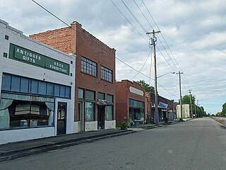
Dublin is a town in Bladen County, North Carolina, United States. As of the 2010 census, the town population was 338. Dublin is located on North Carolina Highway 87 and is known as the "Peanut Capital of North Carolina."

<span class="mw-page-title-main">White Lake, North Carolina</span> Town in North Carolina, United States

White Lake is a town in Bladen County, North Carolina, United States. The population was 802 at the 2010 census, up from 529 in 2000.

<span class="mw-page-title-main">Shallotte, North Carolina</span> Town in North Carolina, United States

Shallotte is a town in western Brunswick County, North Carolina, United States. The population was 3,675 at the 2010 census. The Shallotte River passes through the town.

<span class="mw-page-title-main">St. Stephens, North Carolina</span> Census-designated place in North Carolina, United States

St. Stephens is a census-designated place (CDP) in Catawba County, North Carolina, United States. The population was 8,759 at the 2010 census, down from 9,439 in 2000. It is part of the Hickory–Lenoir–Morganton Metropolitan Statistical Area.

<span class="mw-page-title-main">Eastover, North Carolina</span> Town in North Carolina, United States

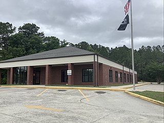
Eastover is a town in Cumberland County, North Carolina, United States. The population was 3,656 at the 2020 census. It was incorporated on July 25, 2007.

<span class="mw-page-title-main">Wilson's Mills, North Carolina</span> Town in North Carolina, United States

Wilson's Mills is a town in Johnston County, North Carolina, United States. In 2010, the population was 2,277, up from 1,291 in 2000. As of 2018, the estimated population was 2,689.

<span class="mw-page-title-main">Village Green-Green Ridge, Pennsylvania</span> Census-designated place in Pennsylvania, United States

Village Green-Green Ridge is a census-designated place (CDP) in Delaware County, Pennsylvania, United States. The population was 7,822 at the 2010 census, down from 8,279 at the 2000 census.

<span class="mw-page-title-main">Northwest Harborcreek, Pennsylvania</span> Census-designated place in Pennsylvania, United States

Northwest Harborcreek is a census-designated place (CDP) in Erie County, Pennsylvania, United States. The population was 8,949 at the 2010 census. It includes the unincorporated communities of Fairfield and Brookside and is part of the Erie Metropolitan Statistical Area.

<span class="mw-page-title-main">Hilda, South Carolina</span> Town in South Carolina, United States

Hilda is a town in Barnwell County, South Carolina, United States. The population was 447 at the 2010 census..

<span class="mw-page-title-main">St. Stephen, South Carolina</span> Town in South Carolina, United States

St. Stephen is a town in Berkeley County, South Carolina, United States. The population was 1,697 at the 2010 census.

<span class="mw-page-title-main">Hollywood, South Carolina</span> Town in South Carolina, United States

Hollywood is a town in Charleston County, South Carolina, United States. The population was 4,714 at the 2010 census, up from 3,946 in 2000. Hollywood is part of the Charleston, South Carolina metropolitan area and the Charleston-North Charleston Urbanized Area.

<span class="mw-page-title-main">McClellanville, South Carolina</span> Town in South Carolina, United States

McClellanville is a small fishing town in rural Charleston County, South Carolina, United States. The population was 605 at the 2020 census. It is situated on the Atlantic coast, on land surrounded by Francis Marion National Forest, and has traditionally derived its livelihood from the Atlantic Ocean and coastal marshes by fishing, shrimping and oystering. McClellanville is part of the Charleston-North Charleston-Summerville metropolitan area and the Charleston-North Charleston Urbanized Area.

<span class="mw-page-title-main">Meggett, South Carolina</span> Town in South Carolina, United States

Meggett is a town in Charleston County, South Carolina, United States. The population was 1,226 at the 2010 census. Meggett is part of the Charleston-North Charleston-Summerville metropolitan area.

<span class="mw-page-title-main">Ravenel, South Carolina</span> Town in South Carolina, United States

Ravenel is a town in Charleston County, South Carolina, United States. The population was 2,465 at the 2010 census. Ravenel is part of the Charleston-North Charleston-Summerville metropolitan area.

<span class="mw-page-title-main">Long View, North Carolina</span> Town in North Carolina, United States

Long View is a town in Burke and Catawba counties in the U.S. state of North Carolina. The population was 4,871 at the 2010 census. It is part of the Hickory–Lenoir–Morganton Metropolitan Statistical Area.

References

  1. "ArcGIS REST Services Directory". United States Census Bureau. Retrieved September 20, 2022.
  2. 1 2 3 U.S. Geological Survey Geographic Names Information System: St. James, North Carolina
  3. 1 2 "U.S. Census website". United States Census Bureau . Retrieved January 31, 2008.
  4. 1 2 "Geographic Identifiers: 2010 Demographic Profile Data (G001): St. James town, North Carolina". U.S. Census Bureau, American Factfinder. Archived from the original on February 12, 2020. Retrieved February 12, 2014.
  5. "Census of Population and Housing". Census.gov. Retrieved June 4, 2015.
  6. "Explore Census Data". data.census.gov. Retrieved December 22, 2021.
  7. 1 2 3 "Profile of General Population and Housing Characteristics: 2010 Demographic Profile Data (DP-1): St. James town, North Carolina". U.S. Census Bureau, American Factfinder. Archived from the original on February 12, 2020. Retrieved February 12, 2014.
  8. "Selected Economic Characteristics: 2008-2012 American Community Survey 5-Year Estimates (DP03): St. James town, North Carolina". U.S. Census Bureau, American Factfinder. Archived from the original on February 12, 2020. Retrieved February 12, 2014.
  9. "Town of St. James North Carolina Town Council". Town of Saint James. Retrieved October 5, 2023.
  10. "North Carolina General Assembly Find Your Legislators". North Carolina General Assembly. Retrieved October 5, 2023.