Northwest, North Carolina

Last updated

Northwest, North Carolina
Motto: 
"Looking to the Future"
USA North Carolina location map.svg
Red pog.svg
Northwest
Location within the state of North Carolina
Coordinates: 34°18′58″N78°08′41″W / 34.31611°N 78.14472°W / 34.31611; -78.14472
Country United States
State North Carolina
County Brunswick
Area
[1]
  Total7.17 sq mi (18.57 km2)
  Land7.17 sq mi (18.57 km2)
  Water0.00 sq mi (0.00 km2)
Elevation
[2]
59 ft (18 m)
Population
 (2020)
  Total703
  Density98.03/sq mi (37.85/km2)
Time zone UTC-5 (Eastern (EST))
  Summer (DST) UTC-4 (EDT)
FIPS code 37-47860 [3]
GNIS feature ID2404401 [2]
Website www.cityofnorthwest.com

Northwest is a city in Brunswick County, North Carolina, United States. The population was 735 at the 2010 census. [4] It is part of the Wilmington, NC Metropolitan Statistical Area.

Contents

History

Northwest was incorporated in 1993. [5]

Geography

Northwest is located near the northernmost point in Brunswick County in North Carolina. U.S. Routes 74 and 76 (Andrew Jackson Highway) pass along the southern border of the community, leading 13 miles (21 km) east to Wilmington and 33 miles (53 km) west to Whiteville.

According to the United States Census Bureau, the city has a total area of 7.0 square miles (18.2 km2), all land. [4]

Demographics

Historical population
CensusPop.Note
2000 671
2010 7359.5%
2020 703−4.4%
2023 (est.)1,005 [6] 43.0%
U.S. Decennial Census [7]

2020 census

Northwest racial composition [8]
RaceNumberPercentage
White (non-Hispanic)20729.45%
Black or African American (non-Hispanic)41859.46%
Native American 50.71%
Asian 30.43%
Other/Mixed 182.56%
Hispanic or Latino 527.4%

As of the 2020 United States census, there were 703 people, 326 households, and 199 families residing in the city.

2000 census

As of the census [3] of 2000, there were 671 people, 260 households, and 185 families residing in the city. The population density was 109.2 inhabitants per square mile (42.2/km2). There were 293 housing units at an average density of 47.7 per square mile (18.4/km2). The racial composition of the city was: 26.83% White, 71.83% Black or African American, 0.75% Hispanic or Latino American, 0.30% Asian American, 0.45% Native American, 0.03% Native Hawaiian or Other Pacific Islander, 0.15% other races, and 0.45% two or more races.

There were 260 households, out of which 32.3% had children under the age of 18 living with them, 48.5% were married couples living together, 18.5% had a female householder with no husband present, and 28.5% were non-families. 24.2% of all households were made up of individuals, and 8.5% had someone living alone who was 65 years of age or older. The average household size was 2.58 and the average family size was 3.07.

In the city, the population was spread out, with 26.7% under the age of 18, 5.5% from 18 to 24, 27.9% from 25 to 44, 27.0% from 45 to 64, and 13.0% who were 65 years of age or older. The median age was 40 years. For every 100 females, there were 79.4 males. For every 100 females age 18 and over, there were 80.9 males.

The median income for a household in the city was $31,250, and the median income for a family was $37,500. Males had a median income of $29,821 versus $19,479 for females. The per capita income for the city was $16,419. About 14.0% of families and 17.6% of the population were below the poverty line, including 21.8% of those under age 18 and 15.6% of those age 65 or over.

Related Research Articles

<span class="mw-page-title-main">Pender County, North Carolina</span> County in North Carolina, United States

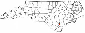
Pender County is a county located in the U.S. state of North Carolina. As of the 2020 census, the population was 60,203. Its county seat is Burgaw. Pender County is part of the Wilmington, NC Metropolitan Statistical Area.

<span class="mw-page-title-main">Wilmington Manor, Delaware</span> CDP in Delaware, United States

Wilmington Manor is a census-designated place (CDP) in north-eastern New Castle County, Delaware, United States. The population was 7,889 at the 2010 census.

Belville is a town in Brunswick County, North Carolina, United States. The population was 1,936 at the 2010 census, up from 285 in 2000. It is part of the Wilmington, NC metropolitan area.

<span class="mw-page-title-main">Boiling Spring Lakes, North Carolina</span> City in North Carolina, United States

Boiling Spring Lakes is a city in Brunswick County, North Carolina, United States. The population was 5,943 at the 2020 census, up from 5,372 in 2010.

<span class="mw-page-title-main">Bolivia, North Carolina</span> Town in North Carolina, United States

Bolivia is a town in Brunswick County, North Carolina, United States. The population was 143 at the 2020 census. It is the county seat of Brunswick County.

Calabash is a small fishing town in Brunswick County, North Carolina, United States. As of the 2020 census, the population of the town was 2,011. It is known as the "Seafood Capital of the World" because of the town's seafood restaurants.

Carolina Shores is a town in Brunswick County, North Carolina, United States. The population was 3,048 at the 2010 census, up from 1,482 in 2000. It is part of the Wilmington, NC Metropolitan Statistical Area.

Sandy Creek is a town in Brunswick County, North Carolina, United States. The population was 260 at the 2010 census. It is part of the Wilmington, NC Metropolitan Statistical Area.

<span class="mw-page-title-main">Shallotte, North Carolina</span> Town in North Carolina, United States

Shallotte is a town in Brunswick County, North Carolina, United States. The population was 3,675 at the 2010 census. The Shallotte River passes through the town.

<span class="mw-page-title-main">Southport, North Carolina</span> City in North Carolina, United States

Southport is a city in Brunswick County, North Carolina, United States, near the mouth of the Cape Fear River. Its population was 3,828 as of the 2018 census. The current mayor, Rich Alt, was elected to a two-year term in November 2023.

St. James or Saint James is a town in Brunswick County, North Carolina, United States. The population was 3,165 at the 2010 census, up from 804 in 2000. It is part of the Wilmington, NC Metropolitan Statistical Area.

Varnamtown is a town in Brunswick County, North Carolina, United States situated on the banks of the Lockwood Folly River. The population was 541 at the 2010 census. It is part of the Wilmington, NC Metropolitan Statistical Area.

<span class="mw-page-title-main">Carolina Beach, North Carolina</span> Town in North Carolina, United States

Carolina Beach is a beach town in New Hanover County, North Carolina, United States, situated about 12 miles (19 km) south of Wilmington International Airport in southeastern coastal North Carolina. As of the 2020 census, the city population was 6,564. It is part of the Wilmington metropolitan area. The community of Wilmington Beach was annexed by the town in 2000.

<span class="mw-page-title-main">Hightsville, North Carolina</span> CDP in North Carolina, United States

Hightsville is a census-designated place (CDP) in New Hanover County, North Carolina, United States. The population was 739 at the 2010 census. It is part of the Wilmington Metropolitan Statistical Area.

<span class="mw-page-title-main">Masonboro, North Carolina</span> Former census-designated place in North Carolina, United States

Masonboro was a census-designated place (CDP) in New Hanover County, North Carolina. The last census count in 2000 was 11,812. Masonboro was located southeast of Wilmington near the Atlantic coast.

<span class="mw-page-title-main">Murraysville, North Carolina</span> CDP in North Carolina, United States

Murraysville is a census-designated place (CDP) in New Hanover County, North Carolina, United States. The population was 14,215 at the 2010 census, up from 7,279 in 2000. It is part of the Wilmington Metropolitan Statistical Area.

<span class="mw-page-title-main">Atkinson, North Carolina</span> Town in North Carolina, United States

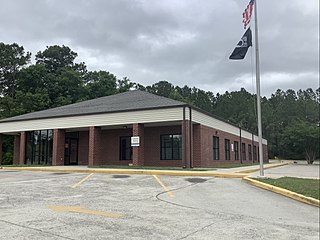
Atkinson is a town in Pender County, North Carolina, United States. At the 2010 census, the town population was 299. It is part of the Wilmington Metropolitan Statistical Area. The town was incorporated in 1989.

Ivanhoe is a census-designated place (CDP) in Sampson County, North Carolina, United States. The population was 198 at the 2020 census.

<span class="mw-page-title-main">Olanta, South Carolina</span> Town in South Carolina, United States

Olanta is a town in Florence County, South Carolina, United States. The population was 563 at the 2010 census, down from 613 in 2000. It is part of the Florence Metropolitan Statistical Area.

<span class="mw-page-title-main">Brunswick, Vermont</span> Town in Vermont, United States

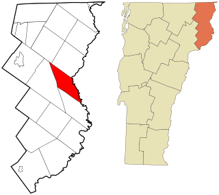
Brunswick is a town in Essex County, Vermont, United States. The town was named after Prince Karl Wilhelm Ferdinand of Brunswick-Lunenburg. The population was 88 at the 2020 census. It is part of the Berlin, NH-VT Micropolitan Statistical Area. Brunswick is home to six mineral springs that made the town a popular resort destination in the 19th century. The land the springs are on is now owned by the Abenaki people.

References

  1. "ArcGIS REST Services Directory". United States Census Bureau. Retrieved September 20, 2022.
  2. 1 2 U.S. Geological Survey Geographic Names Information System: Northwest, North Carolina
  3. 1 2 "U.S. Census website". United States Census Bureau . Retrieved January 31, 2008.
  4. 1 2 "Geographic Identifiers: 2010 Demographic Profile Data (G001): Northwest city, North Carolina". U.S. Census Bureau, American Factfinder. Archived from the original on February 12, 2020. Retrieved February 10, 2014.
  5. "Northwest". Star-News. May 24, 1998. p. 34. Retrieved November 1, 2015.
  6. "City and Town Population Totals: 2020-2023". United States Census Bureau. May 16, 2024. Retrieved May 16, 2024.
  7. "Census of Population and Housing". Census.gov. Retrieved June 4, 2015.
  8. "Explore Census Data". data.census.gov. Retrieved December 22, 2021.