Varnamtown, North Carolina

Last updated

Varnamtown, North Carolina
USA North Carolina location map.svg
Red pog.svg
Varnamtown
Location within the state of North Carolina
Coordinates: 33°56′35″N78°14′11″W / 33.94306°N 78.23639°W / 33.94306; -78.23639
Country United States
State North Carolina
County Brunswick
Area
[1]
  Total0.94 sq mi (2.43 km2)
  Land0.88 sq mi (2.28 km2)
  Water0.06 sq mi (0.14 km2)
Elevation
[2]
26 ft (8 m)
Population
 (2020)
  Total525
  Density595.24/sq mi (229.87/km2)
Time zone UTC-5 (Eastern (EST))
  Summer (DST) UTC-4 (EDT)
FIPS code 37-69795 [3]
GNIS feature ID2406794 [2]
Website varnamtown.io

Varnamtown is a town in Brunswick County, North Carolina, United States situated on the banks of the Lockwood Folly River. The population was 541 at the 2010 census. [4] It is part of the Wilmington, NC Metropolitan Statistical Area.

Contents

History

Varnamtown was incorporated as a town in 1988. [5]

Geography

Varnamtown is located in southern Brunswick County and is bordered to the east by the tidal Lockwood Folly River. The town of Holden Beach is 2.5 miles (4.0 km) to the southwest.

According to the United States Census Bureau, Varnamtown has a total area of 0.97 square miles (2.5 km2), of which 0.89 square miles (2.3 km2) is land and 0.08 square miles (0.2 km2) (6.31%) is water. [4]

Demographics

Historical population
CensusPop.Note
1990 404
2000 48119.1%
2010 54112.5%
2020 525−3.0%
U.S. Decennial Census [6]

As of the census [3] of 2000, there were 481 people, 203 households, and 155 families residing in the town. The population density was 480.2 inhabitants per square mile (185.4/km2). There were 235 housing units at an average density of 234.6 per square mile (90.6/km2). The racial makeup of the town was 99.17% White, 0.42% Native American, 0.21% Asian, and 0.21% from two or more races. Hispanic or Latino of any race were 0.62% of the population.

There were 203 households, out of which 27.1% had children under the age of 18 living with them, 70.0% were married couples living together, 3.9% had a female householder with no husband present, and 23.2% were non-families. 20.2% of all households were made up of individuals, and 8.9% had someone living alone who was 65 years of age or older. The average household size was 2.37 and the average family size was 2.72.

In the town, the population was spread out, with 19.5% under the age of 18, 5.6% from 18 to 24, 28.5% from 25 to 44, 29.5% from 45 to 64, and 16.8% who were 65 years of age or older. The median age was 42 years. For every 100 females, there were 102.1 males. For every 100 females age 18 and over, there were 98.5 males.

The median income for a household in the town was $33,750, and the median income for a family was $35,357. Males had a median income of $29,375 versus $25,694 for females. The per capita income for the town was $18,394. About 9.8% of families and 11.4% of the population were below the poverty line, including 16.5% of those under age 18 and 17.5% of those age 65 or over.

Related Research Articles

<span class="mw-page-title-main">Caswell, Maine</span> Town in the state of Maine, United States

Caswell is a town in Aroostook County, Maine, United States. The population was 293 at the 2020 census.

<span class="mw-page-title-main">Frenchville, Maine</span> Town in the state of Maine, United States

Frenchville is a town in Aroostook County, Maine, United States. The population was 1,052 at the 2020 census.

<span class="mw-page-title-main">Brunswick Station, Maine</span> Census-designated place in Maine, United States

Brunswick Station was a census-designated place (CDP) within the town of Brunswick in Cumberland County, Maine, United States. The population was 578 at the 2010 census. It consists of an area that was part of the former Naval Air Station Brunswick and was part of the Portland–South Portland–Biddeford, Maine Metropolitan Statistical Area. The 2020 census shows it as part of the Brunswick CDP.

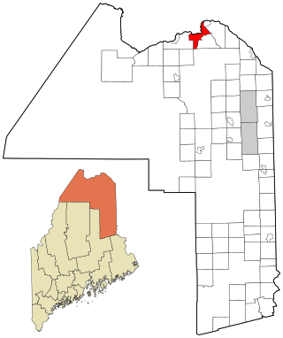
Vanceboro is a town in Washington County, Maine, United States. The town was named after landowner William Vance. The main village in town is located at the eastern terminus of Maine State Route 6. Vanceboro is across the St. Croix River from St. Croix, New Brunswick, Canada, to which it is connected by the Saint Croix–Vanceboro Bridge. Vanceboro is also connected to St. Croix by the Saint Croix–Vanceboro Railway Bridge, which is used by the New Brunswick Southern Railway.

<span class="mw-page-title-main">Lockwood, Missouri</span> City in Missouri, United States

Lockwood is a city in Dade County, Missouri, United States. The population was 846 at the 2020 census.

Belville is a town in Brunswick County, North Carolina, United States. The population was 1,936 at the 2010 census, up from 285 in 2000. It is part of the Wilmington, NC metropolitan area.

<span class="mw-page-title-main">Boiling Spring Lakes, North Carolina</span> City in North Carolina, United States

Boiling Spring Lakes is a city in Brunswick County, North Carolina, United States. The population was 5,943 at the 2020 census, up from 5,372 in 2010.

<span class="mw-page-title-main">Bolivia, North Carolina</span> Town in North Carolina, United States

Bolivia is a town in Brunswick County, North Carolina, United States. The population was 143 at the 2020 census. It is the county seat of Brunswick County.

Carolina Shores is a town in Brunswick County, North Carolina, United States. The population was 3,048 at the 2010 census, up from 1,482 in 2000. It is part of the Wilmington, NC Metropolitan Statistical Area.

<span class="mw-page-title-main">Holden Beach, North Carolina</span> Seaside town in North Carolina, United States

Holden Beach is a seaside town in Brunswick County, North Carolina. The population was 575 at the time of the 2010 census. It is part of the Wilmington, NC Metropolitan Statistical Area.

Northwest is a city in Brunswick County, North Carolina, United States. The population was 735 at the 2010 census. It is part of the Wilmington, NC Metropolitan Statistical Area.

Sandy Creek is a town in Brunswick County, North Carolina, United States. The population was 260 at the 2010 census. It is part of the Wilmington, NC Metropolitan Statistical Area.

<span class="mw-page-title-main">Shallotte, North Carolina</span> Town in North Carolina, United States

Shallotte is a town in Brunswick County, North Carolina, United States. The population was 3,675 at the 2010 census. The Shallotte River passes through the town.

Brunswick is a town in Columbus County, North Carolina, United States. The population was 1,119 at the 2010 census.

<span class="mw-page-title-main">Pollocksville, North Carolina</span> Town in North Carolina, United States

Pollocksville is a town in Jones County, North Carolina, United States. The population was 268 at the 2020 census. It is part of the New Bern, North Carolina Micropolitan Statistical Area. It is situated on US 17 and Highway 58.

<span class="mw-page-title-main">Folly Beach, South Carolina</span> City in South Carolina, United States

Folly Beach is a public city on Folly Island in Charleston County, South Carolina, United States. The population was 2,617 at the 2010 census, up from 2,116 in 2000. Folly Beach is within the Charleston-North Charleston-Summerville metropolitan area and the Charleston-North Charleston Urbanized Areas.

<span class="mw-page-title-main">Brunswick, Vermont</span> Town in Vermont, United States

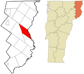
Brunswick is a town in Essex County, Vermont, United States. The town was named after Prince Karl Wilhelm Ferdinand of Brunswick-Lunenburg. The population was 88 at the 2020 census. It is part of the Berlin, NH-VT Micropolitan Statistical Area. Brunswick is home to six mineral springs that made the town a popular resort destination in the 19th century. The land the springs are on is now owned by the Abenaki people.

<span class="mw-page-title-main">Alberta, Virginia</span> Town in Virginia, United States

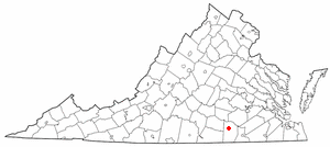
Alberta is a town in Brunswick County, Virginia, United States. The population was 302 at the 2020 census. It is home to the Christanna Campus of Southside Virginia Community College.

<span class="mw-page-title-main">Weddington, North Carolina</span> Town in North Carolina, United States

Weddington is a suburban town in Union County, North Carolina, United States. The population was 9,459 at the 2010 census. It is a suburb in the Charlotte metropolitan area. The current mayor of Weddington is Jim Bell.

<span class="mw-page-title-main">Brunswick (CDP), Maine</span> Census-designated place in Maine, United States

Brunswick is a census-designated place (CDP) in the town of Brunswick in Cumberland County, Maine, United States. The population was 15,175 at the 2010 census. It is part of the Portland–South Portland–Biddeford, Maine Metropolitan Statistical Area.

References

  1. "ArcGIS REST Services Directory". United States Census Bureau. Retrieved September 20, 2022.
  2. 1 2 U.S. Geological Survey Geographic Names Information System: Varnamtown, North Carolina
  3. 1 2 "U.S. Census website". United States Census Bureau . Retrieved January 31, 2008.
  4. 1 2 "Geographic Identifiers: 2010 Demographic Profile Data (G001): Varnamtown town, North Carolina". U.S. Census Bureau, American Factfinder. Archived from the original on February 12, 2020. Retrieved February 12, 2014.
  5. "Varnamtown". Star-News. May 24, 1998. p. 34. Retrieved November 1, 2015.
  6. "Census of Population and Housing". Census.gov. Retrieved June 4, 2015.