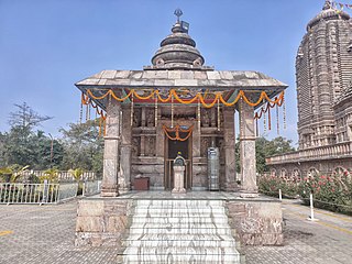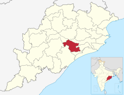
Rayagada district is a district in southern Odisha, a state in India, which became a separate district in October 1992. Its population consists mainly of tribes, primarily the Khonds and the Soras. In addition to Odia, Kui and Sora are spoken by the district's indigenous population. It was founded by Maharajah Biswanatha Deba Gajapati of the Surjyabansha dynasty of Jeypore.

West Singhbhum or Pashchimi Singhbhum is one of the 24 districts of Jharkhand state, India. It came into existence on 16 January 1990, when the old Singhbhum district was bifurcated. Chaibasa is the district headquarters.

Seraikela-Kharsawan district or Saraikella and Kharaswan district is one of the twenty-four districts of Jharkhand state in eastern India. Seraikela town is the district headquarters of Saraikela Kharsawan district. The district is well known for Seraikela Chhau, one of the three distinctive styles of the chhau dance. This district was carved out from West Singhbhum district in 2001. The district was formed from the princely states of Seraikela and Kharaswan, after the independence of India.

Shajapur District is a district of Madhya Pradesh state of central India. The town of Shajapur is the district headquarters.

Cuttack district is one of the 30 districts of Odisha state in India. It is located in the coastal part of the state and its administrative headquarters are located in the city of Cuttack. As of 2011 Census, after Ganjam, it is the second most populous district of Odisha, with a population of 2,624,470. The name is an anglicized form of Kataka or Katak meaning Fort – referring to the Barabati Fort. The district is bisected by the river Mahanadi and its numerous distributaries and occupies a large portion of the river's delta. It is bounded by the Angul, Dhenkanal, Nayagarh and Khurda districts to the west while its southern and eastern boundaries touch Puri, Jagatsinghpur, Kendrapara and Jajpur districts.

Pakur district is one of the twenty-four districts of Jharkhand state, India, and Pakur is the administrative headquarters of this district. Pakur sub-division of Sahibganj district was carved out on 28 January 1994 to constitute Pakur District. The district, with a population of 900,422, and covering an area of 686.21 km2, is situated on the north-eastern corner of Jharkhand state.

Jamtara district is one of the twenty-four districts of Jharkhand state in eastern India. Jamtara town is the administrative headquarters of this district. The district is situated between 23°10′ and 24°05′ north latitudes and 86°30′ and 87°15′ east longitudes.

Khordha district is an administrative division of the state of Odisha, India. It was formed on April 1, 1993, by the division of former Puri District into Puri, Khordha and Nayagarh districts. In the year 2000 the district name was changed to Khordha. The district headquarters is Khordha Town. The capital city of Bhubaneswar is located in this district. Khordha is the most urbanized of all the districts of Odisha.

Kendrapara District is an administrative district of Odisha state in eastern India. The town of Kendrapara is the district headquarters. Kendrapara District is situated in the eastern portion of the state, and is bounded on the north by Bhadrak district, on the east by the Bay of Bengal, on the south by Jagatsinghpur District, on the west by Cuttack District on the northwest by Jajpur District.

Dhenkanal district is one of the 30 districts of the state of Odisha in Eastern India.

Jharsuguda is a district in Odisha, India with Jharsuguda town as its headquarters. This region is rich in coal and other mineral reserves. Of late, many small and medium scale iron and steel units have been set up in the vicinity of Jharsuguda town, giving impetus to the industrial growth of the district.

Sundargarh District is a district in the northwestern part of Odisha state in eastern India.

Jhabua is a district of Madhya Pradesh state in central India. The town of Jhabua is the administrative headquarters of the district.

Puri district is a coastal district of the Odisha state of India. It has one sub-division, 11 tahasils and 11 blocks and comprises 1722 revenue villages. Puri is the only municipality of the district. Konark, Pipili, Satyabadi, Gop, Kakatpur and Nimapada are the NACs in this district while Brahmagiri being a semi-urban town.

Jajpur is a district of Odisha state in eastern India. The Odisha Government carried out a re-organisation of districts of Odisha in 1993. The erstwhile Cuttack district was split into multiple districts with Jajpur being one of them. The district came into being on 1 April 1993.

Balasore District, also known as Baleswar District, is an administrative district of Odisha state, in eastern India. Balasore is one of the coastal districts of Odisha and lies on the northernmost part of the state.

Chitrakoot district is one of the districts of Uttar Pradesh state of India in the Bundelkhand region and Chitrakoot city is the district headquarters. Chitrakoot district is a part of Chitrakoot Division. The district occupies an area of 3,216 km2.The district has a population of 991,730. As of 2011 it is the second least populated district of Uttar Pradesh, after Mahoba.

Mahasamund district is a district in Chhattisgarh state in central India. The city of Mahasamund is the district headquarters. The district is particularly famous for the historical temple town of Sirpur besides the Mahanadi river.

North Delhi is an administrative district of the National Capital Territory of Delhi in India. Alipur is the administrative headquarters of this district. North Delhi is bounded by the Yamuna River and the district of Central Delhi on the east and by the district of North West Delhi to the west.

Malkangiri district is the southwesternmost district in the Indian state of Odisha. It has two Vidhan sabha constituencies.


