Kunnur, natively spelt as Coonor(pronunciation ), is a Taluk and a municipality of the Nilgiris district in the Indian State of Tamil Nadu. As of 2011, the town had a population of 45,494.

Attur or Aathur is a town, municipality and headquarters of Attur taluk in the Salem district in the state of Tamil Nadu, India. As of the 2011 census, the town had a population of 61,793. Attur is growing economically.

Tenkasi is a town and headquarters of the Tenkasi district in Indian state of Tamil Nadu.

Vandavasi, earlier called Wandiwash is a major town and a municipality in the Tiruvannamalai district of the Indian state of Tamil Nadu. The town is well known in the Carnatic history for the Battle of Wandiwash. Vandavasi town is also the largest manufacturer of kora artefacts including mats, shawls and vessels. As of 2011, the town had a population 74,320.
Panruti is a developing city, municipality and taluk headquarters of Cuddalore district, Tamil Nadu, India. Panruti is located between Cuddalore and Neyveli. Panruti is famous for jackfruits and cashew nuts. The jackfruit grown here is exported worldwide and is very sweet. It is a business capital of Cuddalore district. Kananchavadi one of the villages in panruti taluk, famous for palm juice. It has been a great commercial area for more than 200 years. The name Panruti came from the Tamil words "Pann" and "Urutti" meaning "composing song and music", as the place is where many saints and great religious singers such as nayanmars and vainavas sung. A 150-year-old government school was built here by the British East India Company and a more-than-1000-year-old temple Veerattaneswarar temple is nearby in Thiruvathigai. As of 2011, the town had a population of 60,323.

Rajapalayam is a town in the Indian state of Tamil Nadu. It is the largest municipality in the Virudhunagar district. Rajapalayam is located on the Madurai to Quilon National Highway at a distance of 562 km south of the state capital Chennai. The economy is primarily industrial with several mills for spinning and weaving. The town is known for its mango and the Rajapalayam breed of dogs.
Sattur or Saathur is a town in Virudhunagar district in the Indian state of Tamil Nadu. As of 2011, the town had a population of 29,398.
Alandur is a zone of Chennai corporation, and an urban node in Chennai district in Guindy division in the state of Tamil Nadu, India. It is Surrounded by Guindy in the North and East, Adambakkam in the South, Pazhavanthangal in the South-West and St Thomas Mount in the North-West. As of 2011, Alandur had a population of 164,430. The town agglomeration of Alandur will have an estimated population of 300,000 by 2030. Alandur neighbours the St. Thomas Mount Cantontment, the Officers Training Academy of the Indian army and the nearby towns of Guindy and Adambakkam. M. G. Ramachandran, a former chief minister of Tamil Nadu started his political career by winning his first legislative election from Alandur in 1967. Alandur also holds famous landmarks of Chennai namely Nehru Statue and Kathipara Junction.

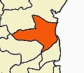
Cuddalore District is one of the 38 districts in the state of Tamil Nadu in India.

Perambalur is a town in the Indian state of Tamil Nadu. It is the headquarters of Perambalur district and Perambalur taluk (sub-district). As of 2011 census, the town had a population of 49,648.
Ambasamudram is the principal town of the Ambasamudram taluk in Tirunelveli district in the state of Tamil Nadu, India. The entire taluk had a population of 392,226 as of 2001, with 42.5% classified as rural. The town of Ambasamudram had a population 35,645 as of 2011.

Bodinayakanur is a Town and a municipality in Theni district in the state of Tamil Nadu, India.

Kavundampalayam is an area located in Coimbatore, Tamil Nadu, India. It is within the Coimbatore Corporation, about 6 km north of the city centre. Goundampalayam is along Mettupalayam road in Coimbatore, one of the arterial roads of the city. As of 2011, the town had a population of 83,908.

Kallakurichi is a Municipality in the Indian state of Tamil Nadu and the administrative headquarters of Kallakurichi district in Tamil Nadu. As of 2019, the town had a population of 73528.
Katthivakkam is an residential and industrial area located in the northern part of Chennai. It is a part of zone 1 in Greater Chennai Corporation. It is under Thiruvottiyur taluk in Chennai district. It is a part of Thiruvottiyur(state assembly constituency) and Chennai North. Formerly a town and a municipality of Thiruvallur district in the Indian state of Tamil Nadu, it has now been absorbed by Chennai city in September 2011 and within Chennai District limit since January 2018. The neighbourhood is served by Katthivakkam railway station. As of 2011, the town had a population of 36,617.

Kuniyamuthur is a part of South Coimbatore. It is about 6 km from Coimbatore City center in the South. Kuniyamuthur is sometimes spelled Kuniamuthur or Kunimattoor. It is one of the busiest markets in the city. It is located on Palakkad road, one of arterial roads of Coimbatore city. The Coimbatore International Airport is about 17 km and Coimbatore Junction is about 6 km from here, Podanur Junction railway station is about 5 km from Kuniyamuthur. As of 2011, the town had a population of 95,924.
Mettupalayam is a municipality town and taluk headquarters of Mettupalayam Taluk in the Coimbatore district of the Indian state of Tamil Nadu, a suburb of Coimbatore. It is the third largest town in the Coimbatore district after Coimbatore and Pollachi. It's located to the North of the Coimbatore city on the way to Ooty in the foothills of Nilgiri hills. As of 2011, the town had a population of 66,595. Mettupalayam railway station is the starting point of Nilgiri Mountain Railway and it operates the only rack railway in India connecting Ooty and Mettupalayam.,Native place of Vishanth ram, Harini sri

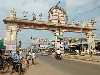
Virudhachalam or Vriddhachalam is a Town and taluk headquarters in Cuddalore district in the Indian state of Tamil Nadu. The ancient name of this town is Thirumudhukundram. As per the 2011 census, the town had a population of 73,585 of which 37,066 are males while 36,519 are females. Population of children in the ages of 0-6 is 7735 which is 10.51 % of the total population. The old Lord Siva temple is located in the heart of town. This is the 41st Devaram Padal Petra Siva Thiruthalam and 9th Thiruthalam in Nadu Naadu(நடுனாடு). Moovar has sung hymns in praise of Lord Siva of this temple. The temple was constructed by one of the Chola Emperors. The famous Kolanjiappar Temple is located 3 km away from the town. Both of them are situated near Cuddalore - Salem highway in Virudhachalam.
Narasingapuram is a Municipality in Attur taluk, Salem district in the Indian state of Tamil Nadu. As of 2011, the town had a population of 23,084.

Thiruvarur district is one of the 38 districts in the Tamil Nadu state of India. As of 2011, the district had a population of 1,264,277 with a sex-ratio of 1,017 females for every 1,000 males.