Vaniyambadi (shortly known as Vnb) is a town in the Tirupathur district of Tamil Nadu and the headquarter for the Vaniyambadi Revenue district comprising Vaniyambadi and Ambur. It is located about 200km from Chennai and 178 kilometer from Bengaluru. The Vaniyambadi Municipality was formed by the G.O. MS. No. 421 Local & Municipality Dept. in April 1886.[1] In 1996 this Municipality was upgraded to Grade II Municipality by G.O. MS. NO. 118 Rural Development Local Administration Dept. dated 01.05.1996. In 1998 this Municipality was upgraded to 1st Grade.
It is one of the hubs of Leather exports in Tamil Nadu. It is also famous throughout India for its special Vaniyambadi Biryani. The city is the home for many prestigious century-old educational institutions viz. The Vaniyambadi Muslim Educational Society (VMES) (Estd. 1901),[2] The Hindu Higher Secondary School (Estd. 1914). The famous hill station Yelagiri is approximately 20 km away from town. Another hill station leading way through Andhra Pradesh is a short way to Kolar Gold Fields and Karnataka.
Etymology
Vaniyambadi in Tamil Nadu derives its name and identity from mythological lore. Vaniyambadi is derived from Vaniampadi = Vani Ammai + Padi (Tamil: வாணி அம்மை + பாடி) which denotes "Vani Ammai" the name of the Goddess Saraswathi, and "Padi" refers the infinitive, "to sing". Legend has it that Saraswati sang on the banks of the Palar River for God Vishnu and God Shiva here, and hence it was named Vaniyambadi. Indeed, temples dedicated to Sundara Varadaraja Perumal (Vishnu) and Athitheeswarar (Shiva) dot both banks of the fast-flowing Palar River. Vaniyambadi, today, is surrounded by lovely hills with many a scenic hill station positioned on them, green farmlands crisscrossed by numerous water channels and a sleepy little town amidst it all.
History
Vaniyambadi is a well-known place in the history of fights against the British. Hyder Ali and his son Tipu Sultan have been known to have camped in Vaniyambadi during their battles against the British empire, also Vaniyambadi battle is first for Tippu at the age of 17 when his Father was ill.[3]
The Mysorean army set off on its fresh round of campaigning in the beginning of November 1767. According to De la Tour,[4][unreliable source?] it was two days after Haidar's mother had departed with her retinue. The main army marched towards Vaniyambadi while another detachment had been sent earlier in the direction of Tirupattur which had again fallen into British hands. The scouting parties of cavalry and infantry had reported an easy approach to Vaniyambadi along the course of the Palar river which flowed past the town and the route was covered with thick undergrowth and trees. Also there was no need of digging trenches for the artillery due to there being a ridge which could serve as a position for the cannons. The garrison there consisted of 30 Europeans with 1000 sepoys, mostly irregulars. The Mysorean army reached the outskirts of the fort at dusk on November 6 and set up a battery of 12 cannons on the ridge at night. The European commander of the artillery received a light wound in the process. Haidar ordered him to rest in his tent and took over the personal command of the battery. Throughout the night he sat under a tree nearby and directed the setting up of the artillery unmindful of the firing by the British who had now noticed his approach. Though this is not mentioned in other sources it is certainly characteristic of Haidar's courage and he would repeat it during the siege of Ambur. He left when the commander returned. The cannons commenced firing soon after dawn on November 7 and soon the British garrison in Vaniyambadi capitulated, probably due to its inadequate strength though no breach had been made.
Geography
Location
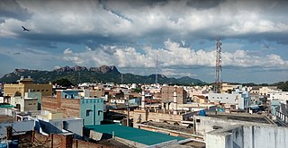
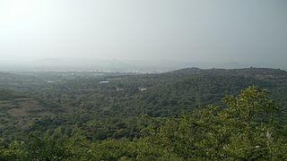
Vaniyambadi is located at 12.6872° N, 78.6303° E.[5] It has an average elevation of 354 metres (1,161ft) and lies in the Eastern Ghats region and on the banks of the Palar river. Yelagiri and Javadi Hills are located to the south of the town.[6] By road Vaniyambadi is surrounded by Ambur and Tirupathur which are 15km, 24km away respectively. It is on the banks of the Palar River.
Climate
Vaniyambadi experiences a tropical savanna climate (Köppen climate classificationAw). The temperature ranges from 10°C (50°F) to 40°C (104°F). In the city, March to May are the hottest months and November to January are the coldest. Vaniyambadi receives 865.3mm (34.07in) of rainfall every year. The southwestern monsoon from June to September brings 360.5mm of rainfall,[7] with September being the rainiest month. The northeastern monsoon which lasts from October to December brings 294.7mm of rainfall. The humidity ranges from 50% to 58% during summer and 61% to 80% during winter.
Climate data for Vaniyambadi – Rainfall (1971 to 2005) & Others (1990 to 2020)
According to 2011 census, Vaniyambadi had a population of 195,061 with a sex-ratio of 1,023 females for every 1,000 males, much above the national average of 929.[8] A total of 12,013 were under the age of six, constituting 6,121 males and 5,892 females. Scheduled Castes and Scheduled Tribes accounted for 15.15% and 0.09% of the population respectively. The average literacy of the town was 85.13%, compared to the national average of 72.99%.[8] The town had a total of 40,559 households. There were a total of 61,013 workers, comprising 94 cultivators, 218 main agricultural labourers, 800 in house hold industries, 26,529 other workers, 3,372 marginal workers, 11 marginal cultivators, 100 marginal agricultural labourers, 202 marginal workers in household industries and 3,059 other marginal workers.[9] It consists of 36 wards.
Islam is the majority religion in the town, while Hinduism is a close second. There is a small Christian minority.
Deccani Urdu is the main language of the town and is spoken by 55.6%, while Tamil is a significant minority of 38.8%. A small Telugu minority of 4.2% is also there due to the proximity of Andhra Pradesh. Leather tanning is a major industry of the town and leather garments, and making leather shoes are one of the economies of the town even today Vaniyambadi leathers have separate value in the global leather market. Agriculture, especially coconut plantations, is the other major source of livelihood.
The Vaniyambadi Municipality was formed by the British Government in April 1886.[1] In 1996 this Municipality was upgraded to Grade II Municipality by Rural Development Local Administration Dept. dated 01.05.1996. In 1998, this Municipality was upgraded to 1st Grade.
The town consists of 36 Wards each with an elected Councillor. Legislative power is vested in the member council, headed by an elected chairperson and assisted by a deputy chairperson. The Municipal Commissioner governs the departments of the municipality. Law and order is maintained by the Tamil Nadu Police, headed by a Deputy superintendent.
Since 1952, the Vaniyambadi Assembly seat was held by the ADMK four times (1980, 2002 (by-election), 2011 and 2016), by the DMK four times (1962, 1989, 1996 and 2006), by the Indian National Congress three times (1957, 1984 and 1991) and by independent candidates four times (1952, 1971, 1977 and 2001). Present MLA is G. Sendhil Kumar from AIADMK.
Since 1952, the Vellore parliament seat was held by the Indian National Congress five times (1952, 1957, 1962, 1977 and 1991), by the DMK four times (1962, 1971, 1996 and 2019), by the Indian Union Muslim League four times (1980, 1989, 2004 and 2009), by the ADMK two times (1984 and 2016) and by the PMK two times (1998 and 1999). The current Member of Parliament from the constituency is D. M. Kathir Anand from the DMK.[15]
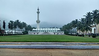
The Sundara Varadaraja Perumal and Athitheeswarar temples are the main draws of this town for pilgrims.[citation needed] The town also has a number of mosques built in the medieval as well as modern Islamic architectural styles.[citation needed] The dargah of Janab Masthan Ali Aulia Saheb draws devotees from all faiths, while the Avanghali temple nearby proclaims this town's great record in harmonious co-existence of different religions. Vaniyambadi is famous for its various local sweets and biryani.[citation needed]
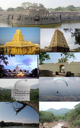
A view of the Vainu Bappu Observatory
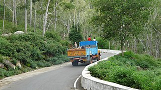
Devotees to the temples here often extend their stay to visit one of the two hill stations that lie within half-hour drives from the town centre.[16]Yelagiri, which is one such hilltop resort set amidst a quarter of mountains. The structure of tribal houses and the locals' small-scale industries, such as honey gathering and weaving, attract tourists to this hill station.[citation needed]
Economy
Vaniyambadi plays a major role in the field of leather industry. The main core business of this town is leather tanning and manufacturing of leather goods such as Garments, Gloves and Shoes. Over several decades, Vaniyambadi has contributed to millions of dollars for the Indian economy by exporting leather garments, leather articles and other chemical effluents all over the world. Vaniyambadi has shown better economy for past many decades. There are more than around 150+ tanneries and 2 effluent water treating plants.
Transport
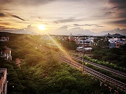
A view of Vaniyambadi Railway StationVaniyambadi Toll Plaza in the Golden Quadrilateral Chennai – Bangalore Highway
Vaniyambadi is well connected by road and rail to major cities of India. The town is separated by a distance with Bangalore [144km] , Chennai [199km], Vellore [64km] and Salem [139km]. The town lies on the highway (NH 48) of the Bangalore-Chennai section which is part of the Golden Quadrilateral. A state highway connects the town to Tirupattur on the Vaniyambadi-Salem(SH-18), Vaniyambadi-Gudiyattam via Gadambur(SH-130) and Polur-Vaniyambadi via Jamunamarathur, Alangayam(SH-215). The town also has a railway station and is also close to Jolarpet Railway Junction, where most of the long haul trains stop. The nearest domestic Airport is Vellore Airport and nearest International Airport is Bangalore International Airport and Chennai International Airport major people's prefer Chennai airport for travelling. From the town, one can easily travel to the Andhra Pradesh, Karnataka and also to the southern parts of Tamil Nadu.
On February 12, 1981, three trains -- Trivandrum Mail, Yercaud Express and a goods train were involved in a crash that left 20 dead and at least 50 injured. According to news reports, the couplings of a goods train had snapped and the loose wagons slipped onto a second line. The Trivandrum Mail (No 20 Madras Mail) crashed into the wagons and derailed. [17]
The city is the home for some of the prestigious century-old educational institutions. Due to their reputation, students from the surrounding towns of Ambur, Tirupattur, Jolarpet, Pallikonda, Gudiyattam and Alangayam travel here to pursue their higher education. They are listed below:
Arcot is a town and urban area of Ranipet district in the state of Tamil Nadu, India. Located on the southern banks of Palar River, the city straddles a trade route between Chennai and Bangalore or Salem, between the Mysore Ghat and the Javadi Hills. As of 2018, the city had a population 129,640. The sweet makkan peda is a local speciality while Arcot biryani, a rice-based traditional food, is also served here.
Vellore, is a sprawling city and the administrative headquarters of Vellore district in the Indian state of Tamil Nadu. It is located on the banks of the Palar River in the northeastern part of Tamil Nadu and is separated into four zones that are further subdivided into 60 wards, covering an area of 87.915 km2 and housing a population of 423,425 as reported by the 2001 census. It is located about 137.20 kilometres (85 mi) west of Chennai, and about 213.20 kilometres (132 mi) east of Bangalore. Vellore is located on the Mumbai–Chennai arm of the Golden Quadrilateral. Vellore is governed under a mayor and the Vellore Municipal Corporation. It is a part of both the Lok Sabha and state assembly constituencies of Vellore.
Kandhili or Kandili block is a small township in the Tirupathur district of Tamil Nadu, India.
Gudiyetram, colloquially Gudiyattam is a municipality in Vellore district in the state of Tamil Nadu in India. It lies between Bangalore and Chennai and the district of Vellore is 33 km away from the town. In 2011, the town had a population of 235,672. The municipality derives its name from 'Gudiye-tram' in Tamil which means habituation of people. The ancient occupation of the people of Guidyatham was handloom weaving.
Ranipettai is a town in Tamil Nadu, India and the headquarters of Ranipet district. Ranipet is an industrial hub of greater Vellore city. It is located about 100 kilometres (62 mi) from the Chennai city center. It is a major industrial town located on NH 4 Chennai-Bangalore highway, on the northern bank of the Palar River.The estimated population is 387,000 as of 2023.
The Javadhu Hills are an extension of the Eastern Ghats spread across parts of Tirupattur and Tiruvannamalai districts in the northern part of the state of Tamil Nadu in southeastern India. This range separates Tirupattur and Tiruvannamalai districts. Tirupattur district lies on the north-western side and Tiruvannamalai district lies on the south-eastern side of this range. The towns of Tirupattur, Vaniyambadi and Ambur of Tirupattur district are located on the north western side and the towns of Chengam and Polur of Tiruvannamalai district are located on the south eastern side.
Vellore district is one of the 38 districts in the Tamil Nadu state of India. It is one of the eleven districts that form the north region of Tamil Nadu. Vellore city is the headquarters of this district. As of 2011, the district had a population of 1,614,242 with a sex ratio of 1,007 females for every 1,000 males. In 2017 Vellore district ranked eleventh in list of districts in Tamil Nadu by Human Development Index.
Ambur is a town and municipality in newly announced Tirupathur district, Vellore region of Tamil Nadu, India. It is located on the banks of the Palar River between Chennai and Bangalore. Ambur has a sizeable leather industry, and is known for its spicy biryani and for the sweet, makkhenpeda. Ambur was the site of two major military actions in the 18th century. The first was the 1749 Battle of Ambur that opened the Second Carnatic War between the Arcot State and the Mughal Empire. In 1767, the siege of Ambur took place during the First Anglo-Mysore War, with local troops and a British force successfully resisting an attack by the Kingdom of Mysore and by the Hyderabad State.
Jolarpettai is a railway town in Tirupattur district, Tamil Nadu, India. It is a commuter rail hub in Southern Railway. It is 7 km from district Tirupattur and 18 km from Vaniyambadi.
Melvisharam is a town and suburb of Vellore city in the Indian state of Tamil Nadu. It is 7 kilometres from Ranipet, 5 km from historic town of Arcot and 17 km from Vellore city.
Priyadarshini Engineering College, Vaniyambadi is an engineering college in Tamil Nadu, India. It is located at Vaniyambadi, Tirupattur District of Tamil Nadu.
Tirupathur taluk is a taluk in Tirupathur district of the Indian state of Tamil Nadu. The headquarters of the taluk is the town of Tirupathur. It is known as the "Sandalwood Town" due to the abundant availability of sandalwood trees in the surrounding hills. On 15 August 2019, Chief Minister of Tamil Nadu, Edapaadi K. Palanisami announced Tirupathur district, as a new district of Tamil Nadu.
Oomerabad or Umarabad is a village in Tirupathur district, Tamil Nadu, India. It is part of Ambur Taluk.
Pernambut is a town and village headquarters also a Municipality in Vellore district in the Indian state of Tamil Nadu. The economy is dependent on leather tanning industry, earning it the nickname Leather Tanning city of Tamil Nadu. Pernambut is a municipality and headquarters of Pernambut Taluk which is an administrative division comprising 52 Revenue villages in the district of Vellore.
The Kandili is a revenue block in the Tirupattur district of Tamil Nadu, India. It has a total of 39 panchayat villages.
Ramanaickenpettai is a Village panchayat in Vaniyambadi of Tirupathur district of the Indian state of Tamil Nadu.
Tirupattur district, or Tirupathur district, is one of the 38 districts in the southern Indian state of Tamil Nadu. The district was formed in 2019 by the division of Vellore district into three smaller districts. Its creation alongside Ranipet district was announced on 15 August 2019, and it was officially declared on 28 November 2019. The town of Tirupattur serves as the district headquarters.
Tirupathur or Tirupattur is the headquarters of Tirupathur district in the state of Tamil Nadu in India and is one of the oldest inhabited places in the state, with a history of over 1,600 years. The town is known for an abundance of sandalwood in the surrounding hills. It is located about 89 km (55 mi) from Vellore, 85 km (53 mi) from Hosur, 60 km (37 mi) from Dharmapuri, 50 km (31 mi) from Krishnagiri, 50 km (31 mi) from Thiruvannamalai, 279 km (173 mi) from coimbatore, 210 km (130 mi) from Chennai, and 125 km (78 mi) from Bangalore.
Vaniyambadi Revenue District in the southern state of Tamil Nadu is one of the major leather export hubs in India. The district comprises two towns viz. Vaniyambadi and Ambur.
1 2 "Census Info 2011 Final population totals". Office of The Registrar General and Census Commissioner, Ministry of Home Affairs, Government of India. 2013. Retrieved 26 January 2014.
This page is based on this Wikipedia article Text is available under the CC BY-SA 4.0 license; additional terms may apply. Images, videos and audio are available under their respective licenses.