Newbarns

Last updated

Newbarns
Newbarns, Barrow-in-Furness.jpg
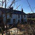
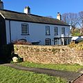
Roundabout at Harrel, Flass and Rating Lane
Newbarns, Barrow location map.jpg
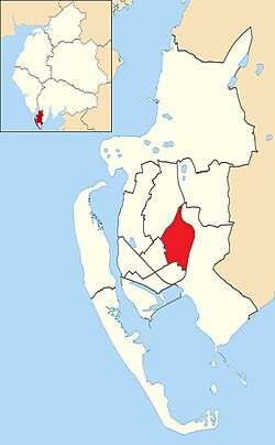
Newbarns shown within Barrow-in-Furness
Population5,487 (2011.Ward)
District
Shire county
Region
Country England
Sovereign state United Kingdom
Post town BARROW-IN-FURNESS
Postcode district LA13
Dialling code 01229
Police Cumbria
Fire Cumbria
Ambulance North West
UK Parliament
List of places
UK
England
Cumbria

Newbarns is an area and electoral ward of Barrow-in-Furness, Cumbria, England. It is bordered by Hawcoat, Parkside, Risedale and Roose, [1] the local population stood at 5,515 in 2001, decreasing to 5,487 at the 2011 Census. [2] Newbarns covers an area of 2.78 square kilometres and lies east of Abbey Road, encompassing Furness Abbey in its entirety, Barrow Sixth Form College and St. Bernard's Catholic High School. Newbarns is extremely diverse, with the majority of the south of the ward being amongst the 6% to 10% most deprived areas of the country, while north Newbarns contains Croslands Park, Barrow's most expensive street and is within the 25% of least deprived areas nationwide.

Contents

History

The area centred on Hector Street marks the original Newbarns village which pre dates much of Barrow and originally lay within the Parish of Dalton-in-Furness. Sandylands Farmhouse is Grade II listed and is the oldest surviving building in Newbarns, dating from 1623. Several other nearby 17th, 18th and 19th century houses are also listed buildings.

Demographics


Vital statistics [3] NewbarnsBarrow-in-FurnessEngland
Religious individuals83.02%81.61%77.71%
Non-religious individuals9.90%10.79%14.59%
Religion withheld7.09%7.59%7.69%
Individuals in fairly
good to good health
87.13%86.75%90.97%
Individuals in bad health12.87%13.25%9.03%
People aged 16–74 who
are economically active
58.03%60.84%66.87%
People aged 16–74 who
aren't economically active
41.98%39.16%33.13%
People aged 16–74
with no qualifications
32.03%32.82%28.85%

Related Research Articles

Barrow-in-Furness Town in Cumbria, North-West England

Barrow-in-Furness is a town in Cumbria, North-West England. Historically part of Lancashire, it was incorporated as a municipal borough in 1867 and merged with Dalton-in-Furness Urban District in 1974 to form the Borough of Barrow-in-Furness. At the tip of the Furness peninsula, close to the Lake District, it is bordered by Morecambe Bay, the Duddon Estuary and the Irish Sea. In 2011, Barrow's population was 57,000, making it the second largest urban area in Cumbria after Carlisle. Natives of Barrow, as well as the local dialect, are known as Barrovian.

Borough of Barrow-in-Furness Place in England

Barrow-in-Furness is a local government district with borough status in Cumbria, England. It is named after its main town, Barrow-in-Furness. Other settlements include Dalton-in-Furness and Askam-in-Furness. It is the smallest district in the county, but is the most densely populated, with 924 people per square kilometre. The population was 71,980 in 2001, reducing to 69,087 at the 2011 Census.

Arnside Human settlement in England

Arnside is a village and civil parish in Cumbria, historically part of Westmorland, near the border with Lancashire, England. The Lake District National Park is located a few miles North. Travelling by road, Arnside is 22 miles (35 km) to the south of Kendal, 25.3 miles (40.7 km) to the east of Ulverston, 35.2 miles (56.6 km) to the east of Barrow-in-Furness, 15.7 miles (25.3 km) to the west of Lancaster and 14.3 miles (23.0 km) to the east of Grange-over-Sands. In the 2001 census the parish had a population of 2,301, increasing at the 2011 census to 2,334.

Pelton, County Durham

Pelton is a village and electoral ward in County Durham, in England. The population of the village and ward taken at the 2011 census was 8,250. It is located about two miles to the northwest of Chester-le-Street. The village of West Pelton is located to the west; separated from it by a few villages between and closer to Stanley than to central Chester-le-Street. Pelton has a newly built community centre updated in 2012, one public house and a small range of convenience stores, including a CO OP, three general stores, a Post Office, chemist, doctors surgery, dentist, library, two parks and some take-away food outlets, and some hair salons. Local schools in the area include a primary school. Pelton is served by public transport, with links to Stanley, Sunderland, Newcastle upon Tyne, Chester-le-Street and Consett with buses running up to every 30 minutes or so to 5 bus stops throughout the village. In local government they are governed by the Pelton Parish Council.

Roose Human settlement in England

Roose or Roosecote is a suburb and ward of Barrow-in-Furness, Cumbria, England. The word 'roose' is Celtic for "moor" or "heath" and the suffix 'cote' of Roosecote means "hut" or "huts". Before the building of Roose Cottages and the arrival of the Cornish miners Roose was pronounced with a hard S, as in goose; now it is locally pronounced 'Rooze', due to the Cornish accent. Roose is served by Roose railway station, one of the few remaining stations on the Furness Line in the Barrow area.

Barrow Island, Barrow-in-Furness Area and electoral ward of Barrow-in-Furness, Cumbria, England

Barrow Island is an area and electoral ward of Barrow-in-Furness, Cumbria, England. Originally separate from the British mainland, land reclamation in the 1860s saw the northern fringes of the island connect to Central Barrow. Barrow Island is also bound to the south and east by the town's dock system and to the west by Walney Channel. The Ward population taken at the 2011 census was 2,616.

Norton Malreward Village an civil parish in Somerset, England

Norton Malreward is a small Somerset village and civil parish 4 miles (6.4 km) south of Bristol, England at the northern edge of the Chew Valley. In 1895 Norton Malreward was combined with the neighbouring hamlet of Norton Hawkfield into a single parish, which has a population of 246.

Clogh, County Antrim

Clogh, also spelt as Clough is a small village in County Antrim, Northern Ireland, 9 miles from Ballymena. It is situated within the Glenravel ward of the Braid electoral area of Mid and East Antrim District Council. It had a population of 220 people in the 2011 Census.

Hawcoat Human settlement in England

Hawcoat is an area and electoral ward of Barrow-in-Furness, Cumbria, England. Historically part of Lancashire, it is one of Barrow's most northerly wards and is bordered by Roose, Newbarns, Parkside, Ormsgill and the town of Dalton-in-Furness to the north.

Central Barrow Human settlement in England

Central Barrow refers both to the town centre of Barrow-in-Furness, Cumbria, England and to the electoral ward that roughly covers the eastern part of that town centre. In 2001 5,584 lived in the Central ward. The population density was 55.96 per hectare, which was well above the local average of 9.24, and England average, 3.77. The population of Central ward had reduced to 4,583 at the 2011 Census. Central Barrow is amongst the 3% most deprived areas in the country and households have an average weekly income around £100 lower than the region's average, however the area being the central business district of the town is also home to many of Barrow's retail outlets, as well as a large amount of offices, restaurants and governmental buildings. Part of the £200 million Waterfront Barrow-in-Furness project is being constructed in the southern part of Central Barrow.

Hindpool Human settlement in England

Hindpool is an area and electoral ward of Barrow-in-Furness, Cumbria, England. It is bordered by Barrow Island, Central Barrow, Ormsgill, Parkside and the Walney Channel, the local population stood at 5,851 in 2011. The ward covers the entire western half of the town centre and includes Barrow's main shopping district. Other local landmarks include the Furness College Channelside campus, the Dock Museum and the Main Public Library. Hindpool is also home to two stadia - Barrow Raiders' Craven Park and Barrow A.F.C.'s Holker Street.

Ormsgill Human settlement in England

Ormsgill is a ward of Barrow-in-Furness, Cumbria, England. It is bordered by Hindpool, Parkside, Hawcoat, Roanhead and Walney Channel. The population of the ward in 2001 stood at 5,961 ,increasing to 6,033 at the 2011 Census. Almost three quarters of Ormsgill is greenspace, with the majority of residents living in the densely populated south-east corridor. The western part of the ward is predominantly industrial and includes a large Kimberly-Clark plant and numerous other industrial estates which provide a base for companies including Blyth, BT, Gyrodata, McBride and Oil States International.

Abbey Road, Barrow-in-Furness

Abbey Road is the principal north to south arterial road through Barrow-in-Furness, Cumbria, England.

Dalton North is a ward of the British town Dalton-in-Furness, within the Borough of Barrow-in-Furness. With 6,599 people residing in Dalton North in 2001, falling to 6135 at the 2011 Census,.

Dalton South is a ward of the British town Dalton-in-Furness, within the Borough of Barrow-in-Furness. With 6,200 people residing in Dalton South in 2001, increasing marginally to 6,207 at the 2011 Census,.

Parkside, Barrow-in-Furness Human settlement in England

Parkside is an area and electoral ward of Barrow-in-Furness, Cumbria, England. It is bordered by Hindpool, Ormsgill, Hawcoat, Newbarns and Risedale and had a population of 5,742 in 2001, reducing to 5,584 at the 2011 Census. It is one of the town's most centralised wards and contains Barrow's main park, as well as the newly established Furness Academy. Abbey Road - Barrow's principal road runs down the entire western side of Parkside. The majority of housing to the west of Abbey Road is terraced and semi-detached, whilst the eastern side of Parkside is predominantly parkland and fields with the exception of some semi and detached housing. There are a number of place of worship in Parkside including Abbey Road Baptist Church, Spring Mount Christian Fellowship and Trinity Church Centre. Barrow's first synagogue was founded in 1902 on Abbey Road although it closed less than twenty years later.

Walney North Human settlement in England

Walney North is one of two wards on Walney Island in the Borough of Barrow-in-Furness, North West England. The 2001 UK census showed 5,604 people were living in the area, reducing to 5,304 at the 2011 Census.

Walney South Human settlement in England

Walney South is one of two wards on Walney Island in the Borough of Barrow-in-Furness, North West England. The 2001 UK census showed 5,784 people were living in the area, reducing to 5,307 at the 2011 Census. There are two main settlements within the ward: Biggar and Vickerstown. Walney Bridge connects Walney South and, in fact, the whole island to mainland Barrow.

Risedale Human settlement in England

Risedale is a ward of Barrow-in-Furness, Cumbria, England. It is bordered by Barrow town centre, Parkside, Newbarns and Roose and had a population of 5,663 in 2001,increasing to 6,294 at the 2011 Census.

Duke Street, Barrow-in-Furness

Duke Street is a road running through the town centre and Hindpool area of Barrow-in-Furness, England. Stretching almost one mile from east to west it connects two major A roads as well as intersecting Abbey Road roughly midway. Designed by Sir James Ramsden as the centrepiece of the 19th century planned town of Barrow, Duke Street is home to three squares alongside many listed buildings including Barrow Town Hall and the Main Public Library. The Forum performing arts centre and Craven Park Stadium are also located on Duke Street.

References

  1. "Maps and details of Barrow's Electoral Boundaries". Barrow Borough Council. Archived from the original on 10 March 2007. Retrieved 3 July 2011.
  2. "Ward population 2011" . Retrieved 13 June 2015.
  3. Newbarns: Key Figures for 2001 Census

Coordinates: 54°07′30″N3°12′00″W / 54.125°N 3.200°W / 54.125; -3.200