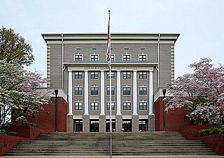
Cherokee County, Alabama is a county located in the northeastern part of the U.S. state of Alabama. As of the 2020 census, the population was 24,971. Its county seat is Centre. The county is named for the Cherokee tribe.

DeKalb County is a county located in the northeastern part of the U.S. state of Alabama. As of the 2020 census, the population was 71,608. Its county seat is Fort Payne, and it is named after Major General Baron Johan DeKalb. DeKalb County is part of the Huntsville-Decatur-Albertville, AL Combined Statistical Area.

Oconee County is the westernmost county in the U.S. state of South Carolina. As of the 2020 census, the population was 78,607. Its county seat is Walhalla and its largest city is Seneca. Oconee County is included in the Seneca, SC Micropolitan Statistical Area, which is also included in the Greenville-Spartanburg-Anderson, SC Combined Statistical Area. South Carolina Highway 11, the Cherokee Foothills National Scenic Highway, begins in southern Oconee County at Interstate Highway 85 at the Georgia state line.

Newberry County is a county located in the U.S. state of South Carolina. As of the 2020 census, its population was 37,719. Its county seat is Newberry. The name is of unknown origin, although one theory suggests that it was named by Quaker settlers in honor of their home of Newberry, a suburb of London in the United Kingdom.

Cherokee County is a county in the U.S. state of South Carolina. As of the 2020 census, the population was 56,216. The county seat is Gaffney. The county was formed in 1897 from parts of York, Union, and Spartanburg Counties. It was named for the Cherokee people who historically occupied this area prior to European encounter.

Cherokee County is located in the US state of Georgia. As of the 2020 Census, the population was 266,620. The county seat is Canton. The county Board of Commissioners is the governing body, with members elected to office. Cherokee County is included in the Atlanta Metropolitan Area.

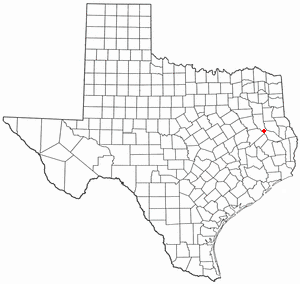
Wells is a town in Cherokee County, Texas, United States. The population was 790 at the 2010 census, and 853 at the 2020 U.S. census.
A land run or land rush was an event in which previously restricted land of the United States was opened to homestead on a first-arrival basis. Lands were opened and sold first-come or by bid, or won by lottery, or by means other than a run. The settlers, no matter how they acquired occupancy, purchased the land from the United States Land Office. For former Indian lands, the Land Office distributed the sales funds to the various tribal entities, according to previously negotiated terms. The Oklahoma Land Rush of 1889 was the most prominent of the land runs while the Land Run of 1893 was the largest. The opening of the former Kickapoo area in 1895 was the last use of a land run in the present area of Oklahoma.
Tryon County is a former county which was located in the U.S. state of North Carolina. It was formed in 1768 from the part of Mecklenburg County west of the Catawba River, although the legislative act that created it did not become effective until April 10, 1769. Due to inaccurate and delayed surveying, Tryon County encompassed a large area of northwestern South Carolina. It was named for William Tryon, governor of the North Carolina Colony from 1765 to 1771.

The Qualla Boundary or The Qualla is territory held as a land trust by the United States government for the federally recognized Eastern Band of Cherokee Indians, who reside in western North Carolina. The area is part of the large historic Cherokee territory in the Southeast, which extended into eastern Tennessee, western South Carolina, northern Georgia and Alabama. Currently, the largest contiguous portion of the Qualla lies in Haywood, Swain, and Jackson counties and is centered on the community of Cherokee, which serves as the tribal capital of the Eastern Band of Cherokee Indians. Smaller, discontiguous parcels also lie in Graham and Cherokee counties, near the communities of Snowbird and Murphy respectively.

Bean Station is a town in Grainger and Hawkins counties in the state of Tennessee, United States. As of the 2020 census, the population was 2,967.

The Broad River is a principal tributary of the Congaree River, about 150 miles (240 km) long, in western North Carolina and northern South Carolina in the United States. Via the Congaree, it is part of the watershed of the Santee River, which flows to the Atlantic Ocean.
The Enoree River is a tributary of the Broad River, 85 mi (137 km) long, in northwestern South Carolina in the United States. Via the Broad and Congaree Rivers, it is part of the watershed of the Santee River, which flows to the Atlantic Ocean.

The 5th congressional district of South Carolina is a congressional district in northern South Carolina bordering North Carolina. The district includes all of Cherokee, Chester, Fairfield, Kershaw, Lancaster, Lee, Union and York counties and parts of Newberry, Spartanburg and Sumter counties. Outside the rapidly growing cities of Rock Hill, Fort Mill, and Lake Wylie the district is mostly rural and agricultural. The district borders were contracted from some of the easternmost counties in the 2012 redistricting.

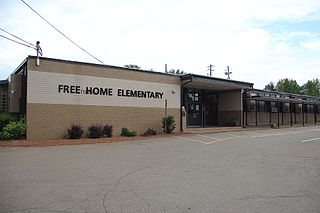
Free Home is an unincorporated community in the eastern part of Cherokee County, Georgia, United States. Centered at the intersection of state highways 20 and 372, the rural community has seen moderate suburbanization of the area since the late 1990s. It is home to Free Home Elementary School. The community is home to a Publix Supermarket center, which has a few stores/restaurants. There is also a Tractor Supply Company that was completed in September 2011.
Ninety-Six District is a former judicial district in the U.S. state of South Carolina. It existed as a district from July 29, 1769 to December 31, 1799. The court house and jail for Ninety-Six District were in Ninety Six, South Carolina.
McCords Crossroads is an unincorporated community in Cherokee County, Alabama, United States. It lies at an elevation of 640 feet.
New Town is an unincorporated community in Gordon County, Georgia, United States, located northeast of Calhoun. New Town is near the New Echota historic site, which was formerly part of the Cherokee Nation. Ashworth Middle School and Gordon Central High School are located in the New Town community.
Adams Crossroads is an unincorporated community in Cherokee County, Alabama, United States.
McFrey Crossroads is an unincorporated community in Cherokee County, Alabama, United States.


