Sand Rock, Alabama

Last updated

Sand Rock, Alabama
Motto: 
"Built on sand solid as a rock"
Cherokee County and DeKalb County Alabama Incorporated and Unincorporated areas Sand Rock Highlighted 0167920.svg
Location of Sand Rock in Cherokee County and DeKalb County, Alabama.
Coordinates: 34°13′57″N85°46′14″W / 34.23250°N 85.77056°W / 34.23250; -85.77056
Country United States
State Alabama
Counties Cherokee, DeKalb
Area
[1]
  Total5.07 sq mi (13.13 km2)
  Land5.07 sq mi (13.13 km2)
  Water0.00 sq mi (0.00 km2)
Elevation
[2]
860 ft (260 m)
Population
 (2020)
  Total591
  Density116.55/sq mi (44.99/km2)
Time zone UTC-6 (Central (CST))
  Summer (DST) UTC-5 (CDT)
ZIP code
35983
Area code 256
FIPS code 01-67920
GNIS feature ID2407282 [2]
Website www.sandrock-al.org

Sand Rock is a town in Cherokee and DeKalb counties in the U.S. state of Alabama. It incorporated in 1988. At the 2020 census, the population was 591.

Contents

History

A post office called Sand Rock was established in 1855, and remained in operation until it was discontinued in 1903. [3] Legend has it the city was named after a pioneer sat on a rock upon sandy ground. [4]

Geography

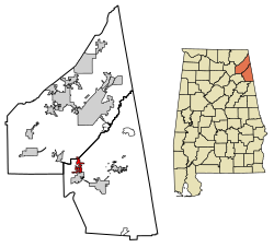
Sand Rock is located in western Cherokee County at 34°13'57.115" North, 85°46'13.516" West (34.232532, -85.770421), [5] atop Lookout Mountain. A portion of the town extends north into DeKalb County. The town is bordered to the south by the town of Leesburg.

According to the U.S. Census Bureau, the town has a total area of 4.4 square miles (11.3 km2), all land. [6]

Demographics

Historical population
CensusPop.Note
1990 438
2000 50916.2%
2010 56010.0%
2020 5915.5%
U.S. Decennial Census [7]
2013 Estimate [8]

As of the census [9] of 2000, there were 509 people, 195 households, and 154 families residing in the town. The population density was 112.4 inhabitants per square mile (43.4/km2). There were 215 housing units at an average density of 47.5 per square mile (18.3/km2). The racial makeup of the town was 99.41% White, and 0.39% Black or African American.

There were 195 households, out of which 33.8% had children under the age of 18 living with them, 68.7% were married couples living together, 7.7% had a female householder with no husband present, and 21.0% were non-families. 19.5% of all households were made up of individuals, and 9.2% had someone living alone who was 65 years of age or older. The average household size was 2.61 and the average family size was 2.96.

In the town, the population was spread out, with 25.3% under the age of 18, 7.9% from 18 to 24, 28.9% from 25 to 44, 23.6% from 45 to 64, and 14.3% who were 65 years of age or older. The median age was 37 years. For every 100 females, there were 99.6 males. For every 100 females age 18 and over, there were 97.9 males.

The median income for a household in the town was $35,179, and the median income for a family was $44,063. Males had a median income of $28,523 versus $17,375 for females. The per capita income for the town was $18,845. About 10.9% of families and 12.6% of the population were below the poverty line, including 16.5% of those under age 18 and 19.7% of those age 65 or over.

Education

The first school was a one-room log cabin. Around 1895, the school was moved to a more central location and was built as a two-room school. In 1916, another room was added to accommodate more students. In 1922 a new school building was constructed. It had five rooms including a small library. Slowly the school expanded and added more grades. In 1932, Sand Rock School had its first graduating class. [10]

Sand Rock School is part of the Cherokee County School District. Schools in the district include Cedar Bluff School, Centre Elementary School, Gaylesville School, Sand Rock School, Centre Middle School, Cherokee County High School, Spring Garden High School and Cherokee County Career & Technology Center.

It is a K-12 school located in Sand Rock, Alabama. There are approximately 819 students and 54 teachers. The principal is Ben East. The assistant principals are Andrew Jones and Brian Mackey.

The official school web site is http://sr.cherokeek12.org/.

Mitchell Guice is the Superintendent of Schools. [11]

Related Research Articles

<span class="mw-page-title-main">Cherokee County, Alabama</span> County in Alabama, United States

Cherokee County, Alabama is a county located in the northeastern part of the U.S. state of Alabama. As of the 2020 census, the population was 24,971. Its county seat is Centre. The county is named for the Cherokee tribe.

<span class="mw-page-title-main">Etowah County, Alabama</span> County in Alabama, United States

Etowah County is a county located in the northeastern part of the U.S. state of Alabama. As of the 2020 census the population was 103,436. Its county seat is Gadsden. Its name is from a Cherokee word meaning "edible tree". In total area, it is the smallest county in Alabama, but one of the most densely populated. Etowah County comprises the Gadsden Metropolitan Statistical Area.

<span class="mw-page-title-main">Lawrence County, Alabama</span> County in Alabama, United States

Lawrence County is a county in the northern part of the U.S. state of Alabama. As of the 2020 census, the population was 33,073. The county seat is Moulton. The county was named after James Lawrence, a captain in the United States Navy from New Jersey.

<span class="mw-page-title-main">Marshall County, Alabama</span> County in Alabama, United States

Marshall County is a county of the state of Alabama, United States. As of the 2020 census the population was 97,612. Its county seat is Guntersville. A second courthouse is in Albertville. Its name is in honor of John Marshall, famous Chief Justice of the United States. Marshall County is a dry county, with the exception of the five cities of Albertville, Arab, Grant, Guntersville, and Boaz. Marshall County comprises the Albertville, AL Micropolitan Statistical Area, which is also included in the Huntsville-Decatur-Albertville, AL Combined Statistical Area.

<span class="mw-page-title-main">Cedar Bluff, Alabama</span> Town in Alabama, United States

Cedar Bluff is a town in Cherokee County, Alabama, United States. At the 2020 census, the population was 1,845. Unlike the rest of the county, Cedar Bluff is a wet town. Cedar Bluff is located on the north shore of Weiss Lake, noted for its crappie fishing.

<span class="mw-page-title-main">Centre, Alabama</span> City in and county seat of Cherokee County, Alabama

Centre is a city in Cherokee County, Alabama, United States. At the 2020 census, the population was 3,587. The city is the county seat of Cherokee County.

<span class="mw-page-title-main">Collinsville, Alabama</span> Town in Alabama, United States

Collinsville is a town in DeKalb and Cherokee counties in the U.S. state of Alabama. It was incorporated in 1887. As of the 2010 census, the population was 1,983.

<span class="mw-page-title-main">Gaylesville, Alabama</span> Town in Alabama, United States

Gaylesville is a town in Cherokee County, Alabama, United States. The population was 144 at the 2010 census.

<span class="mw-page-title-main">Leesburg, Alabama</span> Town in Alabama, United States

Leesburg is a town in Cherokee County, Alabama, United States. At the 2020 census, the population was 911.

<span class="mw-page-title-main">Cherokee, Alabama</span> Town in Alabama, United States

Cherokee is a town in west Colbert County, Alabama, United States. Located near the Tennessee River, it is part of the Florence–Muscle Shoals metropolitan area, known as "The Shoals". As of the 2010 census, the population of the town was 1,048.

<span class="mw-page-title-main">Crossville, Alabama</span> Town in Alabama, United States

Crossville is a town in DeKalb County, Alabama, United States. At the 2010 census the population was 1,862, up from 1,431 in 2000. Crossville is located atop Sand Mountain, a southern extension of the Cumberland Plateau.

<span class="mw-page-title-main">Henagar, Alabama</span> City in Alabama, United States

Henagar is a city in DeKalb County, Alabama, United States. At the 2020 census, the population was 2,292.

<span class="mw-page-title-main">Ider, Alabama</span> Town in Alabama, United States

Ider is a town in DeKalb County, Alabama, United States. At the 2020 census, the population was 735. It incorporated in October 1973.

<span class="mw-page-title-main">Lakeview, Alabama</span> Town in Alabama, United States

Lakeview is a town in DeKalb County, Alabama, United States. At the 2020 census, the population was 161. Lakeview is located atop Sand Mountain.

<span class="mw-page-title-main">Pine Ridge, Alabama</span> Town in Alabama, United States

Pine Ridge is a town in DeKalb County, Alabama, United States. It incorporated in 1982. At the 2020 census, the population was 263.

<span class="mw-page-title-main">Powell, Alabama</span> Town in Alabama, United States

Powell is a town in DeKalb County, Alabama, United States. At the 2020 census, the population was 901. Powell is located atop Sand Mountain.

<span class="mw-page-title-main">Rainsville, Alabama</span> City in Alabama, United States

Rainsville is a city in DeKalb County, Alabama, United States. At the 2010 census the population was 4,948, up from 4,499 in 2000. Rainsville is located on top of Sand Mountain, a southern extension of the Cumberland Plateau.

<span class="mw-page-title-main">Shiloh, DeKalb County, Alabama</span> Town in Alabama, United States

Shiloh is a town in DeKalb County, Alabama, United States. It incorporated in 1962. At the 2020 census, the population was 321. Shiloh is located atop Sand Mountain.

<span class="mw-page-title-main">Sylvania, Alabama</span> Town in Alabama, United States

Sylvania is a town in DeKalb County, Alabama, United States. It incorporated in October 1967. At the 2010 census the population was 1,837, up from 1,186 in 2000. Sylvania is located atop Sand Mountain. Sylvania was incorporated in 1967. The post office /town hall was built in 1977.

<span class="mw-page-title-main">Section, Alabama</span> Town in Alabama, United States

Section is a town in Jackson County, Alabama, United States and is included in the Chattanooga-Cleveland-Dalton, TN-GA-AL Combined Statistical Area. As of the 2010 census, the population of the town was 770, an increase of one person (769) from 2000. Section is located on top of Sand Mountain.

References

  1. "2020 U.S. Gazetteer Files". United States Census Bureau. Retrieved October 29, 2021.
  2. 1 2 U.S. Geological Survey Geographic Names Information System: Sand Rock, Alabama
  3. "Cherokee County". Jim Forte Postal History. Retrieved April 25, 2015.
  4. "Cherokee County, Ala". Calhoun Times. September 1, 2004. p. 46. Retrieved April 24, 2015.
  5. "US Gazetteer files: 2010, 2000, and 1990". United States Census Bureau. February 12, 2011. Retrieved April 23, 2011.
  6. "Geographic Identifiers: 2010 Demographic Profile Data (G001): Sand Rock town, Alabama". U.S. Census Bureau, American Factfinder. Archived from the original on February 12, 2020. Retrieved June 3, 2014.
  7. "U.S. Decennial Census". Census.gov. Retrieved June 6, 2013.
  8. "Annual Estimates of the Resident Population: April 1, 2010 to July 1, 2013" . Retrieved June 3, 2014.
  9. "U.S. Census website". United States Census Bureau . Retrieved January 31, 2008.
  10. "Sand Rock Community History". www.sandrock-al.org. Archived from the original on November 6, 2011.
  11. "Cherokee County Schools". Cherokee County Schools. Retrieved June 21, 2012.