Shiloh, DeKalb County, Alabama

Last updated

Shiloh, Alabama
Shiloh-from-town-hall-al.jpg
Shiloh
DeKalb County Alabama Incorporated and Unincorporated areas Shiloh Highlighted 0169840.svg
Location of Shiloh in DeKalb County, Alabama.
Coordinates: 34°27′55″N85°52′38″W / 34.46528°N 85.87722°W / 34.46528; -85.87722
Country United States
State Alabama
County DeKalb
Area
[1]
  Total2.13 sq mi (5.52 km2)
  Land2.13 sq mi (5.52 km2)
  Water0.00 sq mi (0.00 km2)
Elevation
[2]
1,204 ft (367 m)
Population
 (2020)
  Total321
  Density150.56/sq mi (58.14/km2)
Time zone UTC-6 (Central (CST))
  Summer (DST) UTC-5 (CDT)
ZIP code
35986
Area code 256
FIPS code 01-69840
GNIS feature ID2407327 [2]

Shiloh is a town in DeKalb County, Alabama, United States. [3] It incorporated in 1962. At the 2020 census, the population was 321. Shiloh is located atop Sand Mountain.

Contents

Geography

Shiloh is located west of the center of DeKalb County at 34°27′56″N85°52′38″W / 34.46556°N 85.87722°W / 34.46556; -85.87722 at an elevation of 1,263 feet (385 m). [4] It is bordered to the northeast by the city of Rainsville and to the southwest by the town of Fyffe. Alabama State Route 75 passes through Shiloh, connecting Rainsville and Fyffe.

According to the U.S. Census Bureau, Shiloh has a total area of 1.7 square miles (4.4 km2), all land. [5]

Demographics

Historical population
CensusPop.Note
1970 233
1980 29727.5%
1990 252−15.2%
2000 28914.7%
2010 274−5.2%
2020 32117.2%
U.S. Decennial Census [6]
2013 Estimate [7]

As of the census [8] of 2000, there were 289 people, 116 households, and 80 families residing in the town. The population density was 168.5 inhabitants per square mile (65.1/km2). There were 135 housing units at an average density of 78.7 per square mile (30.4/km2). The racial makeup of the town was 97.58% White, 1.38% Native American, 0.35% from other races, and 0.69% from two or more races. Hispanic or Latino of any race were 0.69% of the population.

There were 116 households, out of which 30.2% had children under the age of 18 living with them, 55.2% were married couples living together, 11.2% had a female householder with no husband present, and 30.2% were non-families. 25.9% of all households were made up of individuals, and 9.5% had someone living alone who was 65 years of age or older. The average household size was 2.49 and the average family size was 3.00.

In the town, the population was spread out, with 22.8% under the age of 18, 10.7% from 18 to 24, 31.1% from 25 to 44, 20.1% from 45 to 64, and 15.2% who were 65 years of age or older. The median age was 35 years. For every 100 females, there were 86.5 males. For every 100 females age 18 and over, there were 84.3 males.

The median income for a household in the town was $34,861, and the median income for a family was $36,696. Males had a median income of $29,219 versus $25,893 for females. The per capita income for the town was $28,431. About 4.3% of families and 9.7% of the population were below the poverty line, including 8.2% under the age of 18 and 15.2% ages 65 or older.

Related Research Articles

<span class="mw-page-title-main">Cherokee County, Alabama</span> County in Alabama, United States

Cherokee County, Alabama is a county located in the northeastern part of the U.S. state of Alabama. As of the 2020 census, the population was 24,971. Its county seat is Centre. The county is named for the Cherokee tribe.

<span class="mw-page-title-main">Tallapoosa County, Alabama</span> County in Alabama, United States

Tallapoosa County is located in the east-central portion of the U.S. state of Alabama. As of the 2020 census, the population was 41,311. Its county seat is Dadeville. Its largest city is Alexander City.

<span class="mw-page-title-main">Collinsville, Alabama</span> Town in Alabama, United States

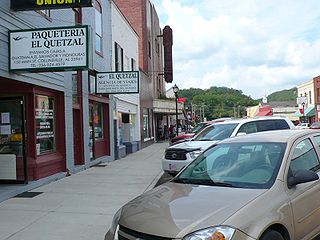
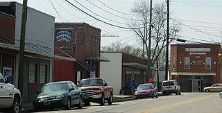
Collinsville is a town in DeKalb and Cherokee counties in the U.S. state of Alabama. It was incorporated in 1887. As of the 2010 census, the population was 1,983.

<span class="mw-page-title-main">Sand Rock, Alabama</span> Town in Alabama, United States

Sand Rock is a town in Cherokee and DeKalb counties in the U.S. state of Alabama. It incorporated in 1988. At the 2020 census, the population was 591.

<span class="mw-page-title-main">Fyffe, Alabama</span> Town in Alabama, United States

Fyffe is a town in DeKalb County, Alabama, United States. It was incorporated in 1956. At the 2020 census, the population was 967. Fyffe is located atop Sand Mountain.

<span class="mw-page-title-main">Geraldine, Alabama</span> Town in Alabama, United States

Geraldine is a town in DeKalb County, Alabama, United States. It was incorporated in February 1957. At the 2020 census, the population was 910.

<span class="mw-page-title-main">Hammondville, Alabama</span> Town in Alabama, United States

Hammondville is a town in DeKalb County, Alabama, United States. It was incorporated in 1937. As of the 2010 census, the population of the town is 488.

<span class="mw-page-title-main">Henagar, Alabama</span> City in Alabama, United States

Henagar is a city in DeKalb County, Alabama, United States. At the 2020 census, the population was 2,292.

<span class="mw-page-title-main">Lakeview, Alabama</span> Town in Alabama, United States

Lakeview is a town in DeKalb County, Alabama, United States. At the 2020 census, the population was 161. Lakeview is located atop Sand Mountain.

<span class="mw-page-title-main">Mentone, Alabama</span> Town in Alabama, United States

Mentone is a town in DeKalb County, Alabama, United States. It is located atop Lookout Mountain.

<span class="mw-page-title-main">Pine Ridge, Alabama</span> Town in Alabama, United States

Pine Ridge is a town in DeKalb County, Alabama, United States. It incorporated in 1982. At the 2020 census, the population was 263.

<span class="mw-page-title-main">Powell, Alabama</span> Town in Alabama, United States

Powell is a town in DeKalb County, Alabama, United States. At the 2020 census, the population was 901. Powell is located atop Sand Mountain.

<span class="mw-page-title-main">Rainsville, Alabama</span> City in Alabama, United States

Rainsville is a city in DeKalb County, Alabama, United States. At the 2010 census the population was 4,948, up from 4,499 in 2000. Rainsville is located on top of Sand Mountain, a southern extension of the Cumberland Plateau.

<span class="mw-page-title-main">Sylvania, Alabama</span> Town in Alabama, United States

Sylvania is a town in DeKalb County, Alabama, United States. It incorporated in October 1967. At the 2010 census the population was 1,837, up from 1,186 in 2000. Sylvania is located atop Sand Mountain. Sylvania was incorporated in 1967. The post office /town hall was built in 1977.

<span class="mw-page-title-main">Valley Head, Alabama</span> Town in Alabama, United States

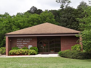
Valley Head is a town in DeKalb County, Alabama, United States. Although the town incorporated in 1921, it was also listed as being incorporated on the 1890 U.S. Census. At the 2020 census, the population was 577.

<span class="mw-page-title-main">Section, Alabama</span> Town in Alabama, United States

Section is a town in Jackson County, Alabama, United States and is included in the Chattanooga-Cleveland-Dalton, TN-GA-AL Combined Statistical Area. As of the 2010 census, the population of the town was 770, an increase of one person (769) from 2000. Section is located on top of Sand Mountain.

<span class="mw-page-title-main">Notasulga, Alabama</span> Town in Alabama, United States

Notasulga is a town in Macon and Lee counties in the U.S. state of Alabama. As of the 2020 census, the population of the town was 914. The portion in Lee County is part of the Auburn Metropolitan Area. According to the 1910 U.S. Census, it incorporated in 1893. Author Zora Neale Hurston was born in Notasulga in 1891. The town name comes from the Creek words noti sulgi, which means "many teeth".

<span class="mw-page-title-main">Ladonia, Alabama</span> Census-designated place & Unincorporated community in Alabama, United States

Ladonia is an unincorporated community and census-designated place (CDP) in Russell County, Alabama, United States. At the 2020 census, the population was 3,074. It is part of the Columbus, Georgia-Alabama, Metropolitan Statistical Area.

<span class="mw-page-title-main">Spring Mount, Pennsylvania</span> Census-designated place in Pennsylvania, United States

Spring Mount is a census-designated place (CDP) in Montgomery County, Pennsylvania, United States. The population was 2,259 at the 2010 census.

<span class="mw-page-title-main">Dowelltown, Tennessee</span> Town in Tennessee, United States

Dowelltown is a town in DeKalb County, Tennessee, United States. The population was 355 at the 2010 census.

References

  1. "2020 U.S. Gazetteer Files". United States Census Bureau. Retrieved October 29, 2021.
  2. 1 2 U.S. Geological Survey Geographic Names Information System: Shiloh, DeKalb County, Alabama
  3. U.S. Geological Survey Geographic Names Information System: Shiloh
  4. "US Gazetteer files: 2010, 2000, and 1990". United States Census Bureau. February 12, 2011. Retrieved April 23, 2011.
  5. "Geographic Identifiers: 2010 Demographic Profile Data (G001): Shiloh town, Alabama". U.S. Census Bureau, American Factfinder. Retrieved October 7, 2015.[ dead link ]
  6. "U.S. Decennial Census". Census.gov. Retrieved June 6, 2013.
  7. "Annual Estimates of the Resident Population: April 1, 2010 to July 1, 2013" . Retrieved June 3, 2014.
  8. "U.S. Census website". United States Census Bureau . Retrieved January 31, 2008.