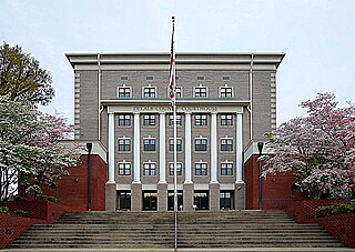
DeKalb County is a county located in the northeastern part of the U.S. state of Alabama. As of the 2020 census, the population was 71,608. Its county seat is Fort Payne, and it is named after Major General Baron Johan DeKalb. DeKalb County is part of the Huntsville-Decatur-Albertville, AL Combined Statistical Area.

DeKalb County is a county located in the U.S. state of Illinois. As of the 2020 United States census, the population was 100,420. Its county seat is Sycamore.
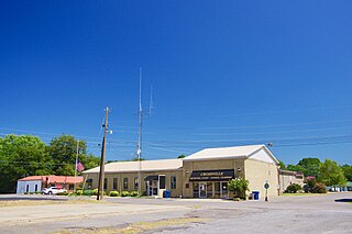
Crossville is a town in DeKalb County, Alabama, United States. At the 2010 census the population was 1,862, up from 1,431 in 2000. Crossville is located atop Sand Mountain, a southern extension of the Cumberland Plateau.

Geraldine is a town in DeKalb County, Alabama, United States. It was incorporated in February 1957. At the 2020 census, the population was 910.

Mentone is a town in DeKalb County, Alabama, United States. It is located atop Lookout Mountain.

Powell is a town in DeKalb County, Alabama, United States. At the 2020 census, the population was 901. Powell is located atop Sand Mountain.
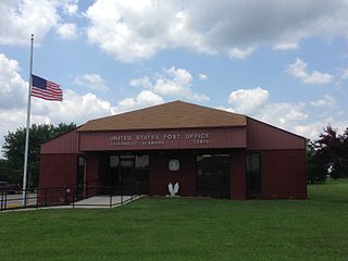
Rainsville is a city in DeKalb County, Alabama, United States. At the 2010 census the population was 4,948, up from 4,499 in 2000. Rainsville is located on top of Sand Mountain, a southern extension of the Cumberland Plateau.

Shiloh is a town in DeKalb County, Alabama, United States. It incorporated in 1962. At the 2020 census, the population was 321. Shiloh is located atop Sand Mountain.

Skyline is a town in Jackson County, Alabama, United States. The town incorporated in 1985. As of the 2010 census, the population of the town was 851, up from 843 in 2000.
Homewood is a city in southeastern Jefferson County, Alabama, United States. It is a suburb of Birmingham, located on the other side of Red Mountain due south of the city center. As of the 2010 census its population was 25,167, and in 2019 the estimated population was 25,377.
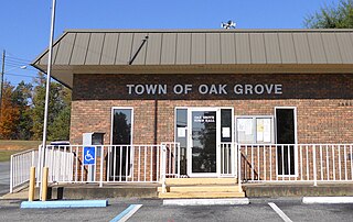
Oak Grove is a town in Talladega County, Alabama, United States. It incorporated in 1966. At the 2020 census, the population was 564.

The tornado outbreak of April 6–9, 1998 was a large tornado outbreak that started on April 6 across the Great Plains and ended on April 9 across the Carolinas and Georgia. A total of 62 tornadoes touched down from the Middle Atlantic States to the Midwestern United States and Texas. The outbreak is infamous for producing a deadly F5 that tore through the suburbs of Birmingham, Alabama, killing 32 people. The Birmingham tornado was one of only two F5 tornadoes that year. The other hit in Lawrence County, Tennessee, on April 16, as part of the same outbreak as the Nashville F3 tornado. This tornado outbreak was responsible for 41 deaths: 7 in Georgia and 34 in Alabama.
Willstown was an important Cherokee town of the late 18th and early 19th century, located in the southwesternmost part of the Cherokee Nation, in what is now DeKalb County, Alabama. It was near Lookout or Little Wills Creek.
Dawson is a small unincorporated community located in DeKalb County, Alabama, United States. It is located atop Sand Mountain, approximately 4 miles (6 km) northeast of the town of Crossville.

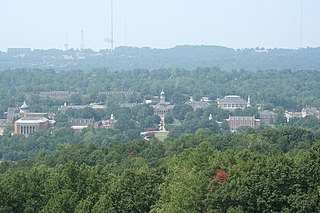
Sand Mountain is a sandstone plateau in northeastern Alabama and northwestern Georgia and southeastern Tennessee where the plateau is known as Raccoon Mountain and Elder Mountain. It is part of the southern tip of the Appalachian mountain chain and it is the largest plateau in the chain. Geologically a continuation of Walden Ridge, Sand Mountain is part of the Cumberland Plateau, separated from the main portion of the plateau by the Tennessee River and Sequatchie Valley. The average elevation on Sand Mountain is around 1,500 feet (460 m) above sea level, compared to about 650 feet (200 m) in the surrounding area. This elevation leads to its having the coolest climate in the state of Alabama. The largest city on Sand Mountain is Albertville, in Marshall County. As of the 2020 census, the population of the city was 22,386.

The Illinois Technology and Research Corridor is a region of commerce and industry located along Interstate 88 in the Chicago metropolitan area, primarily in DuPage, Kane, and DeKalb Counties. The corridor is home to the headquarters or regional centers for many Fortune 1000 companies, several office and industrial parks, colleges and universities, research and scientific institutions, medical centers, government centers, and abundant shopping, dining, lodging, and entertainment amenities. In addition to the I-90 Golden Corridor, the I-94 Lakeshore Corridor, and the I-55 Industrial Corridor, the Illinois Technology and Research Corridor is one of the principal economic centers in suburban Chicago.
Hopewell is an unincorporated community in DeKalb County, Alabama, United States.
Adamsburg is an unincorporated community located on Lookout Mountain in eastern DeKalb County, Alabama, United States, southeast of the county seat of Fort Payne, and just west of Little River Canyon.
Aroney is an unincorporated community located on Sand Mountain in far southwestern DeKalb County, Alabama, United States, approximately five miles east of the city of Boaz.
Beaty Crossroads is an unincorporated community on Sand Mountain in northern DeKalb County, Alabama, United States. It is located within the town limits of Ider at the intersection of Alabama Highway 75 and Alabama Highway 117.

