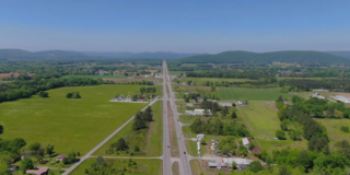
Mooresville is a town in Limestone County, Alabama, United States, located southeast of the intersection of Interstate 565 and Interstate 65, and north of Wheeler Lake.

Owens Cross Roads is a city in Madison County, Alabama, United States, and is included in the Huntsville-Decatur Combined Statistical Area. It was incorporated in 1967. As of the 2020 census, the population of the city was 2,594. The City has a mayor-council form of government.

Wyatt is an unincorporated community located in Madison Township, St. Joseph County, in the U.S. state of Indiana.

Brixey is an unincorporated community in northern Ozark County, Missouri, United States. It is located 1.6 miles (2.6 km) south of Route 95 on Route N or approximately 10 miles (16 km) north of Gainesville.
Tanner is an unincorporated community in central southern Limestone County, Alabama, United States, and is included in the Huntsville-Decatur Combined Statistical Area. It lies nine miles north of the city of Decatur and the Tennessee River, and four miles south of the city of Athens.
Montier is a census-designated place in southwestern Shannon County, Missouri, United States. As of the 2020 census, the population was 49.

Letohatchee is an unincorporated community in Lowndes County, Alabama, United States. It has a very small population and four businesses. The community is part of the Montgomery Metropolitan Statistical Area.
Nogalus Prairie is an unincorporated community in Trinity County, Texas, United States. In 2000, the estimated population was 109 residents. It is located within the Huntsville, Texas micropolitan area.

Montmorenci is an unincorporated census-designated place in Shelby Township, Tippecanoe County, Indiana. Older maps sometimes spell the name Montmorency or Montmorencie.

Stockwell, originally named Lauramie, is a census-designated place in Lauramie Township, Tippecanoe County, in the U.S. state of Indiana. It was once a stop along the Indianapolis, Cincinnati and Lafayette Railroad, but the rail line has since been removed.

Flat Rock is an unincorporated community in Jackson County, Alabama, United States. The Flat Rock post office was established in 1912.

Dixons Mills is an unincorporated community in Marengo County, Alabama, United States. The community was named for a group of mills operated by Joel B. Dixon in the 19th century. Dixons Mills has a post office utilizing the 36736 ZIP code.

East Enterprise is an unincorporated census-designated place in central Cotton Township, Switzerland County, in the U.S. state of Indiana. Although East Enterprise is unincorporated, it has a post office, with the ZIP code of 47019.

Belle Mina is an unincorporated community in southeastern Limestone County, Alabama, United States. As of 2020 the population was estimated to be around 113 people. About 2 kilometers away is the Toyota Mazda plant that was completed in 2020. The population could grow with some new neighborhoods planned to be built in Bella Mina, and nearby the community.

Flintstone is an unincorporated community in Walker County, Georgia, United States. Located in northwestern Georgia, Flintstone lies approximately 12 miles south of Chattanooga, Tennessee, 120 miles northwest of Atlanta, 135 miles southeast of Nashville, Tennessee, and 150 miles northeast of Birmingham, Alabama. Although Flintstone is unincorporated, it has a post office, with the ZIP code of 30725; the ZCTA for ZIP Code 30725 had a population of 3,456 at the 2000 census.
Marion Mills is an unincorporated community in Marion Township, Owen County, in the U.S. state of Indiana.
Thornhope is an unincorporated community in Van Buren Township, Pulaski County, in the U.S. state of Indiana.
Denham is an unincorporated community in Rich Grove Township, Pulaski County, in the U.S. state of Indiana.
Fairview is an unincorporated community in Cotton Township, Switzerland County, in the U.S. state of Indiana.

Bethany is an unincorporated community in Harrison Township, Bartholomew County, in the U.S. state of Indiana.


