
Cherokee County, Alabama is a county located in the northeastern part of the U.S. state of Alabama. As of the 2020 census, the population was 24,971. Its county seat is Centre. The county is named for the Cherokee tribe.
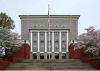
DeKalb County is a county located in the northeastern part of the U.S. state of Alabama. As of the 2020 census, the population was 71,608. Its county seat is Fort Payne, and it is named after Major General Baron Johan DeKalb. DeKalb County is part of the Huntsville-Decatur-Albertville, AL Combined Statistical Area.
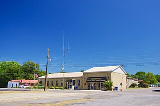
Crossville is a town in DeKalb County, Alabama, United States. At the 2010 census the population was 1,862, up from 1,431 in 2000. Crossville is located atop Sand Mountain, a southern extension of the Cumberland Plateau.

Hammondville is a town in DeKalb County, Alabama, United States. It was incorporated in 1937. As of the 2010 census, the population of the town is 488.

Lakeview is a town in DeKalb County, Alabama, United States. At the 2020 census, the population was 161. Lakeview is located atop Sand Mountain.

Mentone is a town in DeKalb County, Alabama, United States. It is located atop Lookout Mountain.

Pine Ridge is a town in DeKalb County, Alabama, United States. It incorporated in 1982. At the 2020 census, the population was 263.

Powell is a town in DeKalb County, Alabama, United States. At the 2020 census, the population was 901. Powell is located atop Sand Mountain.
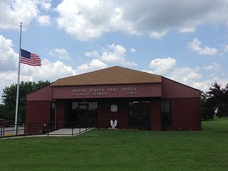
Rainsville is a city in DeKalb County, Alabama, United States. At the 2010 census the population was 4,948, up from 4,499 in 2000. Rainsville is located on top of Sand Mountain, a southern extension of the Cumberland Plateau.

Shiloh is a town in DeKalb County, Alabama, United States. It incorporated in 1962. At the 2020 census, the population was 321. Shiloh is located atop Sand Mountain.

Sylvania is a town in DeKalb County, Alabama, United States. It incorporated in October 1967. At the 2010 census the population was 1,837, up from 1,186 in 2000. Sylvania is located atop Sand Mountain. Sylvania was incorporated in 1967. The post office /town hall was built in 1977.
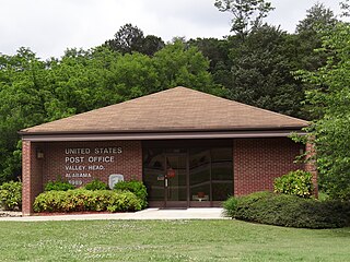
Valley Head is a town in DeKalb County, Alabama, United States. Although the town incorporated in 1921, it was also listed as being incorporated on the 1890 U.S. Census. At the 2020 census, the population was 577.
Grove Oak is a small unincorporated community in DeKalb County, Alabama, United States. It is located atop Sand Mountain in northeastern Alabama.
Willstown was an important Cherokee town of the late 18th and early 19th century, located in the southwesternmost part of the Cherokee Nation, in what is now DeKalb County, Alabama. It was near Lookout or Little Wills Creek. It was in Wills Valley, which also incorporated Big Wills Creek. This was within the territory of the Lower Creek, who had crossed into this area in an effort to avoid European-American encroachment.
Dawson is a small unincorporated community located in DeKalb County, Alabama, United States. It is located atop Sand Mountain, approximately 4 miles (6 km) northeast of the town of Crossville.
The DeKalb County School System serves the rural areas and communities of DeKalb County, Alabama, with the exception of the schools located within the county seat of Fort Payne, which has its own school system. The system serves approximately 8,500 students, and the administrative offices are located in Rainsville. The current superintendent is Wayne Lyles, serving since July 26, 2021.
Hopewell is an unincorporated community in DeKalb County, Alabama, United States.
Adamsburg is an unincorporated community located on Lookout Mountain in eastern DeKalb County, Alabama, United States, southeast of the county seat of Fort Payne, and just west of Little River Canyon.
Bootsville is a ghost town in the Sand Valley area of central DeKalb County, Alabama, United States. It was located roughly five miles west-southwest of Fort Payne, placing it near the present-day intersection of County Road 458 and County Road 461.

