Rawlingsville, Alabama

Last updated
Rawlingsville, Alabama
Unincorporated community
USA Alabama location map.svg
Red pog.svg
Rawlingsville
Location within Alabama
Coordinates: 34°27′40″N85°41′55″W / 34.46111°N 85.69861°W / 34.46111; -85.69861 Coordinates: 34°27′40″N85°41′55″W / 34.46111°N 85.69861°W / 34.46111; -85.69861
Country United States
State Alabama
County DeKalb
Elevation 958 ft (292 m)
Time zone Central (CST) (UTC-6)
  Summer (DST) CDT (UTC-5)
Area code(s) 256
GNIS feature ID 155417 [1]

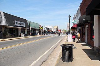
Rawlingsville, also known as Crystal Lake or Hollemans Station, was the first county seat of DeKalb County, Alabama, United States. It served as such from 1835 for a short time until the county seat was moved to Bootsville. [2] Rawlingsville was located within the boundaries of the present city of Fort Payne but has long since ceased to exist as a recognized community.

A county seat is an administrative center, seat of government, or capital city of a county or civil parish. The term is used in Canada, China, Romania, Taiwan and the United States. County towns have a similar function in the United Kingdom and Republic of Ireland, and historically in Jamaica.

DeKalb County, Alabama County in the United States

DeKalb County is a county of the U.S. state of Alabama. As of the 2010 census, the population was 71,109. Its county seat is Fort Payne and it is named after Major General Baron Johan DeKalb.

Bootsville, Alabama Ghost Town in Alabama, United States

Bootsville is a ghost town in the Sand Valley area of central DeKalb County, Alabama, United States. It was located roughly five miles west-southwest of Fort Payne. This would place it near the present-day intersection of County Road 458 and County Road 461.

Related Research Articles

Cherokee County, Alabama County in the United States

Cherokee County, Alabama is a county of the U.S. state of Alabama. As of the 2010 census, the population was 25,989. Its county seat is Centre,. The county is named for the Cherokee tribe.

DeKalb County, Missouri County in the United States

DeKalb County is a county located in the northwest portion of the U.S. state of Missouri. As of the 2010 census, the population was 12,892. Its county seat is Maysville. The county was organized February 25, 1845 and named for General Johann de Kalb, Baron de Kalb, of the Revolutionary War.

DeKalb County, Illinois County in the United States

DeKalb County is a county located in the U.S. state of Illinois. As of the 2010 United States Census, the population was 105,160. Its county seat is Sycamore.

Fort Payne, Alabama City in Alabama, United States

Fort Payne is a city in and county seat of DeKalb County, Alabama, United States. At the 2010 census, the population was 14,012.

Sycamore, Illinois City in Illinois, United States

Sycamore is a city in DeKalb County, Illinois, United States. It has a commercial district based and centered on Illinois Route 64. The population was 17,519 at the 2010 census, up from 12,020 in 2000. Sycamore is the county seat of DeKalb County and was named after the sycamore tree.

Shiloh, Alabama may refer to several places:

Grove Oak, Alabama Unincorporated community in Alabama, United States

Grove Oak is a small unincorporated community in DeKalb County, Alabama, United States. It is located atop Sand Mountain in northeastern Alabama.

Dawson, Alabama Unincorporated community in Alabama, United States

Dawson is a small unincorporated community located in DeKalb County, Alabama, United States. It is located atop Sand Mountain, approximately 4 miles (6 km) northeast of the town of Crossville.

Battelle, Alabama Unincorporated community in Alabama, United States

Battelle is a ghost town in DeKalb County, Alabama, United States. Battelle was once a thriving mining community which was spread in a north – south line along the foot of Lookout Mountain five miles north of Valley Head, Alabama.

The DeKalb County School System (Alabama) controls the schools that serve DeKalb County, Alabama, United States except for the schools located within the county seat of Fort Payne, Alabama which has its own school system. The administrative offices of the system are located in Rainsville.

Hopewell, DeKalb County, Alabama Unincorporated community in Alabama, United States

Hopewell is an unincorporated community in DeKalb County, Alabama, United States.

Alpine, DeKalb County, Alabama Unincorporated community in Alabama, United States

Alpine is an unincorporated community in DeKalb County, Alabama, United States, located northeast of Fort Payne.

Adamsburg, Alabama Unincorporated community in Alabama, United States

Adamsburg is an unincorporated community located on Lookout Mountain in eastern DeKalb County, Alabama, United States, southeast of the county seat of Fort Payne, and just west of Little River Canyon.

Beaty Crossroads, Alabama Unincorporated community in Alabama, United States

Beaty Crossroads is an unincorporated community on Sand Mountain in northern DeKalb County, Alabama, United States. It is located within the town limits of Ider at the intersection of Alabama Highway 75 and Alabama Highway 117.

Dogtown, DeKalb County, Alabama Unincorporated community in Alabama, United States

Dogtown, also known as Cagle's Crossroads,Dog Town, and Ruhama, is an unincorporated community in DeKalb County, Alabama, United States.

Guest, Alabama Unincorporated community in Alabama, United States

Guest is an unincorporated community in DeKalb County, Alabama, United States.

References