
The River Wandle is a tributary of the River Thames in south London, England. With a total length of about 9 miles (14 km), the river passes through the London boroughs of Croydon, Sutton, Merton and Wandsworth, where it reaches the Thames. A short headwater – the Caterham Bourne – is in Surrey, the historic county of the river's catchment. Tributaries of the Wandle include the River Wrythe and the Norbury Brook.

The Holly Lodge Estate is an estate in Highgate, London.

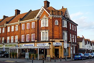
Coombe is a place in the London Borough of Croydon, situated south-east of central Croydon, between Addiscombe, Selsdon and Upper Shirley. It is located in the historic county of Surrey. Formerly a hamlet, since the growth of suburban development the area has become swallowed into the London conurbation and often does not appear on modern map.
Norbury is an area of south London. It shares the postcode London SW16 with neighbouring areas Streatham and Croydon. Norbury is 6.7 miles (10.8 km) south of Charing Cross.

Streatham High Road, some 1.8 miles (2.9 km) in length, is part of the main A23 road from London to Brighton, and is in the London Borough of Lambeth. It begins in the north at Streatham Hill railway station, being an end-on junction with Streatham Hill and continues south to Norbury where the A23 becomes London Road. Because Streatham existed in Saxon times, it is likely the road existed as early as 1068, when it is mentioned in literature.
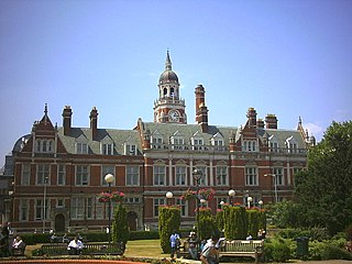
The County Borough of Croydon was a local government district in and around the town of Croydon in north east Surrey, England from 1889 to 1965. Since 1965 the district has been part of the London Borough of Croydon within Greater London.

Arena tram stop is a light rail stop in the Woodside area of South Norwood in the London Borough of Croydon in the southern suburbs of London. The stop is located by the Croydon Sports Arena and serves the council estates of Longheath Gardens Estate and Tollgate Estate.
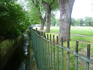
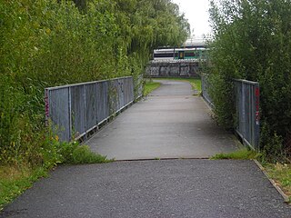
Norbury Brook is a tributary of the River Wandle that rises near Lower Addiscombe Road and flows north-west through Selhurst, Thornton Heath and Norbury to join the Wandle at south Wimbledon.
Croydon North West was a borough constituency represented in the House of Commons of the Parliament of the United Kingdom. It elected one Member of Parliament (MP) by the first past the post system of election.

The Norwood Ridge is a 10-square-mile (26 km2) rectangular upland which occupies the geographical centre of south London, centred 5 miles (8 km) south of London Bridge. Beneath its topsoil it is a ridge of London Clay that is capped on all sides with remaining natural gravel deposits mixed with some sandy soil, which in the South Thames basin is a material known as the Claygate Beds.
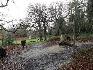
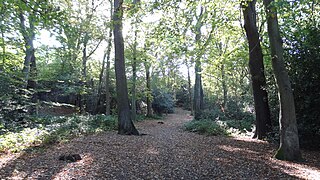
Beaulieu Heights 16 acres (6.5 ha) is an area of ancient woodland between South Norwood and Upper Norwood in the London Borough of Croydon, London. It is located between South Norwood Hill and Auckland Road with Auckland Rise to the north and Tummonds Gardens to the south. There are pedestrian entrances from South Norwood Hill and Auckland Rise, and a pond. The name is pronounced as if spelled "Beulah" like the nearby Beulah Hill, and not like the French word or the town of Beaulieu, Hampshire.
Heavers Meadow is a meadow located in South Norwood and Selhurst in the London Borough of Croydon. South Norwood Recreation Ground is on the other side of the road. The meadow covers an area of 83⁄4 acres. With meadows there are not usually many facilities. Heavers is no exception; the only facility stated on the council's website is a footpath through a flood meadow.

Grangewood Park is an extensive woodland area situated in South Norwood, London. It is managed by the London Borough of Croydon. It is bounded by Grange Road, Wharncliffe Road, and Ross Road. It covers an area of 27.7 acres. The park is located on the main A212 road between Thornton Heath and Upper Norwood/Crystal Palace. The nearest stations are Thornton Heath, Selhurst and Norwood Junction.
Croham Hurst is a 33.6 hectare biological Site of Special Scientific Interest (SSSI) and a Site of Metropolitan Importance for Nature Conservation in South Croydon in the London Borough of Croydon. Its SSSI designation is due to its importance for nature conservation, but it is also a Regionally Important Geological Site.

Littleheath Woods is the collective name for Littleheath Wood, Foxearth Woods, part of Queenhill Shaw and part of Gee Wood in Selsdon in the London Borough of Croydon. It is a Site of Borough Importance for Nature Conservation, Grade I, with an area of 64 acres (26 ha). It is owned by Croydon Council and the Friends of Littleheath Woods assist with the management.

Putney Old Burial Ground is a public urban park and former cemetery in the London Borough of Wandsworth near Putney town centre.
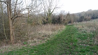
Foxley Wood is an 11.36 hectare Local Nature Reserve and Site of Borough Importance for Nature Conservation, Grade 1, in Purley in the London Borough of Croydon. It is owned and managed by Croydon Council. The site was purchased by Coulsdon and Purley Urban District Council under the Green Belt Act in the 1930s.

Biggin Wood is an area of ancient oak woodland situated within the London Borough of Croydon. The London Wildlife Trust is currently working with Croydon Council and the Friends of Biggin Wood to improve the site for wildlife, as a part of The Great North Wood Project.

Norwood Grove is an ornamental urban park in the northern extent of the London Borough of Croydon, by whom it is managed, although the most westerly part lies within the London Borough of Lambeth. It is bordered to the south-west by Covington Way, to the south-east by Gibson's Hill and to the north-east by Copgate Path, itself also referred to as 'Norwood Grove', and also by Ryecroft Road. To the north-west the grounds adjoin those of The Rookery which itself adjoins Streatham Common of which Norwood Grove was once a part. The main entrances are on Covington Way and Gibson's Hill but access is also available from Copgate Path as it effectively forms part of the park for much of its length.

Putney Park Lane is an unmade road and public urban park in the London Borough of Wandsworth between Putney and Roehampton town centres.
