North Greenwich, Isle of Dogs

Last updated

North Greenwich
North bank foot tunnel - geograph.org.uk - 1342998.jpg
View of North Greenwich from Greenwich
Greater London UK location map 2.svg
Red pog.svg
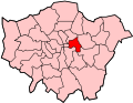
North Greenwich
Location within Greater London
OS grid reference TQ375785
Ceremonial county Greater London
Region
Country England
Sovereign state United Kingdom
Post town LONDON
Postcode district E14, SE10
Dialling code 020
Police Metropolitan
Fire London
Ambulance London
UK Parliament
List of places
UK
England
London
51°29′20″N0°01′08″W / 51.489°N 0.019°W / 51.489; -0.019 Coordinates: 51°29′20″N0°01′08″W / 51.489°N 0.019°W / 51.489; -0.019

North Greenwich is a formal 19th century name for an area now in Millwall situated at the very southern tip of the Isle of Dogs, in the London Borough of Tower Hamlets. It lies to the south of the commercial estates of West India Docks including Canary Wharf and has a short shoreline along London's Tideway part of the River Thames.

Contents

It should not be confused with the Greenwich Peninsula formerly known as East Greenwich that lies south of the river and is the site of The O2 (formerly the Millennium Dome). The opening in 1999 of the North Greenwich tube station on London Underground's Jubilee line has now led to this area being unofficially known colloquially as North Greenwich.

History

The area takes it name after Greenwich but was never a part of it, and was created for the now defunct North Greenwich railway station (1872), that served a former passenger ferry to Greenwich which the name became used to refer to the modern area. The station stood near the later Island Gardens (1897) and Greenwich foot tunnel (1902). [1]

It faces Greenwich town centre over the River Thames and the area is now more usually known as South Millwall. Millwall Football Club played in this area from 1901 to 1910, naming their ground North Greenwich. [2]

Amenities

Island Gardens (New Years Day, January 2008) Island Gardens.jpg
Island Gardens (New Years Day, January 2008)

The historical Island Gardens, opened on 3 August 1895 by local politician Will Crooks, is located almost in front of the former Greenwich Hospital, the Cutty Sark, National Maritime Museum and Greenwich Park. [3]

Landmarks

The Ferry House is a pub on Ferry Street has existed since the Tudor period (1485-1603). The present building dates from 1822, and was used as a drinking establishment by ferry passengers to and from Greenwich until the opening of the Greenwich foot tunnel in 1902. [4]

Education

Transport

Island Gardens DLR station with the disused Millwall Extension Railway beside it. Island Gardens DLR station - geograph.org.uk - 788982.jpg
Island Gardens DLR station with the disused Millwall Extension Railway beside it.

North Greenwich shares a Docklands Light Railway station with Cubitt Town called Island Gardens on the Bank-Lewisham line.

Several London Buses routes call in the area, 135 and D7, N550 run on Manchester Road and 277 on East Ferry Road.

The Greenwich foot tunnel crosses beneath the River Thames, opened on the 4 August 1902 and it original purpose was to allow south London residents to work on the Isle of Dogs without having to make a large detour. It connects North Greenwich to Greenwich town centre. [5]

Sport

Blackwall and District Rowing Club was formed in 1845 and is one of the oldest rowing clubs in the United Kingdom. A Tideway rowing club, historically it known as the Poplar, Blackwall and District Rowing Club. It competes in leading national races, runs Poplar regatta (wind permitting), and is the end of the Great River Race. Its members hold old records in the Doggett's Coat and Badge race for single sculls on the Thames. [6] Its most notable member is Olympic gold and silver medallist, and double-World Champion Mark Hunter.

North Greenwich football ground in East Ferry Road was home to Millwall Athletic Football Club, today Millwall F.C., from 1901 to 1910.

Nearby places

See also

Related Research Articles

Isle of Dogs Area in the East End of London, England

The Isle of Dogs is a large peninsula bounded on three sides by a large meander in the River Thames in East London, England, which includes the Cubitt Town, Millwall and Canary Wharf districts. The area was historically part of the Manor, Hamlet, Parish and, for a time, the wider borough of Poplar. The name had no official status until the 1987 creation of the Isle of Dogs Neighbourhood by Tower Hamlets London Borough Council. It has been known locally as simply "the Island" since the 19th century.

Poplar, London Area of East London, England

Poplar is a district in East London, England, the administrative centre of the borough of Tower Hamlets. Five miles (8 km) east of Charing Cross, it is part of the East End.

Canary Wharf Major business and financial district in London, England

Canary Wharf is an area of London, England, located on the Isle of Dogs in the London Borough of Tower Hamlets. Canary Wharf is defined by the Greater London Authority as being part of London's central business district, alongside Central London. With the City of London, it constitutes one of the main financial centres in the United Kingdom and the world, containing many high-rise buildings including the fourth-tallest in the UK, One Canada Square, which opened on 26 August 1991.

Greenwich foot tunnel Tunnel under the River Thames in London

The Greenwich Foot Tunnel crosses beneath the River Thames in East London, linking Greenwich on the south bank with Millwall on the north. Approximately 4,000 people use the tunnel each day. It opened in 1902.

Metropolitan Borough of Poplar

Poplar was a local government district in the metropolitan area of London, England. It was formed as a district of the Metropolis in 1855 and became a metropolitan borough in the County of London in 1900. It comprised Poplar, Millwall, Bromley-by-Bow and Bow.

Blackwall, London Area of the East End of London, England

Blackwall is an area of Poplar, in the London Borough of Tower Hamlets, East London. The neighbourhood includes Leamouth and the Coldharbour conservation area.

Millwall Human settlement in London, England

Millwall is a district on the western and southern side of the Isle of Dogs, in east London, England, in the London Borough of Tower Hamlets. It lies to the immediate south of Canary Wharf and Limehouse, north of Greenwich and Deptford, east of Rotherhithe, west of Cubitt Town, and has a long shoreline along London's Tideway, part of the River Thames. It was part of the County of Middlesex and from 1889 the County of London following the passing of the Local Government Act 1888, it later became part of Greater London in 1965.

Cubitt Town Area on the Isle of Dogs in London, England

Cubitt Town is a district on the eastern side of the Isle of Dogs in London, England. This part of Poplar was redeveloped as part of the Port of London in the 1840s and 1850s by William Cubitt, Lord Mayor of London (1860–1862), after whom it is named. It is on the east of the Isle, facing Royal Borough of Greenwich across the River Thames. To the west is Millwall, to the east and south is Greenwich, to the northwest Canary Wharf and to the north, across the Blue Bridge, is the rest of Poplar. It is in Blackwall & Cubitt Town Ward of Tower Hamlets London Borough Council.

Millwall Dock

Millwall Dock is a dock at Millwall, London, England, located south of Canary Wharf on the Isle of Dogs.

East London Northeastern part of London, United Kingdom

East London is a popularly and informally defined part of London, capital of the United Kingdom. By most definitions, it is east of the ancient City of London and north of the River Thames. It broadly comprises the London boroughs of Barking and Dagenham, Hackney, Havering, Newham, Redbridge, Tower Hamlets and Waltham Forest. This understanding accords closely, but not exactly, with the interpretation of the area consisting of the former Tower Division, and London east of the Lea. The East End of London is a subset of East London, consisting of areas close to the ancient City of London. The Eastern (E) Postal District is a different subset of East London; and there is also an "East" sub-region used in the London Plan for planning policy reporting purposes. The most recent (2011) iteration includes seven boroughs north of the Thames, with the addition of three boroughs south of the river.

Island Gardens

Island Gardens is a public park located at the southern end of the Isle of Dogs in the London Borough of Tower Hamlets on the north bank of the River Thames. The park was formally opened on 3 August 1895 by local politician Will Crooks.

Tideway

The Tideway is that part of the River Thames in England which is subject to tides. This stretch of water is downstream from Teddington Lock. The Tideway comprises the upper Thames Estuary including the Pool of London.

Mudchute Park and Farm

Mudchute Park and Farm is a large urban park and farm in Cubitt Town on the Isle of Dogs in the London Borough of Tower Hamlets, just south of Canary Wharf. It is a Local Nature Reserve and a Site of Metropolitan Importance for Nature Conservation.

North Greenwich railway station

North Greenwich was a railway station named after the North Greenwich area of the Isle of Dogs in London. It was located on the north side of the River Thames near Island Gardens in the east of the city, and is not to be confused with the present-day North Greenwich station on the London Underground's Jubilee line, which is located on the south side of the river, one mile downstream on the Greenwich Peninsula.

London Buses route 277

London Buses route 277 is a Transport for London contracted bus route in London, England. Running between Crossharbour and Dalston Junction, it is operated by Stagecoach London.

A1206 road (Great Britain)

The A1206, also known as the Isle of Dogs Distributor Road, is a crescent-shaped ring road around the Isle of Dogs, in the East End of London. It is made up of Westferry Road, Manchester Road and Prestons Road and is the main road through the area, connecting parts of the London Docklands.

Poplar Blackwall and District Rowing Club

Poplar Blackwall and District Rowing Club is a rowing club in Millwall, on the River Thames in England, on the northern bank of the Thames opposite Greenwich on the Isle of Dogs, London.

Coldharbour, Tower Hamlets

Coldharbour is a street and wider conservation area in Blackwall, lying on the north bank of the River Thames, east of Canary Wharf. The area is said to be "[t]he sole remaining fragment of the old hamlet of Blackwall" and "one of the last examples of the narrow streets which once characterised the river's perimeter".

References

  1. The Isle of Dogs: Introduction, Survey of London: volumes 43 and 44: Poplar, Blackwall and Isle of Dogs (1994), pp. 375-87 accessed: 13 July 2007
  2. Tarrant. Millwall: The Complete Record. p. 19.
  3. "Tower Hamlets Council > Island Gardens". Tower Hamlets Council. Archived from the original on 27 September 2013. Retrieved 25 September 2013.
  4. "Archived copy". Archived from the original on 10 April 2018. Retrieved 9 April 2018.CS1 maint: archived copy as title (link)
  5. "Greenwich Foot Tunnel - The Open Guide to London: the free London guide".
  6. Blackwall and District Rowing Club Retrieved 2013-08-22