
Willian is a village and former civil parish, adjoining the town of Letchworth, in the North Hertfordshire district of Hertfordshire, England. Along with Norton and Old Letchworth, it is one of the original three villages around which the garden city of Letchworth Garden City was created. Despite this, the village retains a separate character to the rest of Letchworth Garden City. In 1931 the parish had a population of 210.

Chipping Ongar is a market town and former civil parish, now in the parish of Ongar, in the Epping Forest District of the county of Essex, England. It is located 6 miles (10 km) east of Epping, 7 miles (11 km) southeast of Harlow and 7 miles (11 km) northwest of Brentwood. In 2020 the built-up area had an estimated population of 6420.

Testerton is a small village and former civil parish, now in the parish of Pudding Norton, in the North Norfolk district, in the county of Norfolk, England. It is located between the village of Great Ryburgh and the market town of Fakenham. In 1931 the parish had a population of 53.

Greensted is a village and a former civil parish, now in the parish of Ongar, Essex, England, strung out along the Greensted Road approximately one mile to the west of Chipping Ongar. In 1961 the parish had a population of 711.

Abbess Roding is a village and former civil parish, now in the parish of Abbess, Beauchamp and Berners Roding and the Epping Forest District of Essex, England. The village is included in the eight hamlets and villages called The Rodings. It is in west Essex, 5 miles (8 km) north from Chipping Ongar, and 9 miles (14 km) west from the county town of Chelmsford. In 1931 the parish had a population of 169.
Bishopstone is a village and former civil parish, now in the parish of Seaford, in the Lewes district, in the county of East Sussex, England. Bishopstone Village has a population of about 200 people, including the nearby hamlet of Norton. It is located on a no-through country lane west of the town of Seaford, in the South Downs National Park.

Cuddesdon is a mainly rural village and former civil parish, now in the parish of Cuddesdon and Denton, in the South Oxfordshire district, in the county of Oxfordshire, England. centred 5.5 miles (9 km) ESE of Oxford. It has the largest Church of England clergy training centre, Ripon College Cuddesdon. Residents number approximately 430 in Cuddesdon's nucleated village centre and about 70 in the hamlets of Denton and Chippinghurst.

Tatterford is a village and former civil parish, now in the parish of Tattersett, in the North Norfolk district, in the county of Norfolk, England. The village is 4.8 miles south west of the town of Fakenham, 30.3 miles north west of Norwich and 112 miles north north east of London. The nearest railway station is at Sheringham for the Bittern Line which runs between Sheringham, Cromer and Norwich. The nearest airport is Norwich International Airport. In 1931 the parish had a population of 66.

Thwing is a village and civil parish in the Yorkshire Wolds, in the East Riding of Yorkshire, England.

North Benfleet is a village and former civil parish, now in the parish of Bowers Gifford and North Benfleet, in the Basildon district of Essex, England, located between the towns of Basildon to the west and South Benfleet to the east. It adjoins the small village of Bowers Gifford. In 1931 the parish had a population of 560. On 1 January 1937 the parish was abolished to form Billericay.

Kilnsea is a village in the civil parish of Easington, in the East Riding of Yorkshire, England, in an area known as Holderness. It is situated approximately 2 miles (3 km) south of the village of Easington, on the north bank of the Humber Estuary.

Beauchamp Roding is a village and former civil parish, now in the parish of Abbess, Beauchamp and Berners Roding, and in the Epping Forest District of Essex, England. The village is included in the eight hamlets and villages called The Rodings. Beauchamp Roding is 8 miles (13 km) west from the county town of Chelmsford. In 1931 the parish had a population of 173.

Berners Roding is a village and former civil parish, now in the parish of Abbess, Beauchamp and Berners Roding and the Epping Forest District of Essex, England. The village is included in the eight hamlets and villages called The Rodings. Berners Roding is 6 miles (10 km) west from the county town of Chelmsford. In 1931 the parish had a population of 81.

North Grimston is a village in the civil parish of Birdsall, in North Yorkshire, England. It is situated between Norton-on-Derwent and Wharram-le-Street on the B1248 road. In 1931 the parish had a population of 143. On 1 April 1935 the parish was abolished and merged with Birdsall.

Great Holland is a village and former civil parish, now in the parish of Frinton and Walton, in the Tendring district, in the county of Essex, England. It is to the north-east of Holland-on-Sea, and west of Frinton-on-Sea. The village is served by a bus service to Clacton-on-Sea to the south and Kirby Cross, to the north. The village is served by two churches, a Methodist church and the parish church, 'All Saints'. There is an annual church fete held in the grounds of the Old Rectory funds of which go to All Saints. In 2020 the built-up area subdivision had an estimated population of 797.

Isley cum Langley is a civil parish in the North West Leicestershire district of Leicestershire, England, lying immediately south-west of East Midlands Airport. According to the 2001 census it had a population of 64. At the 2011 census the population of the civil parish remained less than 100 and was included in the civil parish of Breedon on the Hill.

Great Rollright is a village and former civil parish, now in the parish of Rollright, in the West Oxfordshire district, in Oxfordshire, England, and about 2.5 miles (4 km) north of Chipping Norton.

Little Rollright is a hamlet and former civil parish, now in the parish of Rollright, in the West Oxfordshire district, in the county of Oxfordshire, England. It is about 3 miles (5 km) northwest of Chipping Norton, it is the village nearest to the megalithic Rollright Stones. An early spelling may be seen, its Latin form, as "Parva Rolrandryght" in 1446. Little Rollright is in the Kingham, Rollright and Enstone ward of West Oxfordshire District Council and the Chipping Norton division of Oxfordshire County Council. In 1931 the parish had a population of 10. On 1 April 1932 the parish was abolished and merged with Great Rollright to form "Rollright".
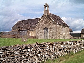
Bremilham, also known as Cowage or Cowich, is a small settlement and former civil parish in north Wiltshire, England. It is near the hamlet of Foxley in the parish of Norton. The nearest town is Malmesbury, about 2 miles (3.2 km) away to the north east.

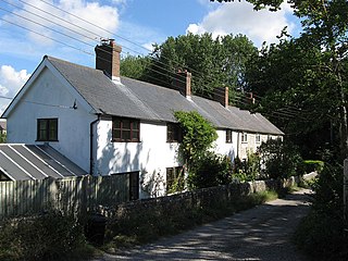
Monkokehampton is a village and civil parish in West Devon, England. The village lies on the River Okement, about 3 miles (4.8 km) east-north-east of Hatherleigh. The parish is bounded by Hatherleigh, Exbourne, Broadwoodkelly and Iddesleigh, and had a population of 139 at the 2011 Census.

