Oak Hills, San Bernardino County, California

Last updated

Oak Hills
USA California location map.svg
Red pog.svg
Oak Hills
Position in California.
Coordinates: 34°23′24″N117°24′11″W / 34.39000°N 117.40306°W / 34.39000; -117.40306
Country Flag of the United States.svg  United States
State Flag of California.svg  California
County San Bernardino
Area
[1]
  Total24.390 sq mi (63.171 km2)
  Land24.390 sq mi (63.171 km2)
  Water0 sq mi (0 km2)  0%
Elevation
[2]
3,799 ft (1,158 m)
Population
 (2010)
  Total8,879
  Density360/sq mi (140/km2)
Time zone UTC-8 (Pacific (PST))
  Summer (DST) UTC-7 (PDT)
GNIS feature ID2583100
U.S. Geological Survey Geographic Names Information System: Oak Hills, San Bernardino County, California

Oak Hills is a census-designated place in the Victor Valley of the Mojave Desert, within San Bernardino County, California. [2]

Contents

Geography

Oak Hills is in the Mojave Desert north of the Cajon Summit of Cajon Pass, southwest of Hesperia, and east of Phelan. [3]

Oak Hills sits at an elevation of 3,799 feet (1,158 m). [2]

According to the United States Census Bureau, the CDP covers an area of 24.4 square miles (63.2 km2), all of it land. The 2010 United States census reported Oak Hills's population was 8,879.

Education

Oak Hills High School, overseen by the Hesperia Unified School District, is located in Oak Hills. [4]

Demographics

At the 2010 census Oak Hills had a population of 8,879. The population density was 364.0 inhabitants per square mile (140.5/km2). In the 2013 Census Estimate, the racial makeup of Oak Hills was 76.5% White (61.7% Non-Hispanic White), [5] 266 (3.0%) African American, 100 (1.1%) Native American, 226 (2.5%) Asian, 28 (0.3%) Pacific Islander, 1,166 (13.1%) from other races, and 297 (3.3%) from two or more races. Hispanic or Latino of any race were 2,719 persons (30.6%). [6]

The whole population lived in households, no one lived in non-institutionalized group quarters and no one was institutionalized.

There were 2,976 [7] households, out of which 1,191 (43.9%) had children under the age of 18 living in them, 1,948 (71.9%) were opposite-sex married couples living together, 217 (8.0%) had a female householder with no husband present, 128 (4.7%) had a male householder with no wife present. There were 113 (4.2%) unmarried opposite-sex partnerships, and 19 (0.7%) same-sex married couples or partnerships. 322 households (11.9%) were one person and 107 (3.9%) had someone living alone who was 65 or older. The average household size was 3.28. There were 2,293 families (84.6% of households); the average family size was 3.53.

The age distribution was 2,429 people (27.4%) under the age of 18, 809 people (9.1%) aged 18 to 24, 1,999 people (22.5%) aged 25 to 44, 2,789 people (31.4%) aged 45 to 64, and 853 people (9.6%) who were 65 or older. The median age was 39.1 years. For every 100 females, there were 102.4 males. For every 100 females age 18 and over, there were 99.4 males.

There were 2,976 housing units at an average density of 122.0 per square mile, of the occupied units 2,403 (88.7%) were owner-occupied and 307 (11.3%) were rented. The homeowner vacancy rate was 2.3%; the rental vacancy rate was 6.1%. 7,780 people (87.6% of the population) lived in owner-occupied housing units and 1,099 people (12.4%) lived in rental housing units.

According to the 2015 United States Census estimate, Oak Hills had a median household income of $69,260, with 9.3% of the population living below the federal poverty line. [8]

See also

Related Research Articles

<span class="mw-page-title-main">San Bernardino County, California</span> County in southern California, United States

San Bernardino County, officially the County of San Bernardino, is a county located in the southern portion of the U.S. state of California, and is located within the Inland Empire area. As of the 2020 U.S. Census, the population was 2,181,654, making it the fifth-most populous county in California and the 14th-most populous in the United States. The county seat is San Bernardino.

<span class="mw-page-title-main">Boron, California</span> Census-designated place in California, United States

Boron is a census-designated place (CDP) in Kern County, California, United States. Boron is 15 miles (24 km) southwest of Red Rock Mountain at an elevation of 2,467 feet (752 m). The population was 2,086 at the 2020 census, up from 2,025 at the 2000 census. Boron is named after the element boron and is the site of the world's largest source of the boron compound boric acid.

<span class="mw-page-title-main">Rosamond, California</span> Unincorporated community in Kern County, California

Rosamond is a unincorporated community in Kern County, California, US, near the Los Angeles county line. Rosamond is part of Greater Los Angeles and is located in the Mojave Desert just north of Lancaster and Palmdale, two of the largest cities in Antelope Valley. As of the 2010 Census, Rosamond's population was 18,150. For statistical purposes, the United States Census Bureau has defined Rosamond as a census-designated place (CDP).

<span class="mw-page-title-main">Apple Valley, California</span> City in California, United States

Apple Valley is an incorporated town in the Victor Valley of San Bernardino County, in the U.S. state of California. Its population was 75,791 as of the 2020 United States Census. The town is east of and adjoining to the neighboring cities of Victorville and Hesperia, 35 miles (56 km) south of Barstow, and 49 miles (79 km) north of San Bernardino through the Cajon Pass. It was incorporated on November 14, 1988, and is one of the 22 incorporated municipalities in California that use "town" in their names instead of "city".

<span class="mw-page-title-main">Big Bear City, California</span> Place in California, United States

Big Bear City is an unincorporated community in San Bernardino County, California, United States along the east shore of Big Bear Lake and surrounded by the San Bernardino National Forest. It is 27 miles (43 km) northeast of the city of San Bernardino, and immediately east of the incorporated city of Big Bear Lake. For statistical purposes, the United States Census Bureau has defined Big Bear City as a census-designated place (CDP). Its population was 12,304 at the 2010 census, up from 5,779 at the 2000 census. Big Bear City is mostly residential, with smaller houses and cabins laid out in typical square block fashion. Big Bear is on the Pacific Crest Trail.

<span class="mw-page-title-main">Hesperia, California</span> City in California, United States

Hesperia is a city in San Bernardino County, California, United States. It is located 35 miles (56 km) north of downtown San Bernardino in Victor Valley and surrounded by the Mojave Desert. Because of its relatively high elevation and the unique and moderate weather patterns of the region, Hesperia is part of what is locally called the High Desert. The name "Hesperia" means "western land". The 2019 census report estimates that the city has a population of 95,750.

<span class="mw-page-title-main">Joshua Tree, California</span> Census-designated place in California, United States

Joshua Tree is a census-designated place (CDP) in San Bernardino County, California, United States. The population was 7,414 at the 2010 census. At approximately 2,700 feet above sea level, Joshua Tree and its surrounding communities are located in the High Desert of California. The center of the business district in Joshua Tree is on California State Route 62.

<span class="mw-page-title-main">Lenwood, California</span> Census-designated place in California, United States

Lenwood is a census-designated place (CDP) in the Mojave Desert near Barstow, in San Bernardino County, California.

<span class="mw-page-title-main">Mountain View Acres, California</span> Census-designated place in California, United States

Mountain View Acres is a census-designated place (CDP) in the Victor Valley of the Mojave Desert, within San Bernardino County, California.

<span class="mw-page-title-main">Victorville, California</span> City in California, United States

Victorville is a city in Victor Valley in San Bernardino County, California. Its population as of the 2020 census was 134,810.

<span class="mw-page-title-main">Crest, California</span> Census-designated place in California, United States

Crest is an unincorporated community in the East County region of San Diego County, California. The Crest census-designated place (CDP) had a population of 2,828 at the 2020 census, down from 2,593 at the 2010 census.

<span class="mw-page-title-main">Granite Hills, California</span> Census-designated place in California, United States

Granite Hills is a census-designated place in San Diego County, California. The name is also applied to a neighborhood within the city limits of El Cajon in the eastern part of that city. The population of the CDP, which does not include the people living within the city of El Cajon, was 3,035 at the 2010 census, down from 3,246 at the 2000 census.

<span class="mw-page-title-main">Baker, California</span> Census designated place in California, United States

Baker is a census-designated place located in San Bernardino County, California, US. As of the 2010 census, the CDP had a total population of 735. Baker's ZIP Code is 92309 and the community is within area codes 442 and 760.

Piñon Hills is a census-designated place in San Bernardino County, California, near the Los Angeles County line. It is located along Pearblossom Highway, 28 miles east of Palmdale, and 15 miles west of the Cajon Pass where Pearblossom Highway meets Interstate 15. The town lies within 25 miles of Hesperia and Victorville. Piñon Hills is in a tri-community that consists of Piñon Hills, Phelan, and Wrightwood. The elevation is 4,173 feet (1,272 m). The population was 7,272 at the 2010 census.

Phelan is an unincorporated community and census-designated place in San Bernardino County, California, in the Victor Valley of the Mojave Desert, north of the San Gabriel Mountains. The population was 14,304 in the 2010 census.

<span class="mw-page-title-main">Lucerne Valley, California</span> Census-designated place in California, USA

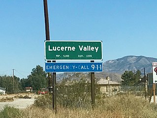
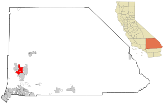
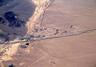
Lucerne Valley is a census-designated place (CDP) and valley landform in the southern Mojave Desert, in western San Bernardino County, California.

<span class="mw-page-title-main">Helendale, California</span> Unincorporated community in California, United States

Helendale or Silver Lakes is an unincorporated community and census-designated place located in the Victor Valley of the Mojave Desert, within San Bernardino County, California.

<span class="mw-page-title-main">Oak Glen, San Bernardino County, California</span> Census-designated place in California, United States

Oak Glen is a census-designated place situated between the San Bernardino Mountains and the Little San Bernardino Mountains in San Bernardino County, California, United States. Oak Glen is located 15 miles east of San Bernardino, at an elevation of 4,734 feet (1,443 m). The population was 638 at the 2010 census.

<span class="mw-page-title-main">Searles Valley, California</span> Census-designated place in California, United States

Searles Valley is a census-designated place (CDP) in the Searles Valley of the Mojave Desert, in northwestern San Bernardino County, California.

<span class="mw-page-title-main">Spring Valley Lake, California</span> Census-designated place in California, United States

Spring Valley Lake is a census-designated place in the Victor Valley of the Mojave Desert, within San Bernardino County, California. It is located in Victorville on the Mojave River.

References

  1. U.S. Census Archived 2012-01-25 at the Wayback Machine
  2. 1 2 3 U.S. Geological Survey Geographic Names Information System: Oak Hills, San Bernardino County, California
  3. San-bernardino.ca: Community plan for Oak Hills.
  4. "Oak Hills High". Hesperia Unified School District. October 22, 2014. Retrieved January 29, 2017.
  5. "Oak Hills CDP, California". Quick Facts. United States Census. Archived from the original on July 2, 2012. Retrieved November 11, 2015.
  6. "2010 Census Interactive Population Search: CA - Oak Hills CDP". U.S. Census Bureau. Archived from the original on July 15, 2014. Retrieved July 12, 2014.
  7. "Population estimates, July 1, 2015, (V2015)". www.census.gov. Retrieved January 29, 2017.
  8. "Population estimates, July 1, 2016, (V2016)". www.census.gov. Retrieved January 30, 2017.