
Leadville is a statutory city that is the county seat, the most populous community, and the only incorporated municipality in Lake County, Colorado, United States. The city population was 2,633 at the 2020 census. It is situated at an elevation of 10,158 feet (3,096 m). Leadville is the highest incorporated city in the United States and is surrounded by two of the tallest peaks in the state.
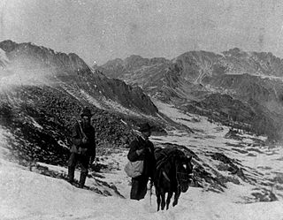
The Pike's Peak gold rush was the boom in gold prospecting and mining in the Pike's Peak Country of western Kansas Territory and southwestern Nebraska Territory of the United States that began in July 1858 and lasted until roughly the creation of the Colorado Territory on February 28, 1861. An estimated 100,000 gold seekers took part in one of the greatest gold rushes in North American history.
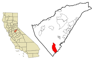
Copperopolis is an unincorporated town and census-designated place (CDP) in Calaveras County, California, United States. The population was 3,671 at the 2010 census, up from 2,363 at the 2000 census. The town is located along State Route 4 and is registered as California Historical Landmark #296.
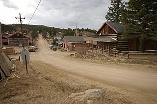
Gold Hill is an unincorporated community and a census-designated place (CDP) located in and governed by Boulder County, Colorado, United States. The CDP is a part of the Boulder, CO Metropolitan Statistical Area. The population of the Gold Hill CDP was 218 at the United States Census 2020. The Boulder post office serves the area.

The Comstock Lode is a lode of silver ore located under the eastern slope of Mount Davidson, a peak in the Virginia Range in Virginia City, Nevada, which was the first major discovery of silver ore in the United States and named after American miner Henry Comstock.

Rhyolite is a ghost town in Nye County, in the U.S. state of Nevada. It is in the Bullfrog Hills, about 120 miles (190 km) northwest of Las Vegas, near the eastern boundary of Death Valley National Park.

Dog Town is a gold rush era ghost town in Mono County, California. It is located at 38°10′13″N119°11′51″W, on Dog Creek, near the junction of Clearwater and Virginia Creeks, about 6 miles (10 km) south-southeast of Bridgeport, at an elevation of 7057 feet.

Nelson is a census-designated place in Clark County, Nevada, United States. The community is in the Pacific Standard Time zone. The location of Nelson is in El Dorado Canyon, Eldorado Mountains. The town is in the southeast region of the Eldorado Valley. As of the 2010 census it had a population of 37.

In the United States, gold mining has taken place continually since the discovery of gold at the Reed farm in North Carolina in 1799. The first documented occurrence of gold was in Virginia in 1782. Some minor gold production took place in North Carolina as early as 1793, but created no excitement. The discovery on the Reed farm in 1799 which was identified as gold in 1802 and subsequently mined marked the first commercial production.
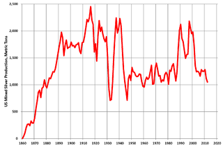
Silver mining in the United States began on a major scale with the discovery of the Comstock Lode in Nevada in 1858. The industry suffered greatly from the demonetization of silver in 1873 by the Coinage Act of 1873, known pejoratively as the "Crime of 73", but silver mining continues today.
Gold mining in Colorado, a state of the United States, has been an industry since 1858. It also played a key role in the establishment of the state of Colorado.

Oro City is a ghost town in Lake County, Colorado, United States
Silver mining in Arizona was a powerful stimulus for exploration and prospecting in early Arizona. Cumulative silver production through 1981 totaled 490 million troy ounces. However, only about 10% of Arizona's silver production came from silver mining. More than 80% of the state's silver was a byproduct of copper mining; other silver came as a byproduct of lead, zinc, and gold mining.
Gold mining in Alaska, a state of the United States, has been a major industry and impetus for exploration and settlement since a few years after the United States acquired the territory in 1867 from the Russian Empire. Russian explorers discovered placer gold in the Kenai River in 1848, but no gold was produced. Gold mining started in 1870 from placers southeast of Juneau, Alaska.

Gold mining in Nevada, a state of the United States, is a major industry, and one of the largest sources of gold in the world. In 2018 Nevada produced 5,581,160 troy ounces, representing 78% of US gold and 5.0% of the world's production. Total gold production recorded from Nevada from 1835 to 2017 totals 205,931,000 troy ounces (6,405.2 t), worth US$322.6 billion at 2020 values. Much of Nevada's gold production comes from large open pit mining using heap leaching recovery.
Lark is a ghost town located 4 miles (6.4 km) west of Herriman in the Oquirrh Mountains of southwest Salt Lake County, Utah, United States. Lark was the location of several copper mines.
Spenceville was a ranching, farming and mining community located in the southwestern part of Nevada County, California, on Spenceville Road just east of Waldo Road, about 17 miles from Grass Valley. Its elevation was about 400 feet. The former townsite is now part of the Spenceville Wildlife Area.
Mining in the United States has been active since the beginning of colonial times, but became a major industry in the 19th century with a number of new mineral discoveries causing a series of mining rushes. In 2015, the value of coal, metals, and industrial minerals mined in the United States was US$109.6 billion. 158,000 workers were directly employed by the mining industry.
Bonanza City is a ghost town, located 13 miles (21 km) southwest of Santa Fe in Santa Fe County, New Mexico, United States. The town was founded in 1880 as a mining town, following the discovery of gold and silver in the nearby Cerrillos Hills. It was abandoned sometime in the early 1900s. Later in the 20th century, The Bonanza Creek Movie Ranch, which contains a movie set depicting a late 19th century mining town, was built near the ruins of Bonanza City.
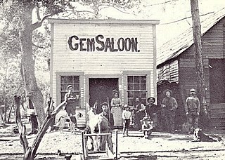
Manchester was a mining town in the Los Burros Mining District in the southern Big Sur region of Monterey County, California from about 1875 to 1895. The town was reached by a 20 miles (32 km) road from King City to Jolon. From Jolon travelers could ride or take a stage or wagon to the Wagon Caves, followed by a difficult 14 miles (23 km) trail over the steep Santa Lucia Mountains to the site, about 4 miles (6.4 km) inland of Cape San Martin. Prospecting began in the area in the 1850s.


