
San Bernardino is a city located in the Riverside–San Bernardino metropolitan area and that serves as the county seat of San Bernardino County, California, United States. As one of the Inland Empire's anchor cities, San Bernardino spans 81 square miles (210 km2) on the floor of the San Bernardino Valley and as of 2017 has a population of 216,995. San Bernardino is the 17th-largest city in California and the 102nd-largest city in the United States. San Bernardino is home to numerous diplomatic missions for the Inland Empire, being one of four cities in California with numerous consulates. The governments of Guatemala and Mexico have also established their consulates in the downtown area of the city.

Yermo is a town in the Mojave Desert in San Bernardino County, California. Its name is derived from one of the Spanish words for "wilderness". It is 13 miles east of Barstow on Interstate 15, just south of the Calico Mountains. Its population was an estimated 1,750 in 2009.

Caliente is an unincorporated community in Kern County, California. It is located 22 miles (35 km) east-southeast of Bakersfield, at an elevation of 1,312 feet (400 m).

Oro Grande is an unincorporated community in the Mojave Desert of San Bernardino County, California, United States. It lies on the city boundary of Victorville and Adelanto. It is at 3,000 feet (910 m) elevation in Victor Valley north of the San Bernardino mountain range. It is located on old Route 66 near Interstate 15 between Victorville and Barstow. The ZIP code is 92368 and the community is inside area codes 442 and 760. Less than 1,000 residents live in the unincorporated area.

Lytle Creek is a census-designated place in the San Gabriel Mountains, within San Bernardino County.
Sugarloaf is an unincorporated community residential area less than a mile south of Big Bear City and 8 miles from the eastern tip of Big Bear Lake in the San Bernardino Mountains of San Bernardino County, California. The area is primarily residential with a convenience store and a post office located at the center of the community. The residential area is set at an elevation of 7,096 feet at its center, whereas its extreme northern border is 6,998 feet above sea level and the southern tip sits at 7,218 feet above sea level. There is no municipal organization for the area, and all fire, water, and police service is provided by San Bernardino County. The ZIP code for the community is 92386, the area code 909, and the population is 1,816. Big Bear High School is located in the northern part of the community.

Chambless is a ghost town in the Mojave Desert of San Bernardino County, California, United States, south of Interstate 40 on the historic Route 66.
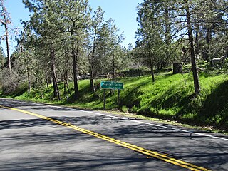
Mountain Center is a census-designated place in the San Jacinto Mountains, within western central Riverside County, California.
Del Rosa is a neighborhood community in the city of San Bernardino, California.

Mount Baldy or Mt Baldy, formerly Camp Baynham and Camp Baldy, is an unincorporated community in the San Gabriel Mountains, in San Bernardino County near the eastern border of Los Angeles County, in Southern California.
Guasti, formerly known as South Cucamonga and Zucker, is an unincorporated community in the Cucamonga Valley region of the Pomona Valley, in southwestern San Bernardino County, California.

Red Mountain, formerly known as Osdick, is an unincorporated community in San Bernardino County, California, United States.
Parker Dam is an unincorporated community in San Bernardino County, California, United States. Parker Dam is located along the Colorado River across from Arizona 24 miles (39 km) east-northeast of Vidal. Parker Dam has a post office with ZIP code 92267. The post office opened in 1935 and closed briefly between 1939 and 1940.
Cedarpines Park is an unincorporated community in San Bernardino County, California, United States. Cedarpines Park is 10 miles (16 km) north-northwest of San Bernardino. Cedarpines Park has a post office with ZIP code 92322. The post office opened in 1927 and was closed from 1943 to 1946.
Crest Park is an unincorporated community in San Bernardino County, California, United States. Crest Park is located in the San Bernardino Mountains on California State Route 18 1 mile (1.6 km) south of Lake Arrowhead. Crest Park had a post office with ZIP code 92326, which opened in 1949.
Patton is an unincorporated community in San Bernardino County, California, United States. Patton is 4.5 miles (7.2 km) northeast of downtown San Bernardino. Patton has a post office with ZIP code 92369, which opened in 1897.

Skyforest is an unincorporated community in San Bernardino County, California, United States. Skyforest is located on California State Route 18 1 mile (1.6 km) southeast of Lake Arrowhead. Skyforest has a post office with ZIP code 92385, which opened in 1928.
Twin Peaks is an unincorporated community in San Bernardino County, California, United States, located on California State Route 189 2.5 miles (4.0 km) west-southwest of Lake Arrowhead. Twin Peaks has a post office with ZIP code 92391, which opened in 1916.
Arrowhead Farms is an unincorporated community of San Bernardino County, California. It is now a foothill and rural neighborhood of the city of San Bernardino located just northeast of the Interstate 215 and Interstate 210 junction. Arrowhead Farms is in the 92407 ZIP Code and is within the 909 area code.


