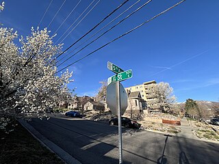
The Avenues is an affluent neighborhood in Salt Lake City, Utah. It is named after the perfectly gridlike, closely laid out roads called Avenues and Streets. First surveyed in the 1850s, the Avenues became Salt Lake City's first neighborhood. Today, the Avenues neighborhood is generally considered younger, more progressive, and somewhat "artsy" when compared to other neighborhoods. Many young professionals choose to live there due to the culture and easy commute to downtown.. It is also one of the most important strongholds of the Utah Democratic Party.

Grant Park refers to the oldest city park in Atlanta, Georgia, United States, as well as the Victorian neighborhood surrounding it.

The Sweet Auburn Historic District is a historic African-American neighborhood along and surrounding Auburn Avenue, east of downtown Atlanta, Georgia, United States. The name Sweet Auburn was coined by John Wesley Dobbs, referring to the "richest Negro street in the world," one of the largest concentrations of African-American businesses in the United States.

West End is a historic neighborhood in the U.S. city of Atlanta, one of the oldest outside Downtown Atlanta, and is listed on the National Register of Historic Places. West End residents are primarily (86%) African American and the neighborhood contains several prominent African American cultural institutions, in addition to being adjacent to the Atlanta University Center which is a consortium of HBCUs. West End is located southwest of Castleberry Hill, east of Westview, west of Adair Park Historic District, and just north of Oakland City. Architectural styles within the district include Craftsman Bungalow, Queen Anne, Stick style, Folk Victorian, Colonial Revival, American Foursquare and Neoclassical Revival.

Cabbagetown is an intown neighborhood on the east side of Atlanta, Georgia, United States, abutting historic Oakland Cemetery. It includes the Cabbagetown District, a historic district listed on the U.S. National Register of Historic Places.

Woodbridge is a historic neighborhood of primarily Victorian homes located in Detroit, Michigan. The district was listed on the National Register of Historic Places in 1980, with later boundary increases in 1997 and 2008. In addition to its historic value, Woodbridge is also notable for being an intact neighborhood of turn-of-the-century homes within walking or biking distance of Detroit's Downtown, Midtown, New Center, and Corktown neighborhoods.
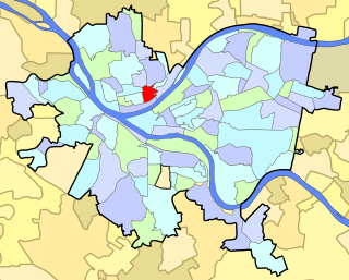
East Allegheny, also known as Deutschtown, is a neighborhood on Pittsburgh's North Side. It has a ZIP code of 15212, and has representation on Pittsburgh City Council by the council member for District 1. The Pittsburgh Bureau of Fire houses 32 engines and 32 trucks in Deutschtown.
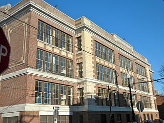
Hawthorne is a neighborhood in the South Philadelphia section of Philadelphia, Pennsylvania, United States. It is located between Broad Street and 11th Street, and extends from South Street to Washington Avenue.

McElderry Park is a neighborhood in the northern part of the southeastern district of the City of Baltimore. Its boundaries are marked by East Fayette Street, East Monument Street, Linwood Avenue, and Patterson Park Avenue. South of McElderry Park is the neighborhood of Patterson Park; Butchers Hill is to the southwest. Ellwood Park is located to the east, and the campus of The Johns Hopkins Hospital to the west. To its north is the neighborhood of Madison-East End.

Brookwood Hills is a historic neighborhood located in intown Atlanta, Georgia, United States, north of Midtown and south-southwest of Buckhead. Home to about 1000 people, it was founded in the early 1920s by Benjamin Franklin Burdett and his son, Arthur. The site of the neighborhood is located where some of the bloodiest battles of the American Civil War took place during the Atlanta Campaign.

The city of Kalamazoo, Michigan consists of multiple neighborhoods. While the number, borders, and naming of neighborhoods can vary by source, the list below gives the most widely agreed upon arrangement, as defined by the City of Kalamazoo. Many of the neighborhoods have a corresponding neighborhood association.

The Old Fourth Ward, often abbreviated O4W, is an intown neighborhood on the eastside of Atlanta, Georgia, United States. The neighborhood is best known as the location of the Martin Luther King Jr. historic site.
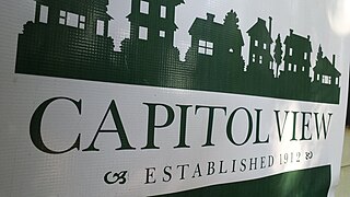
Capitol View is a historic intown southwest Atlanta, Georgia neighborhood. The neighborhood is 2.5 miles from downtown and was named for its views of the Georgia State Capitol building. Its boundaries include Metropolitan Parkway to the east, Lee Street to the west, and the Beltline to the north. On the south, the border follows Arden Street, Deckner Avenue, and Perkerson Park.

Adair Park is a historic residential neighborhood located southwest of downtown Atlanta. It has the form of a left curly bracket, bordered by the MARTA north–south rail line on the northwest, the BeltLine trail on the southwest and Metropolitan Parkway on the east. Historically Adair Park also included the area from Metropolitan Parkway to McDaniel Street on the east, but the city now considers that area part of the Pittsburgh neighborhood.
Mozley Park is a typical early 20th-century residential neighborhood, located approximately three miles west of downtown Atlanta. The community is named after the original landowner, Dr. Hiram Mozley, whose heirs inherited the land after his death in 1902.

The West Canfield Historic District is a neighborhood historic district located primarily on Canfield Avenue between Second and Third Streets in Detroit, Michigan. A boundary increase enlarged the district to include buildings on Third Avenue between Canfield and Calumet. The district was designated a Michigan State Historic Site in 1970 and listed on the National Register of Historic Places in 1971; a boundary increase was added in 1997. The revitalized 1870s era neighborhood is one of the residential areas surrounding the city's Cultural Center Historic District in Midtown. Nearby, East Canfield Avenue leads to the Detroit Medical Center complex, the Romanesque Revival styled St. Josaphat's Catholic Church, and the Gothic revival styled Sweetest Heart of Mary Catholic Church.

Old Southwest is a neighborhood of the independent city of Roanoke, Virginia, United States. Located geographically near the center of the city, Old Southwest was annexed from Roanoke County in 1890 and developed as one of Roanoke's more affluent residential areas. Today the majority of the neighborhood falls within the Southwest Historic District listed on both the Virginia Landmarks Register and the National Register of Historic Places.

Ponce City Market is a mixed-use development located in a former Sears catalogue facility in Atlanta, with national and local retail anchors, restaurants, a food hall, boutiques and offices, and residential units. It is located adjacent to the intersection of the BeltLine with Ponce de Leon Avenue in the Old Fourth Ward near Virginia Highland, Poncey-Highland and Midtown neighborhoods. The 2.1-million-square-foot (200,000 m2) building, one of the largest by volume in the Southeast United States, was used by Sears, Roebuck and Co. from 1926 to 1987 and later by the City of Atlanta as "City Hall East". The building's lot covers 16 acres (65,000 m2). Ponce City Market officially opened on August 25, 2014. It was listed on the National Register of Historic Places in 2016.

English Avenue and Vine City are two adjacent and closely linked neighborhoods of Atlanta, Georgia. Together the neighborhoods make up neighborhood planning unit L. The two neighborhoods are frequently cited together in reference to shared problems and to shared redevelopment schemes and revitalization plans.

Gentrification of Atlanta's inner-city neighborhoods began in the 1970s, and it has continued, at varying levels of intensity, into the present. Many factors have contributed to the city's gentrification. A major increase in gentrification that occurred in the last years of the 20th century has been attributed to the 1996 Summer Olympics. However, during the 2000s, Atlanta underwent a profound transformation demographically, physically, and culturally. Suburbanization, rising prices, a booming economy, and new migrants decreased the city’s black percentage from a high of 67% in 1990 to 54% in 2010. From 2000 to 2010, Atlanta gained 22,763 white residents, 5,142 Asian residents, and 3,095 Hispanic residents, while the city’s black population decreased by 31,678. Much of the city’s demographic change during the decade was driven by young, college-educated professionals: from 2000 to 2009, the three-mile radius surrounding Downtown Atlanta gained 9,722 residents aged 25 to 34 holding at least a four-year degree, an increase of 61%. Between the mid-1990s and 2010, stimulated by funding from the HOPE VI program, Atlanta demolished nearly all of its public housing, a total of 17,000 units and about 10% of all housing units in the city. In 2005, the $2.8 billion BeltLine project was adopted, with the stated goals of converting a disused 22-mile freight railroad loop that surrounds the central city into an art-filled multi-use trail and increasing the city’s park space by 40%. Lastly, Atlanta’s cultural offerings expanded during the 2000s: the High Museum of Art doubled in size; the Alliance Theatre won a Tony Award; and numerous art galleries were established on the once-industrial Westside.
