Related Research Articles
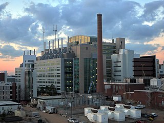
Druid Hills is a community which includes both a census-designated place (CDP) in unincorporated DeKalb County, Georgia, United States, as well as a neighborhood of the city of Atlanta. The CDP's population was 14,568 at the 2010 census. The CDP formerly contained the main campus of Emory University and the Centers for Disease Control and Prevention (CDC); they were annexed by Atlanta in 2018. The Atlanta-city section of Druid Hills is one of Atlanta's most affluent neighborhoods with a mean household income in excess of $238,500.

Buckhead is the uptown commercial and residential district of the city of Atlanta, Georgia, comprising approximately the northernmost fifth of the city. Buckhead is the third largest business district within the Atlanta city limits, behind Downtown and Midtown, a major commercial and financial center of the Southeast.
East Atlanta is a neighborhood on the east side of Atlanta, Georgia, United States The name East Atlanta Village primarily refers to the neighborhood's commercial district.
Kirkwood is a national historic designated neighborhood on the east side of Atlanta, Georgia, United States. It is a historic streetcar suburb, and was designed by architect Will Saunders. Kirkwood is situated entirely in DeKalb County, bordered by the neighborhoods of Lake Claire, East Lake, Edgewood, and Oakhurst. Kirkwood is bound on the north by DeKalb Avenue, on the south by Memorial Drive and Interstate 20, on the west by Montgomery Street, and on the east by 1st Ave. A large part of the neighborhood is listed on the National Register of Historic Places as Kirkwood Historic District.
The Neighborhood Planning Unit is a neighborhood-scale governmental structure used in the city of Atlanta, Georgia.

Westview is a historic intown neighborhood located in southwest Atlanta, Georgia. It is named for the Westview Cemetery that borders the neighborhood to the northwest. The neighborhood is made up of a mixture of architectural styles including Arts & Crafts bungalows, Four-Squares, Tudors, Minimal Traditional houses, and Ranch style houses.

Berkeley Park is a neighborhood located in West Midtown Atlanta, Georgia, United States.

Chastain Memorial Park is the largest city park in Atlanta, Georgia. It is a 268-acre (1.08 km2) park near the northern edge of the city. Included in the park are jogging paths, playgrounds, tennis courts, a golf course, swimming pool, horse park and amphitheater.
Marietta Street Artery is an officially defined neighborhood of the city of Atlanta, Georgia, part of the West Midtown area of Atlanta, also known as the "Westside."
Lindridge/Martin Manor is an intown neighborhood of Atlanta, Georgia. It consists mostly of the single-family homes located off Lindbergh Drive in between I-85 and Cheshire Bridge Road. In addition, it includes a small commercial area of three streets west of I-85 bounded by Peachtree Creek, Piedmont Road and the Southern railroad. The neighborhood's boundaries are I-85 on the northwest, Morningside-Lenox Park on the south, and North Druid Hills in unincorporated DeKalb County, Georgia on the east.

Lakewood Heights is a Black neighborhood in southeast Atlanta. It is bounded by:

Oakland is an officially recognized neighborhood of Atlanta consisting of only four blocks. It is bounded by:
Lindbergh, officially Lindbergh/Morosgo, is a neighborhood in the Buckhead district of Atlanta, Georgia. Most of the neighborhood consists of multi-use development combining retail, office and residential space.
Margaret Mitchell is a neighborhood in the Buckhead Community, in the northwest part of the city of Atlanta, Georgia. It is bounded by Moore's Mill Road on the south, I-75 on the east, and the Paces neighborhood on the west.
Brookwood is a neighborhood at the southernmost tip of the Buckhead Community of Atlanta. It should not be confused with Brookwood Hills, a neighborhood and historic district east of Brookwood across Peachtree Road.
North Buckhead is a neighborhood in the Buckhead district, at the northern edge of the city of Atlanta, Georgia, and is one of Atlanta's most affluent neighborhoods.

Peachtree Park is a neighborhood in the Buckhead Community of Atlanta, Georgia.
Buckhead Forest is a neighborhood of 165 homes in the Buckhead district of Atlanta, Georgia.
Midwest Cascade is a neighborhood of Atlanta at the city's far west edge. Together with the tiny neighborhood of Regency Trace it forms NPU Q, the city's fastest growing NPU from 2000 to 2010.
Argonne Forest is an officially defined neighborhood of Atlanta in the Buckhead area of the city. Its population at the 2010 census was 590. The neighborhood is named after the Argonne Forest in northeastern France, where the American military was heavily involved in the 1918 Meuse-Argonne offensive of World War I.
References
- ↑ "National Register of Historical Places - GEORGIA (GA), Fulton County". Nationalregisterofhistoricplaces.com. Retrieved October 15, 2017.
- ↑ "Atlanta, GA : Neighborhood Planning Unit (NPU)". Atlantaga.gov. Retrieved October 15, 2017.
- ↑ Buckner, Candace (August 29, 2020). "How politics transformed Kelly Loeffler from hoops junkie to WNBA villain". Washington Post . Retrieved January 11, 2020.