Orrstown, Pennsylvania

Last updated
Orrstown, Pennsylvania
Orrstown PA Post Office 17244.JPG
Orrstown Post Office
Franklin County Pennsylvania Incorporated and Unincorporated areas Orrstown Highlighted.svg
Location of Orrstown in Franklin County, Pennsylvania.
USA Pennsylvania location map.svg
Red pog.svg
Orrstown
Usa edcp location map.svg
Red pog.svg
Orrstown
Coordinates: 40°03′31″N77°36′33″W / 40.05861°N 77.60917°W / 40.05861; -77.60917
Country United States
State Pennsylvania
County Franklin
Settled1833
Government
  TypeBorough Council
Area
[1]
  Total0.06 sq mi (0.16 km2)
  Land0.06 sq mi (0.16 km2)
  Water0.00 sq mi (0.00 km2)
Elevation
686 ft (209 m)
Population
 (2020) [2]
  Total214
  Density3,343.75/sq mi (1,300.39/km2)
Time zone UTC-5 (Eastern (EST))
  Summer (DST) UTC-4 (EDT)
ZIP code
17244
Area code 717
FIPS code 42-57112

Orrstown is a borough in Franklin County, Pennsylvania, United States. The population was 214 at the 2020 census. [3]

Contents

History

Orrstown was founded in 1833 by the Orr brothers. It is surrounded by Southampton Township in Franklin County, on the old state road from Shippensburg to Upper Strasburg. Settlements were made in that neighborhood as early as 1738. Before the completion of the Pennsylvania Railroad, horses and cattle were annually driven down the state road (now Pennsylvania Route 533/Orrstown Road) to eastern markets. The town was laid out in 1833, by John, William and James Orr. [4] At first, they called it "Southampton", after the township; but in 1835, when application was made for a post office to be called Southampton, the Post Office Department refused because there was already a post office of that name. George Chambers, who represented the area in Congress, named the post office "Orrstown", and the name has since been attached to the town.

It was incorporated as a borough on May 3, 1847, and in 1878 the town had one hotel, two stores, one carriage factory, and four churches: Lutheran, Presbyterian, United Brethren and Winebrennerian. The populations was then 325. [5]

Geography

Orrstown is located in northeastern Franklin County at 40°3′31″N77°36′33″W / 40.05861°N 77.60917°W / 40.05861; -77.60917 (40.058482, -77.609213), [6] at the intersection of Pennsylvania Routes 433 (Rowe Run Road) and 533 (Orrstown Road). PA 433 leads northwestward 5 miles (8 km) to Roxbury and south 5 miles to the Letterkenny Army Depot. Chambersburg, the county seat, is 11 miles (18 km) to the south via PA 433 and U.S. Route 11. PA 533 leads east five miles to Shippensburg and west 6 miles (10 km) to Upper Strasburg.

According to the United States Census Bureau, the borough has a total area of 0.06 square miles (0.16 km2), all land. [7] The borough sits on a low ridge between Conodoguinet Creek to the north and its tributary, Muddy Run to the south.

Demographics

Historical population
CensusPop.Note
1860 356
1870 305−14.3%
1880 302−1.0%
1890 262−13.2%
1910 247
1920 217−12.1%
1930 211−2.8%
1940 29439.3%
1950 2950.3%
1960 3187.8%
1970 262−17.6%
1980 247−5.7%
1990 220−10.9%
2000 2315.0%
2010 26213.4%
2020 214−18.3%
Sources: [8] [9] [10] [2]

As of the census [9] of 2000, there were 231 people, 79 households, and 59 families residing in the borough. The population density was 3,714.2 inhabitants per square mile (1,434.1/km2). There were 85 housing units at an average density of 1,366.7 per square mile (527.7/km2). The racial makeup of the borough was 99.57% White, 0.43% from other races. Hispanic or Latino of any race were 0.43% of the population.

There were 79 households, out of which 32.9% had children under the age of 18 living with them, 65.8% were married couples living together, 3.8% had a female householder with no husband present, and 24.1% were non-families. 17.7% of all households were made up of individuals, and 8.9% had someone living alone who was 65 years of age or older. The average household size was 2.67 and the average family size was 2.98.

In the borough the population was spread out, with 24.7% under the age of 18, 9.1% from 18 to 24, 27.7% from 25 to 44, 18.6% from 45 to 64, and 19.9% who were 65 years of age or older. The median age was 38 years. For every 100 females there were 958 males. For every 100 females age 18 and over, there were 851 males.

The median income for a household in the borough was $38,542, and the median income for a family was $39,583. Males had a median income of $27,188 versus $21,250 for females. The per capita income for the borough was $14,346. None of the families and 1.4% of the population were living below the poverty line.

Related Research Articles

<span class="mw-page-title-main">Strasburg, Pennsylvania</span> Borough in Pennsylvania, United States

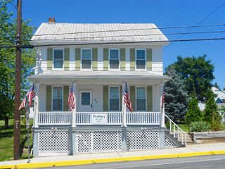
Strasburg is a borough in Lancaster County, Pennsylvania, United States. It developed as a linear village stretching approximately 2 miles (3 km) along the Great Conestoga Road, later known as the Strasburg Road. The population was 3,117 at the 2020 census.

<span class="mw-page-title-main">Franklin County, Pennsylvania</span> County in Pennsylvania, United States

Franklin County is a county in the Commonwealth of Pennsylvania. As of the 2020 census, the population was 155,932 Its county seat is Chambersburg.

<span class="mw-page-title-main">Newburg, Cumberland County, Pennsylvania</span> Borough in Pennsylvania, United States

Newburg is a borough in Cumberland County, Pennsylvania, United States. The population was 336 at the 2010 census. It is part of the Harrisburg–Carlisle metropolitan statistical area.

<span class="mw-page-title-main">Newville, Pennsylvania</span> Borough in Pennsylvania, United States

Newville is a borough in Cumberland County, Pennsylvania, United States. The borough is located west of Carlisle. The population was 1,376 at the 2020 census. It is part of the Harrisburg–Carlisle metropolitan statistical area.

<span class="mw-page-title-main">Shippensburg Township, Cumberland County, Pennsylvania</span> Township in Pennsylvania, United States

Shippensburg Township is a township in Cumberland County, Pennsylvania, United States, adjacent to the borough of Shippensburg. The population of the township was 5,429 at the 2010 census, up from 4,504 at the 2000 census. The township is the location of Shippensburg University of Pennsylvania.

<span class="mw-page-title-main">Southampton Township, Cumberland County, Pennsylvania</span> Township in Pennsylvania, United States

Southampton Township is a township in Cumberland County, Pennsylvania, United States. The population was 6,359 at the 2010 census, up from 4,787 at the 2000 census.

Fayetteville is an unincorporated community and census-designated place (CDP) in Franklin County, Pennsylvania, United States. The population was 3,208 at the 2020 census.

<span class="mw-page-title-main">Greene Township, Franklin County, Pennsylvania</span> Township in Pennsylvania, United States

Greene Township is a township in Franklin County, Pennsylvania, United States. The population was 18,436 at the 2020 census, up from 12,284 at the 2000 census. Part of Caledonia State Park is in Greene Township.

<span class="mw-page-title-main">Letterkenny Township, Franklin County, Pennsylvania</span> Township in Pennsylvania, United States

Letterkenny Township is a township that is located in Franklin County, Pennsylvania, United States. The population was 2,462 at the time of the 2020 census, up from 2,074 at the 2000 census.

<span class="mw-page-title-main">Mercersburg, Pennsylvania</span> Borough in Pennsylvania, United States

Mercersburg is a borough in Franklin County, located near the southern border of Pennsylvania, United States. The borough is 72 miles (116 km) southwest of Harrisburg, the state capital.

<span class="mw-page-title-main">Mont Alto, Pennsylvania</span> Borough in Pennsylvania, United States

Mont Alto is a borough in Franklin County, Pennsylvania, United States. The population was 1,580 at the 2020 census.

<span class="mw-page-title-main">Montgomery Township, Franklin County, Pennsylvania</span> Township in Pennsylvania, United States

Montgomery Township is a township that is located in Franklin County, Pennsylvania, United States. The population was 5,740 at the time of the 2020 census, an increase from the 4,949 figure that was counted during the 2000 census.

<span class="mw-page-title-main">Quincy Township, Franklin County, Pennsylvania</span> Township in Pennsylvania, United States

Quincy Township is a township that is located in Franklin County, Pennsylvania. The population was 5,318 at the time of the 2020 census, a decline from the figure of 5,541 that was tabulated during the 2010 census.

<span class="mw-page-title-main">Southampton Township, Franklin County, Pennsylvania</span> Township in Pennsylvania, United States

Southampton Township is a township in Franklin County, Pennsylvania, United States. The population was 8,566 at the 2020 census, up from 6,138 at the 2000 census.

<span class="mw-page-title-main">Strasburg Township, Lancaster County, Pennsylvania</span> Township in Pennsylvania, United States

Strasburg Township is a township in south central Lancaster County, Pennsylvania, United States. The population was 4,467 at the 2020 census.

<span class="mw-page-title-main">Slatington, Pennsylvania</span> Borough in Pennsylvania, United States

Slatington is a borough in Lehigh County, Pennsylvania. As of the 2010 census, it had a population of 4,232. Slatington is located northwest of Allentown and Bethlehem. Slatington is part of the Lehigh Valley metropolitan area, which had a population of 861,899 and was the 68th-most populous metropolitan area in the U.S. as of the 2020 census.

<span class="mw-page-title-main">Salladasburg, Pennsylvania</span> Borough in Pennsylvania, United States

Salladasburg is a borough in Lycoming County, Pennsylvania, United States. The population was 252 at the 2020 census, making it the smallest borough in Lycoming County. It is part of the Williamsport, Pennsylvania Metropolitan Statistical Area.

<span class="mw-page-title-main">Shippensburg, Pennsylvania</span> Borough in Pennsylvania, United States

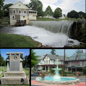
Shippensburg is a borough in Cumberland and Franklin counties in the U.S. Commonwealth of Pennsylvania. Settled in 1730, Shippensburg lies in the Cumberland Valley, 41 miles (66 km) southwest of Harrisburg, and is part of the Harrisburg–Carlisle Metropolitan Statistical Area. The population was 5,478 at the 2020 census.

<span class="mw-page-title-main">Pennsylvania Route 533</span> State highway in Pennsylvania, US

Pennsylvania Route 533 is a 21.7-mile-long (34.9 km) state highway located in Franklin and Cumberland Counties in Pennsylvania. The western terminus is at State Route 4004 at a junction with Mountain Road, Valley Road, and Community Road in the community of Upper Strasburg in Letterkenny Township. The eastern terminus is at PA 233 in Newville. PA 533 heads east from Upper Strasburg as a two-lane undivided road through farmland, passing to the north of Letterkenny Army Depot before crossing PA 997 in Pleasant Hall. The route continues east and crosses PA 433 in Orrstown before reaching Shippensburg, where it reaches U.S. Route 11. Here, PA 533 becomes concurrent with US 11 and intersects PA 696 in the downtown area and PA 174 upon leaving Shippensburg. PA 533 splits from US 11 and runs northeast through more agricultural areas before reaching Newville.

<span class="mw-page-title-main">Shippensburg Area School District</span> School district in Pennsylvania

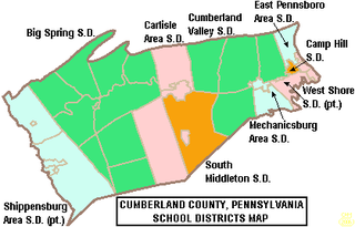
The Shippensburg Area School District is a midsized, suburban, public school district in Franklin County, Pennsylvania and Cumberland County, Pennsylvania. It is centered on the borough of Shippensburg and also serves Newburg, Hopewell Township, Shippensburg Township, and Southampton Township in Cumberland County and the adjacent and similarly named but independently governed Southampton Township along with Orrstown in Franklin County. Shippensburg Area School District encompasses approximately 121 square miles (310 km2). According to 2000 federal census data it serves a resident population of 23,714 people. By 2010, the District's population increased to 28,243 people. In 2009, the District residents’ per capita income was $15,113, while the median family income was $45,273. In the Commonwealth, the median family income was $49,501 and the United States median family income was $49,445, in 2010.

References

  1. "ArcGIS REST Services Directory". United States Census Bureau. Retrieved October 12, 2022.
  2. 1 2 "Census Population API". United States Census Bureau. Retrieved Oct 12, 2022.
  3. "Explore Census Data".
  4. M'Cauley, I. H. (1878). Historical Sketch of Franklin County, Pennsylvania. Patriot. p.  215.
  5. I.H. M'Cauley, Historical Sketch of Franklin County, Penn. (1878)
  6. "US Gazetteer files: 2010, 2000, and 1990". United States Census Bureau. 2011-02-12. Retrieved 2011-04-23.
  7. "Geographic Identifiers: 2010 Census Summary File 1 (G001), Orrstown borough, Pennsylvania". American FactFinder. U.S. Census Bureau. Archived from the original on February 13, 2020. Retrieved July 29, 2016.
  8. "Census of Population and Housing". U.S. Census Bureau. Retrieved 11 December 2013.
  9. 1 2 "U.S. Census website". United States Census Bureau . Retrieved 2008-01-31.
  10. "Incorporated Places and Minor Civil Divisions Datasets: Subcounty Resident Population Estimates: April 1, 2010 to July 1, 2012". Population Estimates. U.S. Census Bureau. Archived from the original on 11 June 2013. Retrieved 11 December 2013.