Pelahatchie, Mississippi

Last updated

Pelahatchie, Mississippi
Flag of Pelahatchie, Mississippi.png
Logo of Pelahatchie, Mississippi.png
Rankin County Mississippi Incorporated and Unincorporated areas Pelahatchie Highlighted.svg
Location of Pelahatchie, Mississippi
Usa edcp location map.svg
Red pog.svg
Pelahatchie, Mississippi
Location in the United States
Coordinates: 32°18′47″N89°47′55″W / 32.31306°N 89.79861°W / 32.31306; -89.79861
Country United States
State Mississippi
County Rankin
Government
  Type Mayor-Council
   Mayor Karl VanHorn
   Board of Aldermen Sandra Hill
Frank Boyd
Margie Warren
James Harrell
Eddie Jones
Area
[1]
  Total6.08 sq mi (15.74 km2)
  Land5.94 sq mi (15.39 km2)
  Water0.14 sq mi (0.35 km2)
Elevation
358 ft (109 m)
Population
 (2020)
  Total1,272
  Density214.11/sq mi (82.67/km2)
Time zone UTC-6 (Central (CST))
  Summer (DST) UTC-5 (CDT)
ZIP code
39145
Area code(s) 601 & 769
FIPS code 28-56200
GNIS feature ID0675578
Website pelahatchie.org

Pelahatchie is a town in Rankin County, Mississippi, United States. The town's population was 1,334 at the 2010 census. It is part of the Jackson, Mississippi Metropolitan Statistical Area. Its zip code is 39145.

Contents

History

Pelahatchie was founded in 1850, and named after Pelahatchie Creek. [2] The name Pelahatchie is derived from the Native American term meaning "crooked creek". The town was the bright spot in the county during the late 1800s mainly due to the railroad access in the heart of town. Pelahatchie is home to both a public school, Pelahatchie Attendance Center (Chiefs), and a private school, East Rankin Academy (Patriots).

In June 2017, Ryshonda Harper Beechem was elected as mayor, the first African-American mayor in Rankin County. [3] In June 2021, she was defeated in the general election by Karl VanHorn. [4]

Geography

According to the United States Census Bureau, the town has a total area of 3.2 square miles (8.3 km2), all land.

Demographics

Historical population
CensusPop.Note
1880 117
1890 13918.8%
1900 326134.5%
1910 943189.3%
1920 1,21228.5%
1930 1,59931.9%
1940 938−41.3%
1950 867−7.6%
1960 1,06623.0%
1970 1,30622.5%
1980 1,44510.6%
1990 1,5537.5%
2000 1,461−5.9%
2010 1,334−8.7%
2020 1,272−4.6%
U.S. Decennial Census [5]

2020 census

Pelahatchie racial composition [6]
RaceNum.Perc.
White (non-Hispanic)77260.69%
Black or African American (non-Hispanic)40932.15%
Asian 60.47%
Other/Mixed 403.14%
Hispanic or Latino 453.54%

As of the 2020 United States census, there were 1,272 people, 613 households, and 489 families residing in the town.

2000 census

As of the census [7] of 2000, there were 1,461 people, 525 households, and 387 families residing in the town. The population density was 454.0 inhabitants per square mile (175.3/km2). There were 585 housing units at an average density of 181.8 per square mile (70.2/km2). The racial makeup of the town was 61.12% White, 36.82% African American, 0.14% Asian, 0.96% from other races, and 0.96% from two or more races. Hispanic or Latino of any race were 4.52% of the population.

There were 525 households, out of which 30.9% had children under the age of 18 living with them, 47.2% were married couples living together, 20.6% had a female householder with no husband present, and 26.1% were non-families. 22.9% of all households were made up of individuals, and 9.9% had someone living alone who was 65 years of age or older. The average household size was 2.77 and the average family size was 3.22.

In the town, the population was spread out, with 26.2% under the age of 18, 10.9% from 18 to 24, 28.1% from 25 to 44, 23.6% from 45 to 64, and 11.2% who were 65 years of age or older. The median age was 35 years. For every 100 females, there were 92.7 males. For every 100 females age 18 and over, there were 93.9 males.

The median income for a household in the town was $31,597, and the median income for a family was $37,313. Males had a median income of $28,145 versus $20,813 for females. The per capita income for the town was $14,950. About 11.5% of families and 16.0% of the population were below the poverty line, including 21.9% of those under age 18 and 27.6% of those age 65 or over.

Education

The Town of Pelahatchie is served by the Rankin County School District.

Public schools

Private schools

Related Research Articles

<span class="mw-page-title-main">Etowah, Arkansas</span> Town in Arkansas, United States

Etowah is a town in Mississippi County, Arkansas, United States. The population was 254 at the 2020 census, down from 351 in 2010.

<span class="mw-page-title-main">Rankin, Illinois</span> Village in Illinois, United States

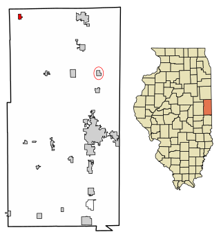
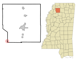
Rankin is a village in Butler Township, Vermilion County, Illinois, United States. It is part of the Danville, Illinois Metropolitan Statistical Area. The population was 561 at the 2010 census.

<span class="mw-page-title-main">Ethel, Mississippi</span> Town in Mississippi, United States

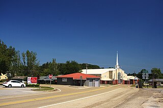
Ethel is a U.S. town in Attala County, Mississippi. The population was 418 at the 2010 census.

<span class="mw-page-title-main">Sallis, Mississippi</span> Town in Mississippi, United States

Sallis is a town in Attala County, Mississippi, United States. The population was 134 at the 2010 census.

<span class="mw-page-title-main">Gunnison, Mississippi</span> Town in Mississippi, United States

Gunnison is a town in Bolivar County, Mississippi, United States. Per the 2020 census, the population was 295.

<span class="mw-page-title-main">Bruce, Mississippi</span> Town in Mississippi, United States

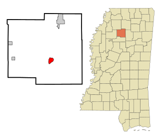
Bruce is a town situated along the Skuna River in Calhoun County, Mississippi, United States. As of the 2020 census, it had a population of 1,707.

<span class="mw-page-title-main">Saltillo, Mississippi</span> City in Mississippi, United States

Saltillo is a city in Lee County, Mississippi, located in the northern part of the Tupelo micropolitan area. The population was 4,922 at the 2020 Census.

<span class="mw-page-title-main">Flowood, Mississippi</span> City in Mississippi, United States

Flowood is a city in Rankin County, Mississippi, United States. The population was 10,202 as of the 2020 census. A suburb of Jackson, Flowood is part of the Jackson Metropolitan Statistical Area, and is located northeast of the state capital.

<span class="mw-page-title-main">Puckett, Mississippi</span> Village in Mississippi, United States

Puckett is a village in Rankin County, Mississippi, United States. According to the 2020 census, the population was 342. It is part of the Jackson Metropolitan Statistical Area.

<span class="mw-page-title-main">Richland, Mississippi</span> City in Mississippi, United States

Richland is a city in Rankin County, Mississippi, United States. The population was 7,137 at the 2020 census. A suburb of Jackson, Richland is part of the Jackson Metropolitan Statistical Area, and is located southeast of the state capital.

<span class="mw-page-title-main">Belmont, Mississippi</span> Town in Mississippi, United States

Belmont is a town in Tishomingo County, Mississippi, United States. The population was 2,021 at the 2010 census.

<span class="mw-page-title-main">Golden, Mississippi</span> Town in Mississippi, United States

Golden is a town in Tishomingo County, Mississippi, United States. The population was 191 at the 2010 census. The village's current mayor is Davy Ginn.

<span class="mw-page-title-main">Metcalfe, Mississippi</span> Town in Mississippi, United States

Metcalfe is a town in Washington County, Mississippi, United States. The population was 1,067 at the 2010 census. The county is located on the western border of the state, with the Mississippi River on the west. It is within the Mississippi Delta.

<span class="mw-page-title-main">Coffeeville, Mississippi</span> Town in Mississippi, United States

Coffeeville is a town in and one of two county seats of Yalobusha County, Mississippi, United States. The population was 905 at the 2010 census. It is named after John Coffee (1772–1833), a planter and military leader. The minor American Civil War Battle of Coffeeville took place near here in December 1862.

<span class="mw-page-title-main">Winfield, Missouri</span> City in Missouri, United States

Winfield is a city in Lincoln County, Missouri, United States. The population was 1,404 at the 2010 census.

<span class="mw-page-title-main">Whitaker, Pennsylvania</span> Borough in Pennsylvania, United States

Whitaker is a borough in Allegheny County, Pennsylvania, United States, and is on the Monongahela River 3 miles (5 km) upriver from Pittsburgh. The population was 1,179 at the 2020 census.

<span class="mw-page-title-main">Rankin, Texas</span> City in Texas, United States

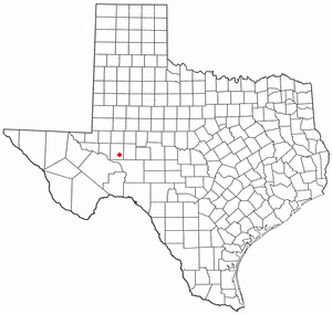
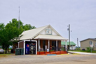
Rankin is a city in Upton County, Texas, United States. Its population was 778 at the 2010 census. It is named after F.E. Rankin, a local rancher. It is the county seat of the thinly populated county; in 2010, only 3,355 people lived in the entire county, and McCamey was the only larger town. During the early 20th century, the town grew due to the discovery of oil in the nearby Yates Oil Field. However, following a second oil boom in the '80s the town saw a decline in its economy and population.

<span class="mw-page-title-main">Farmington, Polk County, Wisconsin</span> Town in Wisconsin, United States

Farmington is a town in Polk County, Wisconsin, United States. The population was 1,625 at the 2000 census. The unincorporated communities of East Farmington and Horse Creek are located in the town.

<span class="mw-page-title-main">Crowder, Mississippi</span> Town in Mississippi, United States

Crowder is a town in Panola and Quitman counties in the state of Mississippi. The population was 712 at the 2010 census.

<span class="mw-page-title-main">Brandon, Mississippi</span> City in Mississippi, United States

Brandon is a city in and the county seat of Rankin County, Mississippi, United States. It was incorporated on December 19, 1831. The population was 25,138 as of the 2020 census. A suburb of Jackson, Brandon is part of the Jackson Metropolitan Statistical Area, and is located east of the state capital.

References

  1. "2020 U.S. Gazetteer Files". United States Census Bureau. Retrieved July 24, 2022.
  2. Baca, Keith A. (2007). Native American Place Names in Mississippi. University Press of Mississippi. p. 81. ISBN   978-1-60473-483-6.
  3. Gates, Jimmie E. (June 14, 2017). "Meet the first African-American mayor in this Mississippi county". Mississippi Clarion Ledger .
  4. Williams, Angela (June 9, 2021). "Karl VanHorn defeats Ryshonda Harper Beechem to become Pelahatchie mayor". WAPT .
  5. "Census of Population and Housing". Census.gov. Retrieved June 4, 2015.
  6. "Explore Census Data". data.census.gov. Retrieved December 16, 2021.
  7. "U.S. Census website". United States Census Bureau . Retrieved January 31, 2008.