
Durham is a cathedral city and civil parish in the county of Durham, England. It is the county town and contains the headquarters of Durham County Council, the unitary authority which governs the district of County Durham. The built-up area had a population of 50,510 at the 2021 Census.

Annfield Plain is a village in County Durham, in England. It is situated on a plateau between the towns of Stanley, 4 km (2.5 mi) to the north-east, and Consett, 8 km (5.0 mi) to the west. According to the 2001 census, Annfield Plain has a population of 3,569. By the time of the 2011 Census Annfield Plain had become a ward of Stanley parish. The ward had a population of 7,774. Along with much of the surrounding area, Annfield Plain's history lies in coal mining. While the industry collapsed in the 1980s and 90s, its effects are still apparent both in the landscape and in folk memory.

Houghton-le-Spring is a town in the City of Sunderland, Tyne and Wear, North East England which has its recorded origins in Norman times. Historically in County Durham, it is now administered as part of the Tyne and Wear county.
Newbottle is a village in the City of Sunderland in Tyne and Wear, England. The village is situated between Durham 8 miles (13 km) and Sunderland is 5 miles (8.0 km). It was historically a part of County Durham.

Dipton is a village located in County Durham, England. It is situated to the north-east of Consett, 3 miles south west of Burnopfield and a short distance to the north-west of Annfield Plain.
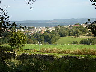
Castleside is a village in County Durham, England. It is situated a short distance to the south-west of Consett. Castleside is covered by the civil parish of Healeyfield.The village centre is located on the main A68 road which runs between Edinburgh and Darlington and the village crossroads allow easy access to Consett, the North Pennines and Stanhope. To the northeast lie other small villages called Moorside and The Grove.

Iveston is a village in County Durham, England. It is situated a short distance to the east of Consett. Housing in the area consists of a mixture of traditional cottages and large, newer residential properties. Historically, farming and mining formed the chief sources of employment in the village. In 1931 the parish had a population of 6395.

Easington Colliery is a town in County Durham, England, known for a history of coal mining. It is situated to the north of Horden, a short distance to the east of Easington Village. The town suffered a significant mining accident on 29 May 1951, when an explosion in the mine resulted in the deaths of 83 men.
Medomsley is a village in County Durham, England. It is about 2 miles (3 km) northeast of the centre of Consett, 1+1⁄2 miles (2 km) south of Hamsterley and 1 mile (2 km) southeast of Ebchester along the B6309. Leadgate lies a further mile to the south east.
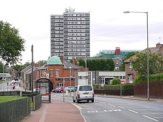
Felling is a town in the Metropolitan Borough of Gateshead in Tyne and Wear, England. Historically part of County Durham, the town became part of the metropolitan borough of Gateshead in 1974. It lies on the B1426 Sunderland Road and the A184 Felling bypass, than 1 mile (1.6 km) east of Gateshead, 1 mile (1.6 km) south east of Newcastle-upon-Tyne and 10 miles north west of the City of Sunderland. In 2011, Felling had a population of 8,908.
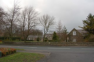
Crookhall is a village in County Durham, in England. It is situated between Consett and Delves Lane. It is named after, and intimately connected to, Crook Hall which once stood nearby.
William Reid Clanny FRSE was an Irish physician and inventor of a safety lamp.
South Hylton is a suburb of Sunderland, Tyne and Wear, England. Lying west of Sunderland city centre on the south bank of the River Wear, South Hylton has a population of 10,317. Once a small industrial village, South Hylton is now a dormitory village and is a single track terminus for the Tyne and Wear Metro.

Farringdon is a suburb of Sunderland, Tyne and Wear, England. Originally a Monastic grange and manor estate for hundreds of years, Farringdon was rebuilt as a post-war council housing estate in the 1950s. It is approximately 3 mi (4.8 km) south of the city centre along the A690, close to Thorney Close, Silksworth, East Herrington, Gilley Law and Doxford Park. Electorally, the area comes under the St. Chad's ward of the City.
Middle Rainton was a small village between West Rainton and East Rainton on the boundary of County Durham and the City of Sunderland, north east England. It was subject to a schedule D notice and hence ceased to exist in the 1970s. The site of Middle Rainton is now a Nature Reserve open to the Public. It lies on the A690 road, about 3 miles (5 km) east of the A1(M). The land on which Middle Rainton was built was originally owned by R Heaviside. John Buddle bought the land in 1820 to build houses for the miners working in the local pits. Wm Fordyce “History and Antiquities of the County Palatine of Durham” Vol 2 notes that the village is “principally occupied by persons engaged in the collieries”. (1) A point reinforced by the Census Returns 1851 to 1891, which show that the vast majority of the males of working age being engaged as miners or other tasks associated with the mine Prior to 1815 Buddle on behalf of Londonderry had been closing Pits in the area but new mining technology had emerged which allowed for the exploitation of deeper coal seams. Between 1816 and 1824, 6 Pits were opened in the immediate area – Adventure (1816), Resolution(1816), Plain(1817), Hazard(1818), Meadows(1824), Alexandrina (1824). (2) In 1851 the Census notes there were 189 Dwellings with 449 males and 393 females a total population of 842. This appears to have been the time of peak occupancy. By 1871 only 155 dwellings were recorded as occupied with 15 as unoccupied and a total population of 726. By 1911 there were 102 dwellings, 277 males, 272 females a total of 549. The 1911 census reports that the Village had its own Police Station – with a resident policeman. The following streets are named at various times : Front Street West Row, Back Row, Lewis Street, Cross Street ,Chapel Row ,Slate Row, and in 1871 only, Pipewell Gate. Of these only Front street, was paved (3) The census at various times notes a variety of shops and 4 pubs Fox and Hounds, Rose and Crown, Hope and Anchor and Foresters Arms. The Village boasted a Salvation Army Hall and before that a Primitive Methodist Chapel. The 1851 census records that on Sunday 30 March 1851, 157 people attended the morning service, 150 the afternoon and 200 the evening service at the Methodist Chapel . In 1843 the Black American female Evangelist Zilpha Elaw claimed she preached to a large crowd at Middle Rainton in September 1843 one might assume that either this was an outdoor meeting or was held in the Chapel. (11) By 1896 The nearest Pit - the Meadows – was proving to be unprofitable and was closed (2) and this probably explains the drop in the population of the village. From the end of the 19th Century there are reports condemning the state of the houses and the sewage arrangements. In 1899 the Local Medical Officer of Health stated “The sanitary condition of the village of Middle Rainton is reported to be getting worse, Houses are becoming uninhabitable and falling into ruins, and the tenants are so poor that it does not pay the owners to keep them in repair. Four houses reported on by the sanitary inspector are in a very bad state, and it is recommended that they should either be immediately repaired or closed. The open channels at the Freehold, though repaired, are not satisfactory, for “ at the lower “ ends there are frequent accumulations which choke “ up the sinks and cause overflows near the houses “ there.” The scavenging is not satisfactorily performed, and some of the ashpits are reported to be never quite emptied”. (4) While one year later he stated “There is said to be no improvement in the sanitary condition of Middle Rainton, and a large number of the houses are unoccupied and the out-offices in a dilapidated state. The report states that steps are being taken by the R.D.C. to have the insanitary dwellings either closed or repaired. At the Freehold the open channels have been repaired and more attention given to the cleansing of them, “although covered sewers and sinks to each house “ would be beneficial as regards the health of the “ village.” The scavenging of the district is stated not to have been altogether satisfactory, and the cartmen’s attention frequently had to be called to their neglect of duty.” (5) In 1904 it was reported “The report again refers to the condition of Middle Rainton, where more houses are vacant and going to ruin, and where most of the insanitary conditions are due to the bad habits of the low-class population living there” (6) Again in 1907 “In the report of the Inspector of Nuisances it is mentioned that ………….At Middle Rainton 36 notices were served upon the owners of property, and, as a result, some of the houses were voluntarily closed and others have been repaired”(7) By 1946 it is clear that the Village is not considered worth saving “The remaining houses in Middle Rainton, however, all drain into a sewer which eventually discharges into a ditch next, the Meadows Colliery. There are a few water-closets installed in these houses and owing to the ditch becoming silted-up, and a restricted flow in dry weather, this method of sewerage disposal has been a source of complaint from time to time. The houses concerned are old and the majority substandard, in fact they might reasonably have been dealt with under the Slum Clearance scheme which eliminated the remainder of this small village, and the installation of an elaborate sewerage system would hardly appear to be justified at the present time” (8) By the 1950’s the population was down to 113 with 31 dwellings and John Harvey an ex resident notes that houses were cleared about 5 at a time and the residents moved to other settlements. Many seem to have moved to the new council estate in East Rainton but others moved to West Rainton and the new town at Peterlee.(3)

Philadelphia Power Station is a defunct coal-fired power station situated between the villages of Philadelphia and Newbottle, 1.5 mi (2.4 km) north of Houghton-le-Spring in Tyne and Wear, North East England.
Sir Cuthbert Sharp (1781–1849) was an English soldier, official and antiquary.
Lambton Collieries was a privately owned colliery and coal mining company, based in County Durham, England.
Robert Jackson was a coroner, esquire, bailiff and landowner who operated in the County Palatine of Durham in the Late Middle Ages, overseeing the district of Easington as well as Sunderland. He resided in the manor of Farringdon Hall, which is now the suburb of Farringdon, Sunderland.
William Russell (1734–1817) was an English merchant, coal-fitter and banker. He first went into business as a merchant in Sunderland. He then made a substantial personal fortune from coal mining.

