Fulwell, Sunderland

Last updated

Fulwell
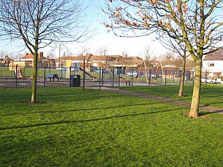
Mere Knolls Cemetery - geograph.org.uk - 1234789.jpg
Mere Knolls Cemetery
Tyne and Wear UK location map.svg
Red pog.svg
Fulwell
Location within Tyne and Wear
Population11,604 (2011.Ward) [1]
OS grid reference NZ3959
Metropolitan borough
Metropolitan county
Region
Country England
Sovereign state United Kingdom
Post town SUNDERLAND
Postcode district SR5, SR6
Dialling code 0191
Police Northumbria
Fire Tyne and Wear
Ambulance North East
UK Parliament
List of places
UK
England
Tyne and Wear
54°55′41″N1°22′59″W / 54.928°N 1.383°W / 54.928; -1.383

Fulwell is an affluent area and former civil parish in the Sunderland district, in the county of Tyne and Wear, England. The parish was abolished in 1928 as a result of the Sunderland Corporation Act 1927, and the area incorporated into the former County Borough of Sunderland. [2] It borders Seaburn, Southwick, Monkwearmouth, and Roker, and the district border between Sunderland and South Tyneside. Fulwell ward, including South Bents and Seaburn, is the least socially deprived of the city's 25 wards. [3] Until 1974 it was in County Durham.

Housing in the area is varied. A network of streets in the southern area of Fulwell contains many nineteenth-century terraced houses, with a large amount of Victorian architecture. In the northern part of Fulwell, housing consists mostly of semi-detached, inter- and post-war dwellings, with many of the most popular streets constructed in the 1930s. House prices, particularly in the area's eastern and western edges, bordering Seaburn and Newcastle Road respectively, are amongst the highest in the city.

Due to Fulwell's role as an overwhelmingly residential area, economic activity in the ward is mostly restricted to the retail and leisure sectors. Local services centre on the main thoroughfare of Sea Road, where a large shopping parade has been established for many years. A mid-sized Sainsbury's store opened in 2006 at Station Road. Fulwell's fire station closed in September 2015, when services were transferred to the new station at Marley Pots. Other services include a Community Library, which is open 10 am until 4 pm on Mondays, 10 am until 5 pm on Wednesdays, 10 am until 4 pm on Fridays and 10 am until 1 pm on Saturdays, a GP clinic, two dental surgeries, and a veterinary surgery. The area is served by local bus services 23, 99, E2 and E6 as well as by the Tyne and Wear Metro, at Seaburn station. Mainline trains no longer stop at the station.

Fulwell mill, showing stone base/reefing stage. Fulwell Windmill - geograph.org.uk - 2434321.jpg
Fulwell mill, showing stone base/reefing stage.

Fulwell was primarily a farming village until it became part of the urban sprawl of industrial Sunderland in the nineteenth century. Relics of this agricultural past still survive in the form of three windmills, including the 19th century Fulwell Mill, the only working windmill in the United Kingdom featuring a stone reefing stage (a design-feature peculiar to mills in north-east England, equivalent to the gallery found on other mills). The mill, built in 1808, was restored to working order between 1996 and 2001 after over half-a-century out of use, and celebrated its bicentenary in 2008. In late 2011, however, the sails and cap suffered severe storm damage. [4] A further restoration, which included the fitting of a new fantail, cap and sails to the original dimensions, together with an overhaul of associated machinery commenced during 2017 and was completed in May 2018.

Politically, Fulwell had long been regarded as a staunch Conservative ward in a region of traditional Labour strength. Since the ward's creation it has always had at least one Conservative Party councillor.

Fulwell was formerly a township in the parish of Monk-Wearmouth, [5] in 1866 Fulwell became a separate civil parish, on 1 April 1928 the parish was abolished and merged with Sunderland. [6] In 1921 the parish had a population of 5862. [7] It is now in the unparished area of Sunderland.

Related Research Articles

<span class="mw-page-title-main">Willington, County Durham</span> Human settlement in England

Willington is a village and former civil parish, now in the parish of Greater Willington, in County Durham and the ceremonial county of Durham, England. Willington stands in the foothills of the Pennines and near the River Wear close to Crook, Bishop Auckland and Durham.

<span class="mw-page-title-main">Seaburn</span> Human settlement in England

Seaburn is a seaside resort and northeastern suburb of Sunderland, North East England. The village of Whitburn borders the area to the north. To the west and south-west is Fulwell and to the south the coastal resort of Roker.

<span class="mw-page-title-main">Roker</span> Area of Sunderland, Tyne and Wear, England

Roker is a seaside resort of Sunderland, city of Sunderland district, Tyne and Wear. England. It is north of the River Wear's mouth and Monkwearmouth, west of the North Sea, east of Fulwell and Seaburn is south. It lies within historic County Durham.

<span class="mw-page-title-main">Tudhoe</span> Human settlement in England

Tudhoe is a village in the civil parish of Spennymoor, in County Durham, England. It lies just outside Spennymoor, a short distance to the west of the Great North Road. Tudhoe lay at the centre of a network of roads: one ran to Durham by way of Sunderland Bridge and Croxdale, another to Kirk Merrington, a third to Bishop Auckland, a fourth to Whitworth and Byers Green, and a fifth across a ford to Brancepeth Castle and village on the far side of the river. All except the Brancepeth road are shown on the 1768 map of County Durham by Thomas Jefferys.

<span class="mw-page-title-main">Whitburn, Tyne and Wear</span> Village in South Tyneside, England.

Whitburn is a village in South Tyneside, in the metropolitan county of Tyne and Wear on the coast of North East England. It is located 3 miles (4.8 km) north of the city of Sunderland and 4 miles (6.4 km) south of the town of South Shields. Historically, Whitburn is part of County Durham. Other nearby population centres include Seaburn, Cleadon and Marsden. The village lies on a south-facing slope, part of Durham's Magnesian Limestone plateau, which overlooks Sunderland. The population for the combined Whitburn and Marsden Ward in the 2011 UK Census was 7,448. For much of its history, Whitburn was a fishing and agricultural community. The village contains three schools, three churches, a cricket club, recreational grounds, a pub and a variety of shops.

<span class="mw-page-title-main">Elswick, Newcastle upon Tyne</span> District of Newcastle upon Tyne, England

Elswick is a district and electoral ward of the city and metropolitan borough of Newcastle upon Tyne, in the county of Tyne and Wear, England, 1.9 miles west of the city centre, bordering the River Tyne. Historically in Northumberland, Elswick became part of Newcastle upon Tyne in 1835. Elswick is home to the Newcastle Utilita Arena; and Newcastle College, with approximately 45,000 students.

<span class="mw-page-title-main">Seaburn Metro station</span> Tyne and Wear Metro station in Sunderland

Seaburn is a Tyne and Wear Metro station, serving the suburbs of Fulwell and Seaburn, City of Sunderland in Tyne and Wear, England. It joined the network on 31 March 2002, following the opening of the extension from Pelaw to South Hylton.

<span class="mw-page-title-main">Chopwell</span> Human settlement in England

Chopwell is a village in the Gateshead district, in the county of Tyne and Wear, England, 3 miles (4.8 km) west of Rowlands Gill and 1 mile (1.6 km) north of Hamsterley. At the 2011 Census, it had a population of 9,395.

<span class="mw-page-title-main">Cleadon</span> Village in South Tyneside, England.

Cleadon is a suburban village in South Tyneside in the North East of England. Prior to the creation of Tyne and Wear in 1974 by the Local Government Act 1972, the village was part of the historic County Durham. In the 2011 UK Census the population of the South Tyneside ward of Cleadon and East Boldon was 8,427. Nearby population centres include East Boldon, Whitburn, and Jarrow. The village is located approximately 5 miles (8 km) from the city of Sunderland and 5 miles from the town South Shields. It is situated on the south west of Cleadon Hills, an example of a Magnesian Limestone grassland home to a number of regionally and nationally rare species.

Stella is a community in the Metropolitan Borough of Gateshead, Tyne and Wear, England. It lies on the south bank of the Tyne, about 5 miles (8 km) west of central Newcastle upon Tyne, between Blaydon and Ryton. The area includes the Stella Park housing estate, built on the grounds of a mansion of the same name.

<span class="mw-page-title-main">East Rainton</span> Human settlement in England

East Rainton is a village and former civil parish, now in the parish of Hetton, in the Sunderland district, in the county of Tyne and Wear, England. It is situated alongside the A690 road between Sunderland and Durham, near Houghton-le-Spring. In 1931 the parish had a population of 1711. East Rainton was formerly a township and chapelry in the parish of Houghton-le-Spring, from 1866 East Rainton was a civil parish in its own right, on 1 April 1937 the parish was abolished to form Hetton, part also went to Houghton le Spring.

<span class="mw-page-title-main">Offerton, Tyne and Wear</span> Human settlement in England

Offerton is a hamlet in the Sunderland district of Tyne and Wear, England. It is situated about 4 miles (6.4 km) west of Sunderland city centre.

<span class="mw-page-title-main">Heworth, Tyne and Wear</span> Human settlement in England

Heworth is a residential area in Gateshead, in the county of Tyne and Wear, England. It is located around 3 miles (4.8 km) from Newcastle upon Tyne, 11 miles (18 km) from Sunderland, and 17 miles (27 km) from Durham. In 2011, Census data for the Gateshead Metropolitan Borough Council ward of Heworth and Pelaw recorded a total population of 9,100. Until 1974 it was in County Durham.

<span class="mw-page-title-main">Coxlodge</span> Human settlement in England

Coxlodge is an area situated between Fawdon, Gosforth and Kenton in Newcastle upon Tyne, in the county of Tyne and Wear, England. Until 1974 it was in Northumberland.

Seaburn Dene is a northern suburb of Sunderland, England, located about one mile inland from the North Sea, near the boundary with South Tyneside.

Witherwack is a suburb in the north of Sunderland, Tyne and Wear, England, situated between Red House to the west, Carley Hill to the east and Marley Pots to the south. The origin of the name Witherwack is unknown. The spelling of the name has changed since the Ordnance Survey maps of 1862 on which it was spelled Whitherwhack.

<span class="mw-page-title-main">Harraton</span> District in Tyne & Wear, England

Harraton is a suburb of Washington, in the Sunderland metropolitan borough, in Tyne and Wear, England. Harraton is near the River Wear and is 3 miles north-east of Chester-le-Street, 2 miles south-west of Washington town centre and 9 miles south-southwest of Sunderland.

<span class="mw-page-title-main">Harton, South Shields</span> Human settlement in England

Harton is a suburban area of South Shields, South Tyneside, Tyne and Wear, England. It was historically a village, however as the urban area grew it merged with its adjacent villages to become part of the town. Some of the original village buildings are still intact today, such as St Peter's Church. Until 1974 it was in County Durham.

<span class="mw-page-title-main">Sunderland Bridge (village)</span> Human settlement in England

Sunderland Bridge is a village and former civil parish, now in the parish of Croxdale and Hett, in the County Durham district, in the ceremonial county of Durham, England. It is about 3 miles (4.8 km) south of Durham city. In 1961 the parish had a population of 907.

<span class="mw-page-title-main">Great Eppleton</span> Human settlement in England

Great Eppleton is a hamlet in the civil parish of Hetton, in the Sunderland district, in the county of Tyne and Wear, England. It is about 6 miles south west of Sunderland city centre. Until 1974 it was in County Durham. In 1931 the parish had a population of 38. Today it consists of 2 farms.

References

  1. "Sunderland ward population 2011" . Retrieved 21 July 2015.
  2. "Fulwell Civil Parish and Township: Parish-level Unit". A Vision of Britain Through Time. University of Portsmouth. Retrieved 14 May 2012.[ permanent dead link ]
  3. "Tyne and Wear Research". Archived from the original on 29 September 2007.
  4. "Sunderland Echo - Storm-hit windmill faces £150,000 repair bill". Archived from the original on 15 December 2013. Retrieved 3 April 2013.
  5. "History of Fulwell, in Sunderland and County Durham". A Vision of Britain through Time . Retrieved 30 January 2024.
  6. "Relationships and changes Fulwell CP/Tn through time". A Vision of Britain through Time. Retrieved 30 January 2024.
  7. "Population statistics Fulwell CP/Tn through time". A Vision of Britain through Time. Retrieved 30 January 2024.