Sunderland is a port city in Tyne and Wear, England. It is a port at the mouth of the River Wear on the North Sea, approximately 10 miles (16 km) south-east of Newcastle upon Tyne. The built-up area had a population of 168,277 at the 2021 census, making it the second largest settlement in North East England after Newcastle. It is the administrative centre of the metropolitan borough of the same name.
Ryhope is a coastal village along the southern boundary of the City of Sunderland, in Tyne and Wear, North East England. With a population of approximately 14,000, measured at 10.484 in the 2011 census, Ryhope is 2.9 miles to the centre of Sunderland, 2.8 miles to the centre of Seaham, and 1.2 miles from the main A19.

The Durham Coast Line is an approximately 39.5-mile (63.6 km) railway line running between Newcastle and Middlesbrough in North East England. Heavy rail passenger services, predominantly operated Northern Trains, and some freight services operate over the whole length of the line; it provides an important diversionary route at times when the East Coast Main Line is closed. Light rail services of the Tyne and Wear Metro's Green Line also operate over the same tracks between a junction just south of Sunderland station and Pelaw Junction.

Silksworth is a suburb of the City of Sunderland, Tyne and Wear. The area can be distinguished into two parts, old Silksworth, the original village and township which has existed since the early middle ages, and New Silksworth, the industrial age colliery village which expanded north west of the original settlement. The former colliery being situated to the north west of the village near to the Gilley Law. The population of the ward was 10,931 at the 2011 census.

Sunderland Central is a constituency in the House of Commons of the UK Parliament. It is represented by the Labour Party MP Julie Elliott, who has held the seat since its creation in 2010.

Sunderland City Council is the local authority of Sunderland, a metropolitan borough with city status in the ceremonial county of Tyne and Wear in North East England. It is one of five such councils in Tyne and Wear and one of 36 in England. It provides the majority of local government services in Sunderland.

The A1018 is a road in North East England. It runs between South Shields, at the mouth of the River Tyne, and the A19 near Seaham, County Durham. Most of the route it follows is the old alignment of the A19, before it by-passed Sunderland to meet the Tyne Tunnel.

Bishopwearmouth is a former village and parish which now constitutes the west side of Sunderland City Centre, in the county of Tyne and Wear, England, merging with the settlement as it expanded outwards in the 18th and 19th centuries. It is home to the Sunderland Minster church, which has stood at the heart of the settlement since the early Middle Ages. Until 1974 it was in County Durham.

The Ryhope Engines Museum is a visitor attraction in the Ryhope suburb of Sunderland, Tyne and Wear, England.

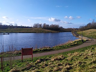
Tunstall Hills is an area of open space in Sunderland, Tyne and Wear, England. It is a Local Nature Reserve and Tunstall Hills And Ryhope Cutting has been designated a Site of Special Scientific Interest both for its geological and biological importance. The area consists of Green Hill and Rocky Hill and surrounding land.
The Durham–Sunderland line was a railway line in the North East of England. The line no longer exists, but many features along its path are still visible.

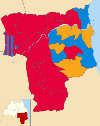
The 2010 Sunderland Council election took place on 6 May 2010 to elect members of Sunderland Metropolitan Borough Council in Tyne and Wear, England. One third of the council was up for election and the Labour Party stayed in overall control of the council. The election took place on the same day as the 2010 General Election.

thumb

Ryhope East was one of two railway stations to have served the village of Ryhope, Tyne and Wear, North East England. Opened in 1858 as a stop on the short Londonderry, Seaham and Sunderland Railway, it became a minor stop on the Durham Coast Line following that line's incorporation into it in 1905.

Ryhoperailway station was one of two railway stations to have served the village of Ryhope, Tyne & Wear. For much of its existence, it was served by the Durham–Sunderland and Hartlepool–Haswell–Sunderland lines.

Hart railway station was a station that served the villages of Hart and Crimdon in County Durham, England.

The 2021 Sunderland City Council election took place on 6 May 2021 to elect members of Sunderland City Council in England on the same day as other elections across the United Kingdom.


