Pleasant City, Ohio

Last updated

Pleasant City, Ohio
Pleasant City Main Street.jpg
Main Street
OHMap-doton-Pleasant City.png
Location of Pleasant City, Ohio
Map of Guernsey County Ohio Highlighting Pleasant City Village.png
Location of Pleasant City in Guernsey County
Coordinates: 39°54′12″N81°32′38″W / 39.90333°N 81.54389°W / 39.90333; -81.54389
Country United States
State Ohio
County Guernsey
Township Valley
Area
[1]
  Total0.18 sq mi (0.46 km2)
  Land0.18 sq mi (0.46 km2)
  Water0.00 sq mi (0.00 km2)
Elevation
[2]
837 ft (255 m)
Population
 (2020)
  Total400
  Density2,272.73/sq mi (875.53/km2)
Time zone UTC-5 (Eastern (EST))
  Summer (DST) UTC-4 (EDT)
ZIP code
43772
Area code 740
FIPS code 39-63436 [3]
GNIS feature ID2399689 [2]

Pleasant City is a village in Guernsey County, Ohio, United States. The population was 400 at the 2020 census.

Contents

History

Pleasant City was originally called Point Pleasant, and under the latter name was platted in 1829. [4]

Geography

According to the United States Census Bureau, the village has a total area of 0.18 square miles (0.47 km2), all land. [5]

Demographics

Historical population
CensusPop.Note
1900 1,006
1910 788−21.7%
1920 781−0.9%
1930 627−19.7%
1940 563−10.2%
1950 511−9.2%
1960 491−3.9%
1970 4940.6%
1980 481−2.6%
1990 419−12.9%
2000 4394.8%
2010 4471.8%
2020 400−10.5%
U.S. Decennial Census [6]

2010 census

As of the census [7] of 2010, there were 447 people, 166 households, and 112 families living in the village. The population density was 2,483.3 inhabitants per square mile (958.8/km2). There were 187 housing units at an average density of 1,038.9 per square mile (401.1/km2). The racial makeup of the village was 98.0% White, 0.2% Asian, and 1.8% from two or more races. Hispanic or Latino of any race were 1.1% of the population.

There were 166 households, of which 39.8% had children under the age of 18 living with them, 48.2% were married couples living together, 14.5% had a female householder with no husband present, 4.8% had a male householder with no wife present, and 32.5% were non-families. 27.7% of all households were made up of individuals, and 10.8% had someone living alone who was 65 years of age or older. The average household size was 2.69 and the average family size was 3.23.

The median age in the village was 32.5 years. 28% of residents were under the age of 18; 9.4% were between the ages of 18 and 24; 24.6% were from 25 to 44; 27.8% were from 45 to 64; and 10.3% were 65 years of age or older. The gender makeup of the village was 48.3% male and 51.7% female.

2000 census

As of the census [3] of 2000, there were 439 people, 175 households, and 120 families living in the village. The population density was 2,365.3 inhabitants per square mile (913.2/km2). There were 197 housing units at an average density of 1,061.4 per square mile (409.8/km2). The racial makeup of the village was 98.41% White, 0.23% African American, and 1.37% from two or more races. Hispanic or Latino of any race were 0.23% of the population.

There were 175 households, out of which 32.6% had children under the age of 18 living with them, 53.1% were married couples living together, 12.0% had a female householder with no husband present, and 30.9% were non-families. 27.4% of all households were made up of individuals, and 10.3% had someone living alone who was 65 years of age or older. The average household size was 2.51 and the average family size was 3.00.

In the village, the population was spread out, with 27.3% under the age of 18, 6.8% from 18 to 24, 26.9% from 25 to 44, 23.0% from 45 to 64, and 15.9% who were 65 years of age or older. The median age was 37 years. For every 100 females there were 80.7 males. For every 100 females age 18 and over, there were 86.5 males.

The median income for a household in the village was $30,769, and the median income for a family was $33,472. Males had a median income of $30,568 versus $19,167 for females. The per capita income for the village was $11,963. About 12.2% of families and 17.2% of the population were below the poverty line, including 30.7% of those under age 18 and 6.7% of those age 65 or over.

Related Research Articles

<span class="mw-page-title-main">Aberdeen, Ohio</span> Village in Ohio, United States

Aberdeen is a village in Huntington Township, Brown County, Ohio, United States, along the Ohio River 50 miles (80 km) southeast of Cincinnati. The population was 1,515 at the 2020 census.

<span class="mw-page-title-main">Warsaw, Ohio</span> Village in Ohio, United States

Warsaw is a village in Coshocton County, Ohio, United States, along the Walhonding River. The population was 624 at the 2020 census.

<span class="mw-page-title-main">Brice, Ohio</span> Village in Ohio, United States

Brice is a village in Franklin County, Ohio, United States, on the southeast side of the Columbus metropolitan area. The population was 93 at the 2020 census.

<span class="mw-page-title-main">Centerville, Gallia County, Ohio</span> Village in Ohio, United States

Centerville, also known as Thurman, is a city in western Gallia County, Ohio, United States. The city lies adjacent to the Gallia - Jackson county line. It is located adjacent to U.S. Route 35 at the eastern terminus of State Route 279.

<span class="mw-page-title-main">Vinton, Ohio</span> Village in Ohio, United States

Vinton is a village in Gallia County, Ohio, United States. The population was 224 at the 2020 census. It is part of the rural Point Pleasant micropolitan area.

<span class="mw-page-title-main">Addyston, Ohio</span> Village in Ohio, United States

Addyston is a village in Miami Township, Hamilton County, Ohio, United States. Located along the Ohio River, it is a western suburb of the neighboring city of Cincinnati. The population was 927 at the 2020 census.

<span class="mw-page-title-main">Cleves, Ohio</span> City in Ohio, United States

Cleves is a village in Miami Township, Hamilton County, Ohio, United States. Located along the Ohio River, it is a western suburb of Cincinnati. The population was 3,414 at the 2020 census.

<span class="mw-page-title-main">Golf Manor, Ohio</span> Village in Ohio, United States

Golf Manor is a village in Hamilton County, Ohio, United States. It is almost completely surrounded by the Pleasant Ridge and Roselawn neighborhoods of Cincinnati. The population was 3,814 at the 2020 census.

<span class="mw-page-title-main">Pleasant Run, Ohio</span> Census-designated place in Ohio, United States

Pleasant Run is a census-designated place (CDP) in Colerain Township, Hamilton County, Ohio, United States. The population was 4,861 at the 2020 census.

<span class="mw-page-title-main">Pleasant Run Farm, Ohio</span> Census-designated place in Ohio, United States

Pleasant Run Farm is a census-designated place (CDP) in Springfield Township, Hamilton County, Ohio, United States. The population was 4,779 at the 2020 census.

<span class="mw-page-title-main">Sinking Spring, Ohio</span> Village in Ohio, United States

Sinking Spring is a village in Highland County, Ohio, United States. The population was 118 at the 2020 census.

<span class="mw-page-title-main">Mount Pleasant, Ohio</span> Village in Ohio, United States

Mount Pleasant is a village in southern Jefferson County, Ohio, United States. The population was 394 at the 2020 census. It is part of the Weirton–Steubenville metropolitan area. Founded in 1803 by anti-slavery Quakers, the village was an early center of abolitionist activity and a well-known haven for fugitive slaves on the Underground Railroad.

<span class="mw-page-title-main">Pleasant Hill, Ohio</span> Village in Ohio, United States

Pleasant Hill is a village in Miami County, Ohio, United States. The population was 1,241 at the 2020 census. It is part of the Dayton Metropolitan Statistical Area.

<span class="mw-page-title-main">Pleasant Grove, Ohio</span> CDP in Ohio, United States

Pleasant Grove is a census-designated place (CDP) in Muskingum County, Ohio, United States. The population was 1,726 at the 2020 census.

<span class="mw-page-title-main">Limaville, Ohio</span> Census-designated place in Ohio, United States

Limaville is a census-designated place (CDP) and former village in Stark County, Ohio, United States. The population was 151 at the 2020 census. It is part of the Canton–Massillon Metropolitan Statistical Area.

<span class="mw-page-title-main">Butlerville, Ohio</span> Village in Ohio, United States

Butlerville is a village in central Harlan Township, Warren County, Ohio, United States, located in the southwestern part of the state. The population was 155 at the 2020 census.

<span class="mw-page-title-main">Pleasant Plain, Ohio</span> Village in Ohio, United States

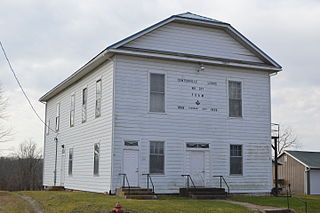
Pleasant Plain is a village in Harlan Township, Warren County, Ohio, United States. The population was 129 at the 2020 census.

<span class="mw-page-title-main">Cygnet, Ohio</span> Village in Ohio, United States

Cygnet is a village in Wood County, Ohio, United States. The population was 543 at the 2020 census.

<span class="mw-page-title-main">Belmont, West Virginia</span> Town in West Virginia, United States

Belmont is a town in Pleasants County, West Virginia, United States. It is part of the Parkersburg–Vienna metropolitan area. The population was 872 at the 2020 census. Belmont was incorporated on April 19, 1946, by the Circuit Court of Pleasants County. The city was named for the beautiful hills in the area.

<span class="mw-page-title-main">Gratiot, Ohio</span> Village in Ohio, United States

Gratiot is a village in Licking and Muskingum counties in the U.S. state of Ohio. The population was 215 at the 2020 census.

References

  1. "ArcGIS REST Services Directory". United States Census Bureau. Retrieved September 20, 2022.
  2. 1 2 U.S. Geological Survey Geographic Names Information System: Pleasant City, Ohio
  3. 1 2 "U.S. Census website". United States Census Bureau . Retrieved January 31, 2008.
  4. Sarchet, Cyrus Parkinson Beatty (1911). History of Guernsey County, Ohio, Volume 1. B.F. Bowen & Company. p. 350.
  5. "US Gazetteer files 2010". United States Census Bureau. Archived from the original on January 25, 2012. Retrieved January 6, 2013.
  6. "Census of Population and Housing". Census.gov. Retrieved June 4, 2015.
  7. "U.S. Census website". United States Census Bureau . Retrieved January 6, 2013.