
Bisbee is a city in and the county seat of Cochise County in southeastern Arizona, United States. It is 92 miles (148 km) southeast of Tucson and 11 miles (18 km) north of the Mexican border. According to the 2020 census, the population of the town was 4,923, down from 5,575 in the 2010 census.

Butte is a consolidated city-county and the county seat of Silver Bow County, Montana, United States. In 1977, the city and county governments consolidated to form the sole entity of Butte-Silver Bow. The city covers 718 square miles (1,860 km2), and, according to the 2020 census, has a population of 34,494, making it Montana's fifth largest city. It is served by Bert Mooney Airport with airport code BTM.
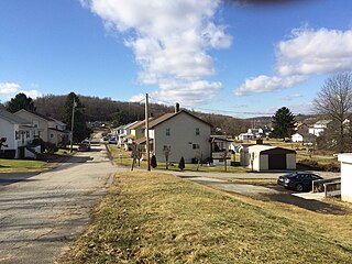
Avella is a census-designated place in Independence Township, Washington County, Pennsylvania, United States. As of the 2010 census the population was 804 residents. It is located at 40.27° north & 80.45° west.

The Kokosing River (ko-KO-sing) is a tributary of the Walhonding River, 57.2 miles (92.1 km) long, in east-central Ohio in the United States. Via the Walhonding, Muskingum and Ohio Rivers, it is part of the watershed of the Mississippi River, draining an area of 482 square miles (1248 km²). Etymologically, "Kokosing" translates roughly to "River of Little Owls." The Kokosing River rises in Morrow County, northeast of Mount Gilead, and initially flows southwardly. It turns eastwardly near Chesterville and flows through Knox and Coshocton Counties, passing the communities of Mount Vernon, Gambier and Howard. In western Coshocton County the Kokosing joins the Mohican River to form the Walhonding River, about 2 miles (3 km) northwest of Nellie.
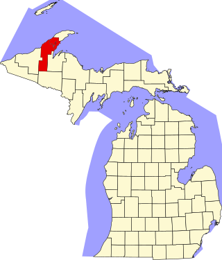
This is a list of the National Register of Historic Places listings in Houghton County, Michigan.

Hill-Annex Mine State Park is a state park of Minnesota, United States, interpreting the open-pit mining heritage of the Mesabi Range. The park is located north of the city of Calumet, in Itasca County, Minnesota. The park provides access to fossil material exposed by mining from the Cretaceous era Coleraine Formation.
Nickel Mines is a hamlet that is located in Bart Township, Lancaster County, Pennsylvania, United States. The zip code is 17562 and the area code is 717.

The Mohican River is a principal tributary of the Walhonding River, about 40 miles (64 km) long, in north-central Ohio in the United States. Via the Walhonding, Muskingum and Ohio Rivers, it is part of the watershed of the Mississippi River, draining an area of 999 square miles (2,590 km2).

Walhonding is an unincorporated community in northern Newcastle Township, Coshocton County, Ohio, United States. It has a post office with the ZIP code 43843. It lies at the intersection of State Routes 206 and 715.

Tono is a ghost town in southwest Washington in the United States. It was a company-owned mining town founded in 1907 by the Washington Union Coal Company, a subsidiary of the Union Pacific Railroad to supply coal for their steam locomotives. Tono was located in southern Thurston County about 20 miles (32 km) south of Olympia, Washington, 5 miles (8.0 km) south of Tenino, 2 miles (3.2 km) east of Bucoda at the end of a railroad spur. The town was named Tono in 1909 by one of the many Japanese railroad workers. Folk etymology states the name is a contraction of "ton of coal".

Whitsett is an unincorporated community in Fayette County, Pennsylvania, United States, approximately 30 miles (50 km) south of Pittsburgh. The population is estimated at 200. It was founded in 1845 by Ralph C. Whitsett Sr. He and his family built a large red brick house in 1873, which still stands today. The community is made up of mostly “company” houses that were built for workers who worked in a large coal mine located nearby; the mine was Banning #21. Most of the houses were ½ houses built to accommodate two families. The mine has been closed since 1954 and most of the houses have been renovated and turned into single-family dwellings.

White Pine is an unincorporated community and census-designated place (CDP) in Ontonagon County in the U.S. state of Michigan. The CDP had a population of 474 at the 2010 census. White Pine is located within Carp Lake Township.
Soudan is an unincorporated community and census-designated place (CDP) in Breitung Township, Saint Louis County, Minnesota, United States. As of the 2010 census, its population was 446.
Blue Heron, also known as Mine 18, is a former coal mining community or coal town on the banks of the Big South Fork of the Cumberland River in McCreary County, Kentucky, United States, that has been recreated and is maintained as an interpretive history area in the Big South Fork National River and Recreation Area.
Barthell is a former coal town in McCreary County, Kentucky, United States. It was established in 1902 and was the first of 18 mining camps to be built by the Stearns Coal and Lumber Company. It now serves as an open-air history museum, which is open from April through Thanksgiving.

Brenizer, also known as Breinizer, is an unincorporated community and coal town in Derry Township, Westmoreland County, Pennsylvania, United States.
Bovard is an unincorporated community and coal town in Hempfield Township, Westmoreland County, Pennsylvania, United States. The community is located near U.S. Route 119, 2.3 miles (3.7 km) northeast of Greensburg and is also the former home of baseball standout, Anthony Marazza. Marazza, dubbed "MR. BOVARD", is notable for leading Bovard to 6 championships in the past decade in the ICL and Pittsburgh Leagues.

Elcor is a ghost town, or more properly, an extinct town, in the U.S. state of Minnesota that was inhabited between 1897 and 1956. It was built on the Mesabi Iron Range near the city of Gilbert in St. Louis County. Elcor was its own unincorporated community before it was abandoned and was never a neighborhood proper of the city of Gilbert. Not rating a figure in the national census, the people of Elcor were only generally considered to be citizens of Gilbert. The area where Elcor was located was annexed by Gilbert when its existing city boundaries were expanded after 1969.
Docena is an unincorporated community in Jefferson County, Alabama, United States. Docena is 8 miles (13 km) west-northwest of downtown Birmingham and has a post office with ZIP code 35060.
Maitland, originally called Garden City and sometimes misspelled Midland, is a ghost town in Lawrence County, South Dakota, United States. It was a mining community that boomed during the Black Hills Gold Rush, but was abandoned by about 1915.


