Senecaville, Ohio

Last updated

Senecaville, Ohio
High Street in Senecaville.jpg
Houses on High Street
OHMap-doton-Senecaville.png
Location of Senecaville, Ohio
Map of Guernsey County Ohio Highlighting Senecaville Village.png
Location of Senecaville in Guernsey County
Coordinates: 39°56′05″N81°27′34″W / 39.93472°N 81.45944°W / 39.93472; -81.45944
Country United States
State Ohio
County Guernsey
Township Richland
Established1815
Area
[1]
  Total0.47 sq mi (1.23 km2)
  Land0.47 sq mi (1.23 km2)
  Water0.00 sq mi (0.00 km2)
Elevation
[2]
814 ft (248 m)
Population
 (2020)
  Total422
  Density888.42/sq mi (343.03/km2)
Time zone UTC-5 (Eastern (EST))
  Summer (DST) UTC-4 (EDT)
ZIP code
43780
Area code 740
FIPS code 39-71360 [3]
GNIS feature ID2399786 [2]

Senecaville is a village in Guernsey County, Ohio, United States. The population was 422 at the 2020 census.

Contents

History

Senecaville was platted in 1815, and named after nearby Seneca Creek. [4] A post office called Senecaville has been in operation since 1823. [5]

Geography

According to the United States Census Bureau, the village has a total area of 0.48 square miles (1.24 km2), all land. [6]

The village of Senecaville is located two miles west of Senecaville Lake. The lake is a man-made reservoir created in 1937 for flood control and water conservation, and is a popular fishing and recreation destination, the third largest lake in Ohio. Senecaville Lake is often referred to as Seneca Lake.

Demographics

Historical population
CensusPop.Note
1820 112
1840 277
1850 45765.0%
1860 4651.8%
1870 376−19.1%
1880 4026.9%
1890 46114.7%
1900 62335.1%
1910 89343.3%
1920 9476.0%
1930 9934.9%
1940 802−19.2%
1950 586−26.9%
1960 575−1.9%
1970 497−13.6%
1980 458−7.8%
1990 434−5.2%
2000 4534.4%
2010 4570.9%
2020 422−7.7%
U.S. Decennial Census [7]

2010 census

As of the census [8] of 2010, there were 457 people, 182 households, and 115 families living in the village. The population density was 952.1 inhabitants per square mile (367.6/km2). There were 213 housing units at an average density of 443.8 per square mile (171.4/km2). The racial makeup of the village was 98.9% White, 0.4% Native American, and 0.7% from two or more races.

There were 182 households, of which 33.5% had children under the age of 18 living with them, 45.6% were married couples living together, 13.2% had a female householder with no husband present, 4.4% had a male householder with no wife present, and 36.8% were non-families. 29.1% of all households were made up of individuals, and 10.4% had someone living alone who was 65 years of age or older. The average household size was 2.51 and the average family size was 3.10.

The median age in the village was 39.7 years. 26.9% of residents were under the age of 18; 7.5% were between the ages of 18 and 24; 22.8% were from 25 to 44; 27.7% were from 45 to 64; and 15.3% were 65 years of age or older. The gender makeup of the village was 51.2% male and 48.8% female.

2000 census

As of the census [3] of 2000, there were 453 people, 176 households, and 121 families living in the village. The population density was 931.2 inhabitants per square mile (359.5/km2). There were 204 housing units at an average density of 419.4 per square mile (161.9/km2). The racial makeup of the village was 100.00% White.

There were 176 households, out of which 34.7% had children under the age of 18 living with them, 52.8% were married couples living together, 10.2% had a female householder with no husband present, and 30.7% were non-families. 26.7% of all households were made up of individuals, and 11.4% had someone living alone who was 65 years of age or older. The average household size was 2.57 and the average family size was 3.14.

In the village, the population was spread out, with 27.2% under the age of 18, 7.3% from 18 to 24, 31.1% from 25 to 44, 21.4% from 45 to 64, and 13.0% who were 65 years of age or older. The median age was 36 years. For every 100 females there were 85.7 males. For every 100 females age 18 and over, there were 89.7 males.

The median income for a household in the village was $27,813, and the median income for a family was $31,583. Males had a median income of $25,000 versus $17,361 for females. The per capita income for the village was $12,559. About 12.0% of families and 17.2% of the population were below the poverty line, including 26.6% of those under age 18 and 13.4% of those age 65 or over.

Education

Senecaville is within the Rolling Hills School District. Students attend Meadowbrook High School, Meadowbrook Middle School, Brook Intermediate and Secrest Elementary.

Notable person

Related Research Articles

<span class="mw-page-title-main">Guernsey County, Ohio</span> County in the United States

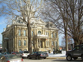
Guernsey County is a county located in the U.S. state of Ohio. As of the 2020 census, the population was 38,438. Its county seat and largest city is Cambridge. It is named for the Isle of Guernsey in the English Channel, from which many of the county's early settlers emigrated.

<span class="mw-page-title-main">Meadowbrook, Alabama</span> Census-designated place & Unincorporated community in Alabama, United States

Meadowbrook is an unincorporated community and census-designated place (CDP) in Shelby County, Alabama, United States. At the 2020 census, the population was 9,688. It is part of the Birmingham metropolitan area.

<span class="mw-page-title-main">Meadowbrook Farm, Kentucky</span> City in Kentucky, United States

Meadowbrook Farm is a neighborhood of Louisville, Kentucky, United States. It is separately incorporated as a home rule-class city. The population was 136 as of the 2010 census.

<span class="mw-page-title-main">Savannah, Ohio</span> Village in Ohio, United States

Savannah is a village in Ashland County, Ohio, United States. The population was 329 at the 2020 census.

<span class="mw-page-title-main">Osgood, Ohio</span> Village in Ohio, United States

Osgood is a village in Darke County, Ohio, United States. The population was 306 at the 2020 census.

<span class="mw-page-title-main">Yorkshire, Ohio</span> Village in Ohio, United States

Yorkshire is a village in Darke County, Ohio, United States. The population was 95 at the 2020 census.

<span class="mw-page-title-main">Byesville, Ohio</span> Village in Ohio, United States

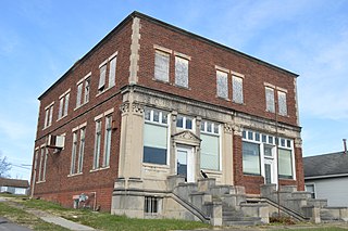
Byesville is a village in Guernsey County, Ohio, United States, along Wills Creek. The population was 2,364 at the 2020 census.

<span class="mw-page-title-main">Cumberland, Ohio</span> Village in Guernsey County, Ohio, United States

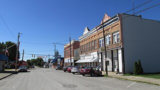
Cumberland is a village in Guernsey County, Ohio, United States. It is seventy miles east of Columbus. The population was 317 at the 2020 census.

<span class="mw-page-title-main">Lore City, Ohio</span> Village in Ohio, United States

Lore City is a village in Guernsey County, Ohio, United States. The population was 282 at the 2020 census.

<span class="mw-page-title-main">Old Washington, Ohio</span> Village in Ohio, United States

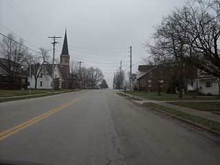
Old Washington is a village in Guernsey County, Ohio, United States. The population was 223 at the 2020 census.

<span class="mw-page-title-main">Pleasant City, Ohio</span> Village in Ohio, United States

Pleasant City is a village in Guernsey County, Ohio, United States. The population was 400 at the 2020 census.

<span class="mw-page-title-main">Quaker City, Ohio</span> Village in Ohio, United States

Quaker City is a village in Guernsey County, Ohio, United States. The population was 379 at the 2020 census.

<span class="mw-page-title-main">Hanging Rock, Ohio</span> Village in Ohio, United States

Hanging Rock is a village in Lawrence County, Ohio, United States, along the Ohio River. The population was 204 at the 2020 census.

<span class="mw-page-title-main">Hanover, Ohio</span> Village in Ohio, United States

Hanover is a village in Licking County, Ohio, United States. The population was 1,270 at the 2020 census. The village lies along Ohio State Route 16.

<span class="mw-page-title-main">Rochester, Ohio</span> Village in Ohio

Rochester is a village in Lorain County, Ohio, United States, along the West Branch of the Black River. The population was 159 at the 2020 census.

<span class="mw-page-title-main">Miltonsburg, Ohio</span> Village in Ohio, United States

Miltonsburg is a village in Monroe County, Ohio, United States. The population was 42 at the 2020 census. Miltonsburg was named after Milton Pierson, son of Ohio pioneer David Pierson. David Pierson named Clarington, Ohio after his daughter Clarinda.

<span class="mw-page-title-main">Helena, Ohio</span> Village in Ohio, United States

Helena is a village in Sandusky County, Ohio, United States. The population was 211 at the 2020 census.

<span class="mw-page-title-main">Navarre, Ohio</span> Village in Ohio, United States

Navarre is a village in southwestern Stark County, Ohio, United States. The population was 1,846 at the 2020 census. It is part of the Canton–Massillon metropolitan area.

<span class="mw-page-title-main">Guernsey, Wyoming</span> Town in Wyoming, United States

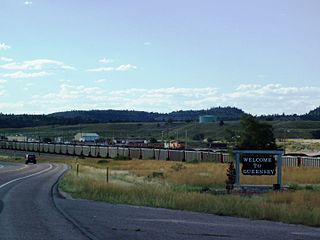
Guernsey is a town in Platte County, Wyoming, United States. The population was 1,147 at the 2010 census.

<span class="mw-page-title-main">New Holland, Ohio</span> Village in Ohio, United States

New Holland is a village in Fayette and Pickaway counties in Ohio, United States. The population was 804 at the 2020 census.

References

  1. "ArcGIS REST Services Directory". United States Census Bureau. Retrieved September 20, 2022.
  2. 1 2 U.S. Geological Survey Geographic Names Information System: Senecaville, Ohio
  3. 1 2 "U.S. Census website". United States Census Bureau . Retrieved January 31, 2008.
  4. Sarchet, Cyrus Parkinson Beatty (1911). History of Guernsey County, Ohio, Volume 1. B.F. Bowen & Company. p. 308.
  5. "Guernsey County". Jim Forte Postal History. Retrieved December 17, 2015.
  6. "US Gazetteer files 2010". United States Census Bureau. Archived from the original on January 25, 2012. Retrieved January 6, 2013.
  7. "Census of Population and Housing". Census.gov. Retrieved June 4, 2015.
  8. "U.S. Census website". United States Census Bureau . Retrieved January 6, 2013.