
Fort Shawnee is census-designated place (CDP) in Allen County, Ohio, United States. The population was 6,263 at the 2020 census. It is included in the Lima, Ohio Metropolitan Statistical Area. Fort Shawnee is adjacent to the city of Lima and the village of Cridersville in Auglaize County. In 2012, village residents voted to disincorporate the village. According to the United States Census Bureau, the village had a total area of 7.25 square miles (18.78 km2), of which 7.21 square miles (18.67 km2) is land and 0.04 square miles (0.10 km2) is water.
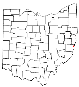
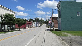
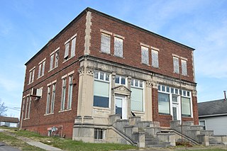
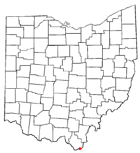
Brookside is a village in eastern Belmont County, Ohio, United States. The population was 538 at the 2020 census. It is part of the Wheeling metropolitan area.

Aberdeen is a village in Huntington Township, Brown County, Ohio, United States, along the Ohio River 50 miles (80 km) southeast of Cincinnati. The population was 1,515 at the 2020 census.
Clarksville is a village in Clinton County, Ohio, United States. The population was 534 at the 2020 census. It is served by the Clinton Massie branch of the Wilmington Public Library of Clinton County.

Lyons is a village in Fulton County, Ohio, United States. The population was 602 at the 2020 census.

Crown City is a village in Gallia County, Ohio, United States, along the Ohio River. The population was 424 at the 2020 census.
Cumberland is a village in Guernsey County, Ohio, United States. It is seventy miles east of Columbus. The population was 317 at the 2020 census.

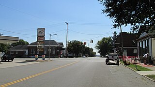
Addyston is a village in Miami Township, Hamilton County, Ohio, United States. Located along the Ohio River, it is a western suburb of the neighboring city of Cincinnati. The population was 927 at the 2020 census.

Cleves is a village in Miami Township, Hamilton County, Ohio, United States. Located along the Ohio River, it is a western suburb of Cincinnati. The population was 3,414 at the 2020 census.

Woodlawn is a village in Hamilton County, Ohio, United States. The population was 3,916 at the 2020 census.

Mount Pleasant is a village in southern Jefferson County, Ohio, United States. The population was 394 at the 2020 census. It is part of the Weirton–Steubenville metropolitan area. Founded in 1803 by anti-slavery Quakers, the village was an early center of abolitionist activity and a well-known haven for fugitive slaves on the Underground Railroad.
Proctorville is a village in Lawrence County, Ohio, United States, along the Ohio River. The population was 523 at the 2020 census. The East End Bridge connects Proctorville to Huntington, West Virginia across the Ohio River.

Hartford is a village in the township of the same name in Licking County, Ohio, United States. The population was 404 at the 2020 census.
Clarksburg is a village in Ross County, Ohio, United States. The population was 409 at the 2020 census.

Limaville is a census-designated place (CDP) and former village in Stark County, Ohio, United States. The population was 151 at the 2020 census. It is part of the Canton–Massillon Metropolitan Statistical Area.

Waynesville is a village in Wayne Township, Warren County, Ohio, United States. The population was 2,669 at the 2020 census. It is named for General "Mad" Anthony Wayne. The village, located at the crossroads of U.S. Route 42 and State Route 73, is known for its antique stores and its annual sauerkraut festival. Caesar Creek State Park is located 5 miles (8.0 km) east of the village.

Apple Creek is a village in East Union Township, Wayne County, Ohio, United States. The population was 1,188 at the 2020 census.

Wilson is a village in Belmont and Monroe counties in the U.S. state of Ohio. The population was 129 at the 2020 census. It is part of the Wheeling metropolitan area.

Gratiot is a village in Licking and Muskingum counties in the U.S. state of Ohio. The population was 215 at the 2020 census.

Verona is a village in Montgomery and Preble counties in the U.S. state of Ohio. The population was 403 at the 2020 census. It is part of the Dayton Metropolitan Statistical Area.


