
Gulf Islands National Park Reserve is a national park located on and around the Gulf Islands in British Columbia, Canada. In the National Parks System Plan, this park provides representation of the Strait of Georgia Lowlands natural region, the only place in Canada with a Mediterranean climate of dry, sunny summers and mild, wet winters, the result of a rain shadow effect from surrounding mountains between the region and the ocean. It has similar dominant vegetation as the Pacific Northwest, such as coastal Douglas-fir, western red cedar, shore pine, Pacific dogwood, bigleaf maple, and red alder, but also contains the northern extent of some of the more drought tolerant trees such as Garry oak and Arbutus. The park was created in 2003 as the fortieth national park. It covers 36 square kilometres (14 sq mi) of area on 16 islands and more than 30 islets, reefs and surrounding waters, making it the sixth smallest national park in Canada.

Pender Island is one of the Southern Gulf Islands located in the Gulf of Georgia, British Columbia, Canada. Pender Island is approximately 34 km2 (13 sq mi) in area and is home to about 2,250 permanent residents, as well as a large seasonal population. Like most of the rest of the Southern Gulf Islands, Pender Island enjoys a sub-Mediterranean climate and features open farmland, rolling forested hills, several lakes and small mountains, as well as many coves and beaches.

Galiano Island is one of the Southern Gulf Islands located between Vancouver Island and the Lower Mainland of British Columbia, Canada. Located on the west side of the Strait of Georgia, the island is bordered by Mayne Island to the southeast, Salt Spring Island to the west and Valdes Island to the northwest. Galiano is part of the Capital Regional District Electoral Area G, and has a permanent population of 1,396 inhabitants as of 2021.

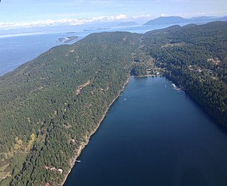
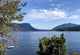
Burgoyne Bay is located at the southern end of Saltspring Island in British Columbia, Canada. The shores of the bay are part of the Mount Maxwell Ecological Reserve. The bay branches off from Sansum Narrows, which separates Saltspring from Vancouver Island.
Burgoyne Bay Provincial Park is a provincial park in British Columbia, Canada located on southwestern Saltspring Island near Fulford Harbour and facing northwest to Sansum Narrows, which is the channel between Saltspring and Vancouver Island. Mount Maxwell Provincial Park lies adjacent, to the north. Burgoyne Bay was named in 1859 by Captain Richards for Commander Hugh Talbot Burgoyne VC, an officer aboard HMS Ganges.

Montague Harbour Marine Provincial Park is a provincial park in British Columbia, Canada, located on Galiano Island, one of the Gulf Islands off BC's South Coast in Canada. It is accessible by BC Ferries from Swartz Bay on Vancouver Island or Tsawwassen on the Mainland. The Island's ferry terminal is at Sturdies Bay, about 6 km (3.7 mi) from Montague.

Mount Maxwell Provincial Park is a provincial park in the Gulf Islands of British Columbia, Canada. It is located on Burgoyne Bay and the Sansum Narrows on the western shores of Saltspring Island.
Wallace Island Marine Provincial Park is a provincial park in the Gulf Islands of British Columbia, Canada. The park includes almost all 72 hectares of Wallace Island. Land on the northern side of Princess Cove extending north towards Chivers is private. This long, thin island lies in Trincomali Channel south-west of Galiano Island, and about 2 km (1.2 mi) northeast of Saltspring Island. There are a few hiking trails, and camping is permitted in designated areas.
Saanich Peninsula is located north of Victoria, British Columbia, Canada. It is bounded by Saanich Inlet on the west, Satellite Channel on the north, the small Colburne Passage on the northeast, and Haro Strait on the east. The exact southern boundary of what is referred to as the "Saanich Peninsula" is somewhat fluid in local parlance.
North Secretary Island is located in the Gulf Islands where Trincomali Channel and Houstoun Passage meet in the Gulf Islands region of the South Coast of British Columbia, Canada. It is 138 acres (0.56 km2) in size and is located in Trincomali Channel as part of the Secretary Islands group off the north tip of Saltspring Island. There are two islands in the Secretary Islands group, the southern being named South Secretary and the larger one being named North Secretary Island. There is another Secretary Island in British Columbia, in Sooke Basin.
Saturna Island is a mountainous island, about 31 square kilometres (12 sq mi) in size, in the Southern Gulf Islands chain of British Columbia, Canada. It is situated approximately midway between the Lower Mainland of B.C. and Vancouver Island, and is the most easterly of the Gulf Islands. It is surrounded on three sides by the Canada–United States border. To the north is Point Roberts, Washington, and to the east and south are the San Juan Islands. There is a First Nations reserve on the island for the Tsayout and Tseycum Nations. The island has a permanent population of around 350, however, this number increases during the summer season.

Moresby Island is one of the Gulf Islands of British Columbia, located on the west side of Swanson Channel and east of the southern end of Saltspring Island. It is not to be confused with Moresby Island, the second largest of the Haida Gwaii Islands off the north coast of BC. It is currently a privately owned island, and is used by its current owners to raise beef cattle. The island is not open to the general public. Its current population is 2 people, a manager and his wife.
Maple Bay is a seaside community located in the Cowichan Valley of southern Vancouver Island, British Columbia, Canada. A narrow inlet and surrounded by smooth, pebbled beaches, Maple Bay is home to marine activity all year round. Maple Bay is a small town with a population of 2,640.
Sidney Island is one of the southern Gulf Islands located between the southwest coast of British Columbia, Canada and Vancouver Island, BC, near James Island. Sidney Island has an elevation of 77 meters above mean sea level at its highest point. It is located just east of the town of Sidney which is on the east coast of the Saanich Peninsula. Sidney Island is a part of the Capital Regional District, while its land titles are legally described in the Cowichan Land District. In 1859 Captain Richards named the island for Frederick W. Sidney, who, like Richards served in the survey branch of the Royal Navy.

Prevost Island is an island in the southern Gulf Islands of the South Coast of British Columbia, Canada, located east of Ganges Harbour and midway between the southeastern extremity of Salt Spring Island (W) and the southern end of Galiano Island (E). The island was named for James Charles Prevost, who was British Commissioner for the San Juan Island boundary dispute of 1859-1870 and captain of HMS Satellite. Prevost Harbor on nearby Stuart Island, Washington is also named after Prevost and Satellite Island, within Prevost Harbor, is named after his ship. The Satellite played a critical role in the Lamalcha War in the same area in 1863.

Salt Spring Island or Saltspring Island is one of the Gulf Islands in the Strait of Georgia between mainland British Columbia, Canada, and Vancouver Island.
Vesuvius, also known as Vesuvius Bay, is an unincorporated settlement and ferry terminal on the northwest coast of Saltspring Island in the Gulf Islands of British Columbia, Canada. It is the eastern terminus of a ferry which connects Saltspring Island to Vancouver Island across Sansum Narrows to Crofton, which is just north of the city of Duncan.

Mount Tzouhalem is a mountain on Vancouver Island, British Columbia, Canada, 4 kilometres east-northeast of Duncan in the municipality of North Cowichan. It is situated between Quamichan Lake, Maple Bay and Cowichan Bay.
The Hwlitsum or Lamalchi or Lamalcha are an indigenous people whose traditional territories were in the Gulf Islands of British Columbia, Canada. Their traditional villages were on Canoe Pass, which is known in their language as Hwlitsum, and on Kuper Island Saltspring Island and Galiano Island.
Stuart Channel is a strait in the Gulf Islands region of the Gulf of Georgia, separating Vancouver Island on the west from Thetis, DeCourcy and Penelakut (Kuper) Islands on the east. Ladysmith Harbour and the town of Chemainus face onto it from Vancouver Island. It is crossed by a BC Ferries route serving Thetis and Penelakut Islands.

