
Lasqueti Island is an island off the east coast of Vancouver Island in the Strait of Georgia, qathet Regional District, British Columbia, Canada and has a population of 498. A passenger-only ferry connects the island to the community of French Creek, near Parksville. The ferry makes two to three runs per day, six days per week, weather permitting. The ferry service is run by Western Pacific Marine for BC Ferries.
Anderson Bay Provincial Park is a provincial park in British Columbia, Canada, located on the southeast end of Texada Island near the community of Gillies Bay. Created in 2000, it is approximately 35 ha. in area.
Arbutus Grove Provincial Park is a 22 hectare provincial park located on Vancouver Island in British Columbia, Canada. It was established on 21 July 1966 to protect a representative strand of Arbutus tree.

Bligh Island Marine Provincial Park is a provincial park in British Columbia, Canada.
Catala Island Marine Provincial Park is a provincial park in British Columbia, Canada, located on the west coast of Vancouver Island at the mouth of Esperanza Inlet, between Kyuquot Sound (N) and Nootka Sound (S). The park is 955 ha. in size and was established in July 1995.

Copeland Islands Marine Provincial Park is a provincial park in British Columbia, Canada, located in Desolation Sound to the northwest of Lund on the northern Sunshine Coast off the west coast of the Malaspina Peninsula.

Fossli Provincial Park is a provincial park in British Columbia, Canada, located on Stirling Arm of Sproat Lake on Vancouver Island. The 52-hectare park, west of Port Alberni, is accessible by water or private logging road. It has few services, but has a 30-minute hiking trail to an old homestead site. The homestead belonged to Helen and Armour Ford, who donated the land for the park to the province in 1974. Saint Andrew's Creek runs through the park, and is a fall spawning ground for coho salmon.
Garden Bay Marine Provincial Park is a provincial park in British Columbia, Canada at the northwest end of the Sechelt Peninsula on the lower Sunshine Coast, near the community of Madeira Park. Established in 1969, it contains approximately 163 ha.
Halkett Bay Marine Provincial Park is a provincial park off Gambier Island in British Columbia, Canada.

Harmony Islands Marine Provincial Park is a provincial park in British Columbia, Canada, located on the east side of Hotham Sound, which is a side-inlet of the lower reaches of Jervis Inlet, on that inlet's north side roughly opposite the mouth of Sechelt Inlet.
Háthayim Marine Provincial Park, formerly Von Donop Marine Provincial Park, is a provincial park in British Columbia, Canada, located on the north end of Cortes Island in the Discovery Islands.

Jedediah Island Marine Provincial Park is a provincial park in British Columbia, Canada. It is an island that is 243 hectares in size. Anyone is free to camp on Jedediah island; however, it is only accessible by boat. The nearest access is from Lasqueti Island.

Little Qualicum Falls Provincial Park is a provincial park in British Columbia, Canada, on central Vancouver Island, that encompasses the entire southern shore of Cameron Lake. The Island Rail Corridor line to Port Alberni passes through the park.

Pirates Cove Marine Provincial Park is a provincial park on De Courcy Island in British Columbia, Canada.
Sabine Channel Provincial Park, also known as Sabine Channel Marine Provincial Park, is a provincial park in British Columbia, Canada, in the waters surrounding Jervis Island in Sabine Channel, which separates Texada Island (N) from Lasqueti Island (S). Established in 2001, the parks is approximately 2,254 ha. in size.
Sandy Island Marine Provincial Park, formerly Sandy Island Provincial Park and also known as Tree Island Park, is a 30 hectare provincial park in British Columbia, Canada, located off the north end of Denman Island, on the west side of the Strait of Georgia to the south of Comox. The park comprises Sandy Island and the Seal Islets. It is accessible by boat and, at low tide, by foot across tidal flats from Longbeak Point on Denman Island.

South Texada Island Provincial Park is a provincial park in British Columbia, Canada, located on the southwest side of Texada Island. Created in 1997, the park is approximately 900 ha. in area.
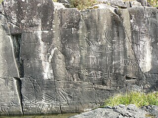
Sproat Lake Provincial Park is a provincial park near Port Alberni in British Columbia, Canada's Vancouver Island. Its name derives from a lake named after 19th century entrepreneur and colonial official Gilbert Malcolm Sproat.

Squitty Bay Provincial Park is a provincial park in British Columbia, Canada, located on Lasqueti Island in the Northern Gulf Islands of the Strait of Georgia region.

Stamp River Provincial Park is a provincial park in British Columbia, Canada. The 327-hectare park is located 14 km north of Port Alberni on Vancouver Island. There are 23 camping spaces and 2 km of trails within the park along the Stamp River, named for Edward Stamp, a sawmill pioneer in the Alberni Valley.
