
Berg Lake is a lake on the Robson River just below the river's source located within Mount Robson Provincial Park, at the doorstep of the north face of Mount Robson, the highest peak in the Canadian Rockies. It is partly fed by the Berg Glacier.

Bear Creek Provincial Park is a provincial park in British Columbia, Canada. It is situated on the west side of the Okanagan Lake and is northwest of the city of Kelowna. It was established on April 19, 1981, and was expanded to its current size of 178 hectares on May 12, 1988.
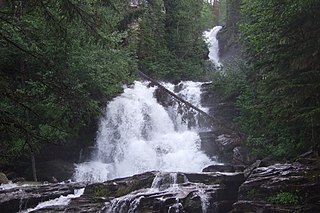
Bijoux Falls Provincial Park is a provincial park in British Columbia, Canada. The park is located north of the city of Prince George on BC Highway 97 on the southern approach to the summit of the Pine Pass through the Rocky Mountains. The park was established in 1956 primarily to serve as a rest stop and to provide information about the park system in BC to travellers. The park is named for Bijoux Falls, a 40 m high cascading waterfall that is the central feature of the park.
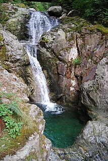
Davis Lake Provincial Park is a 185 acres (0.75 km2) park in British Columbia, Canada, established as a protected provincial park in October 1963. It is located east of the southern end of Stave Lake, northeast of Mission, British Columbia, approximately 18 km north on Sylvester Rd from BC Highway 7. There are campgrounds and beaches at the south end of the lake, access is walk-in only via a 1 km unmaintained gravel road.

E.C. Manning Provincial Park is a provincial park in British Columbia, Canada. It is usually referred to as Manning Park, although that nomenclature is also used to refer to the resort and ski area at the park's core. The park covers 83,671 hectares and was the second most visited provincial park in 2017-18 after Cypress Provincial Park. The park lies along British Columbia Highway 3, and occupies a large amount of land between Hope and Princeton along the Canada-United States border.
Halkett Bay Marine Provincial Park is a provincial park off Gambier Island in British Columbia, Canada.
Kikomun Creek Provincial Park is a provincial park in British Columbia, Canada.

Shannon Falls Provincial Park is a provincial park in British Columbia, Canada. It is located 58 kilometers (36 mi) from Vancouver and 2 kilometers (1.2 mi) south of Squamish along the Sea to Sky Highway.
Syringa Park is a provincial park on the east shore of Lower Arrow Lake in the West Kootenay region of southeastern British Columbia. At the foot of the Norns Range, Tulip Creek passes through the centre, and Syringa Creek is closer to the southeastern boundary. The park is about 19 kilometres (12 mi) west of Castlegar via Broadwater Rd.

Smuggler Cove Marine Provincial Park is a provincial park in British Columbia, Canada.

Stamp River Provincial Park is a provincial park in British Columbia, Canada. The 327-hectare park is located 14 km north of Port Alberni on Vancouver Island. There are 23 camping spaces and 2 km of trails within the park along the Stamp River, named for Edward Stamp, a sawmill pioneer in the Alberni Valley.
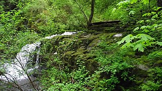
Errington is a small community on Vancouver Island, British Columbia, Canada, located on Errington Road, off Highway 4, just south of Parksville and Qualicum Beach.
The Pine Pass, in the Hart Ranges of the Northern Rockies of British Columbia, connects the Peace Country of the province's Northeastern Interior. Highway 97 and the Canadian National Railway (CNR) traverse this mountain pass, which is the location of the Bijoux Falls Provincial Park, the Pine Le Moray Provincial Park, and the Powder King Mountain Resort at Azouzetta Lake.
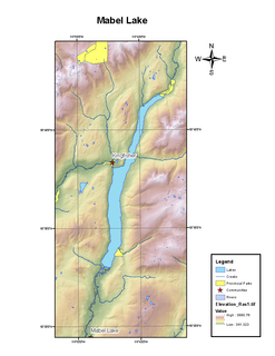
Mabel Lake is a lake located in southern Interior British Columbia, Canada, that is fed by and drained by the Shuswap River. It is located southeast of Shuswap Lake, northeast of Okanagan Lake, and west of the Monashee Mountains, and is popular for camping and fishing. The area around the lake is mountainous and sparsely populated.
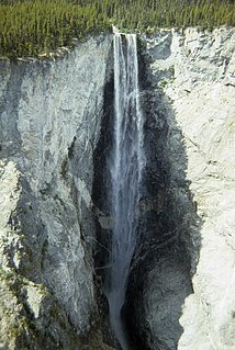
Hunlen Falls is a waterfall located at the mouth of Turner Lake in the Pacific Ranges of British Columbia, Canada. With an estimated height of 260 m (850 ft), it is tied with Takakkaw Falls in Yoho National Park for having the fourth tallest single drop of any waterfall in Canada.
Monkman Pass, in the Canadian Rockies, is southwest of Tumbler Ridge and northeast of Hansard. Found in the Hart Ranges, some consider this mountain pass as the southern limit of the informal grouping known as the Northern Rockies, although those are occasionally reckoned as extending farther southeast to Mount Ovington or even to Mount Robson.
The Green Bowl is a gorge just southeast of Kinuseo Falls at the north end of Monkman Provincial Park in the Northern Rockies of British Columbia, Canada, northeast of the city of Prince George and south of the community of Tumbler Ridge.

Kinuseo Falls is a waterfall on the Murray River, which flows through the northern tip of Monkman Provincial Park in the Northern Rockies of British Columbia, Canada. The falls are located south of the community of Tumbler Ridge and northeast of the city of Prince George, though there is no road access from the Prince George side of the Rocky Mountains.

Mount Seymour Provincial Park is a park in Vancouver, British Columbia's North Shore Mountains. With an area of 35 square kilometres, it is located approximately 15 kilometres north of Downtown Vancouver. The park, named after Frederick Seymour, was established in 1936. Mount Seymour Provincial Park provides visitors with a variety of recreational activities and animals with natural habitat.
Misinchinka Ranges, is the largest subdivision range of the Hart Ranges, of the Northern Rockies in British Columbia, Canada. The boundaries of the Misinchinka Ranges generally lie between the Rocky Mountain Trench to the west, Clearwater Creek and the Sukunka River to the east, the Peace Arm of Williston Reservoir to the north and Monkman Provincial Park to the south.


