
Stein Valley Nlaka'pamux Heritage Park is a provincial park in British Columbia, Canada. It was established on November 22, 1995 by BC Parks and the Lytton First Nation to protect the ecological and cultural significance of the Stein River valley.

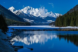
Kokanee Glacier Provincial Park is one of the oldest provincial parks in British Columbia, established in 1922. The park has an area of 320.35 km2 (123.69 sq mi) and is located in the Selkirk Mountains in the West Kootenays region of BC. The park has three glaciers that feed over 30 alpine lakes which are the headwaters of many creeks.

Beaver Creek Provincial Park is a Class C provincial park in the Regional District of Kootenay Boundary in British Columbia, Canada.
Duffey Lake Provincial Park is a provincial park in British Columbia, Canada, located at the lake of the same name, which lies along BC Highway 99 just east of the summit of Cayoosh Pass. The lake's inflow and outflow are Cayoosh Creek. The park's highest point is Mount Rohr at the westernmost boundary.
Davis Lake Provincial Park is a 185 acres (0.75 km2) park in British Columbia, Canada, established as a protected provincial park in October 1963. It is located east of the southern end of Stave Lake, northeast of Mission, British Columbia, approximately 18 km north on Sylvester Rd from BC Highway 7. There are campgrounds and beaches at the south end of the lake, access is walk-in only via a 1 km unmaintained gravel road.
F.H. Barber Provincial Park is a provincial park in British Columbia, Canada. Comprising 8.5 ha of Fraser River floodplain in its natural state, it is one of only two secured public access points to the Fraser between Chilliwack and Hope. It is located at the confluence of Wahleach Creek and the Fraser one mile west of Laidlaw, British Columbia and is bounded on the south by the tracks of the Canadian National Railway.
Gladstone Provincial Park is a provincial park in British Columbia, Canada, surrounding and north of the north end of Christina Lake in that province's Boundary Country.
Kakwa Provincial Park and Protected Area is a 170,890 ha provincial park in northeastern British Columbia, Canada. There are significant amounts of fish fossils there. The tallest mountains are Mount Sir Alexander and Mount Ida. Fishing in Kakwa Lake is permitted. Snowmobiling is permitted on trails, meadows, and along mountain sides.

Kikomun Creek Provincial Park is a provincial park in British Columbia, Canada.

Kokanee Creek Provincial Park is a provincial park on the west shore of Kootenay Lake in the West Kootenay region of southeastern British Columbia. Highway 3A bisects the park 19 kilometres (12 mi) east of Nelson.

Nahatlatch Provincial Park and Protected Area is a provincial park in British Columbia, Canada, surrounding the Nahatlatch River in the southern Lillooet Ranges to the southwest of Lytton. Access to the river and the park is via the Boston Bar-North Bend Bridge and the Nahatlatch Forest Service Road.

Northern Rocky Mountains Provincial Park is a provincial park in British Columbia, Canada. It is located in the north-eastern part of the province, 90 km south-west from Fort Nelson and it is bordered to the north by the Alaska Highway. Access is mostly done by boat, aircraft, on horseback or by hiking.
West Twin Provincial Park and Protected Area is a provincial park and protected area located in the Robson Valley of British Columbia, Canada. It was established on June 29, 2000 to protect local wildlife and to preserve the only protected corridor across Robson Valley.
Weymer Creek Provincial Park, formerly Weymer Creek Karst Provincial Park, is a provincial park located on the west coast of Vancouver Island in British Columbia, Canada, just southeast of the community of Tahsis in the region of Nootka Sound. Its most important feature is its karst topography and some of the deepest caves in Canada. Caving is currently not permitted in the park and visitors to the area are requested to practice "no trace" camping.

The Purcell Wilderness Conservancy is a provincial park in British Columbia, Canada. It was established in 1974, and encompasses six large drainages in the Purcell Mountains in the southeast of the province. It contains high peaks, alpine meadows and ridges, deep creek and river valleys, and hot springs at Dewar Creek.

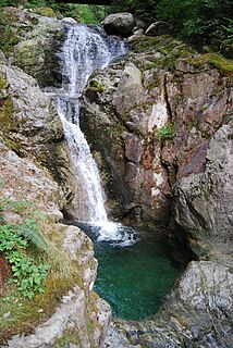
Rosewall Creek Provincial Park is a provincial park in British Columbia, Canada, located northwest of the community of Bowser. The park is situated along picturesque Rosewall Creek, south of Fanny Bay on central Vancouver Island. The park features a mixture of coniferous trees interspersed with striking broad leaf maple trees. One of the best times to visit this park is in the fall when the color of the maple leaves makes an attractive backdrop for photographers.
Swan Lake Kispiox River Provincial Park is a provincial park in northwest British Columbia, Canada. It lies within the territories of the Gitanyow and Gitxsan First Nations. The park and the area surrounding it are important to First Nations people for cultural activities. There are trumpeter swans known to be on Club Creek in the winter.

Tantalus Provincial Park is a provincial park located in the Tantalus Range overlooking Squamish Valley in British Columbia, Canada. It was established on December 19, 1998 to protect a large area of pristine alpine wilderness.
Tranquil Creek Provincial Park is a provincial park in British Columbia, Canada, located at the head of the Kennedy River, east of the head of Bedwell Sound on Vancouver Island.
Close To The Edge Provincial Park and Protected Area is a provincial park and a protected area in British Columbia, Canada.

