
The Similkameen River runs through southern British Columbia, Canada, eventually discharging into the Okanagan River near Oroville, Washington, in the United States. Through the Okanagan River, it drains to the Columbia River. The river is said to be named for an indigenous people called Similkameigh, meaning "treacherous waters".

Cathedral Provincial Park and Protected Area, usually known as Cathedral Provincial Park and also as Cathedral Park, is a provincial park in British Columbia, Canada. It is located east of E.C. Manning Provincial Park, south of BC Highway 3, and southeast of the town of Princeton and southwest of Keremeos. Its southern boundary is the border with the United States. Much of the park is the basin of the Ashnola River.
Animals of Conkle Lake Provincial Park
Ellison Provincial Park is a provincial park in British Columbia, Canada, located on the east side of Okanagan Lake to the south of the city of Vernon. The park contains approximately 219 acres (0.89 km2) of land, 200 ha. of it upland, 19 ha. of it foreshore.
Eneas Lakes Provincial Park is a provincial park in British Columbia, Canada, located west of the town of Peachland, to the south of Peachland Creek. The park is approximately 1036 ha. in size and was established in 1968. The Eneas Lakes lie at the head of Finlay Creek.

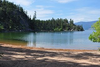
Herald Provincial Park is a provincial park in British Columbia, Canada.
Johnstone Creek Provincial Park is a provincial park in British Columbia, Canada, located west of the confluence of Rock Creek and the Kettle River and the town of Rock Creek. The park has a roughly 38 hectare area, and is near to the Crowsnest Highway.
Kickininee Provincial Park is a provincial park in British Columbia, Canada, located just south of the town of Summerland in that province's Okanagan region. Originally established in 1970 with approximately 7 acres (28,000 m2) of upland and 113.5 acres (0.459 km2) of foreshore, the park today comprises approximately 48.76 ha.
Monte Lake Provincial Park is a provincial park in British Columbia, Canada, located on the east side of Monte Lake and to the south of the community of Monte Lake, British Columbia which is at the north end of the lake. About five hectares in size, it protects an area of Ponderosa pine and grasslands.
Mount Terry Fox Provincial Park is a provincial park in British Columbia, Canada. It is located in the Rocky Mountains near Mount Robson and the city of Valemount, British Columbia. The park and Mount Terry Fox, which is within the park, are named in honor of amputee long-distance runner and cancer research activist Terry Fox, a native of Winnipeg, Manitoba who grew up in British Columbia.
Okanagan Falls Provincial Park, now officially named sx̌ʷəx̌ʷnitkʷ Provincial Park, is a provincial park in British Columbia, Canada, located within the traditional territory of the Osoyoos Indian Band. Since time immemorial, the Osoyoos Indian Band's Okanagan ancestors have inhabited and cared for the lands and waters in their traditional territory. The park is also located within the town of Okanagan Falls, protecting the area around the waterfall of the same name, which lies below the outlet of Skaha Lake in the course of the Okanagan River.
Pritchard Provincial Park is a provincial park in British Columbia, Canada, located on the north side of the South Thompson River between the communities of Monte Creek (W) and Chase (E). The Park is actually split into two sections. The best access to the actual Park is from the water; as you would need Private Land owners permission to access from the land. The area in between the Park's boundaries is supposedly under the Province of British Columbia's jurisdiction, but is not part of the Provincial Park itself.
The Lower Similkameen Indian Band or Lower Smelqmix, is a First Nations band government in the Canadian province of British Columbia. Their office was in the village of Keremeos in the Similkameen region, until 2015 when they moved into their own $7million multi-purpose facility south of Cawston. They are a member of the Okanagan Nation Alliance.
The Similkameen Country, also referred to as the Similkameen Valley or Similkameen District, but generally referred to simply as The Similkameen or more archaically, Similkameen, is a region roughly coinciding with the basin of the river of the same name in the Southern Interior of British Columbia. The term "Similkameen District" also refers to the Similkameen Mining District, a defunct government administrative district, which geographically encompasses the same area, and in more casual terms may also refer to the Similkameen electoral district, which was combined with the Grand Forks-Greenwood riding by the time of the 1966 election. The Similkameen Country has deep historical connections to the Boundary Country and the two are sometimes considered one region, partly as a result of the name of the electoral district. It is also sometimes classed as being part of the Okanagan region, which results from shared regional district and other administrative boundaries and names. The term "Similkameen District" may also historically refer to the Similkameen Division Yale Land District, which also includes Osoyoos and the Boundary Country to Osoyoos' east.

CIGV-FM is a Canadian radio station, which broadcasts at 100.7 FM in Penticton, British Columbia, with rebroadcasters in Keremeos and Princeton. Founded by The Robinson Family of Great Valleys Radio in 1981, the station was sold to Newcap Radio in 2011, and approved by the CRTC on February 15, 2012. CIGV is the only country format station in the Okanagan Valley and was rebranded to Country 100.7 on April 27, 2012. On May 14, 2012, at 5:30 a.m., 'Okanagan Mornings with Troy Scott and Roo Phelps' went on the air. Troy Scott was released from the company in August 2012 and became Program Director of CJSU-FM. 100.7 re-branded the morning show as "Okanagan Mornings with Roo Phelps." Scott George hosts Okanagan Afternoons.
Chopaka is an unincorporated settlement near the US border on the west bank of the Similkameen River in the Southern Interior of British Columbia, Canada. Largely comprising two Indian Reserves, 'Chopaka IR No. 7 and Chopaka IR No. 8, the location was formerly listed as a railway station on the Great Northern Railroad. There is a border crossing at Chopaka, open daily 9 AM to 5 PM.

The Ashnola River is a tributary of the Similkameen River, rising in the northeastern part of the North Cascades in Washington, United States, and flowing north into British Columbia, Canada, to join the Similkameen River about halfway along that river's course between the towns of Princeton and Keremeos. The river crosses the international boundary at 49°00′00″N120°19′37″W and transits Cathedral Provincial Park. It has one main tributary, Ewart Creek, which is about 25 kilometres (16 mi) long and begins virtually at the border and is entirely within Cathedral Park.
Richter Pass is a mountain pass to the south of the summit of British Columbia highway 3 between Keremeos (W) and Osoyoos (E), linking the Similkameen Valley with the South Okanagan over the southernmost end of the Thompson Plateau. The pass is traversed by Old Richter Pass Road and is ~650 m (2,130 ft) in elevation though the name is generally used for the route of Highway 3 as well.
Carcajou Pass is a mountain pass on the Continental Divide and British Columbia–Alberta boundary at the north end of Mount Robson Provincial Park. On the Alberta side lies the northwestern part of Jasper National Park. Carcajou is the French word for "wolverine".
Gwyneth Lake Provincial Park is a provincial park in British Columbia, Canada, located 70 kilometres west of Lillooet, British Columbia. The park, which is 132 ha. in size, was established in 2010.
