Desolation Sound Marine Provincial Park

Last updated
Desolation Sound Marine Provincial Park
Grace Harbour, Desolation Sound Marine Park, BC.jpg
Grace Harbour
Canada British Columbia location map 2.svg
Red pog.svg
Location of Desolation Sound Provincial Marine Park in British Columbia
Location British Columbia, Canada
Nearest city Powell River
Coordinates 50°8′0″N124°44′0″W / 50.13333°N 124.73333°W / 50.13333; -124.73333
Area84 km2
Designation Marine Provincial Park
Established1973
Governing body BC Parks

Desolation Sound Marine Provincial Park is a provincial park in British Columbia, Canada. The park is distinguished by its many picturesque sheltered coves and anchorages, frequented by yachts and pleasure craft. The scenery consists of waterfalls, rugged glaciated peaks, and steep forested slopes that fall into the ocean.

Contents

The park's many inlets, islets, coves, and bays attract many pleasure crafts each summer, [2] when it is not uncommon for a hundred boats to share a small anchorage. [3] The sound is home to a wide variety of wildlife and remains relatively free from development, although some areas, such as Theodosia Inlet, show signs of clear-cut logging. [3]

The area has a long history of use by First Nations and it supports tremendous ecological diversity. From the time when Captain George Vancouver first visited the area to modern times, Indigenous people have been pressured off their land and have lost access to most of their hunting and gathering spots due to environmental protection, tourists, and pollution. [4] Health authorities that are operated by First Nations groups are currently investigating the effects of environmental pollution in the area. [5]

Land use in the marine area is now strictly controlled by the British Columbia provincial government, and any operations in this marine area that do not conform to the laws are eradicated. [6]

Location and size

The park is located approximately 32 km north of Powell River and 150 km north of Vancouver. This provincial marine park, approximately 84 km2 in size, is only accessible by boat.

Desolation Sound Marine Provincial Park created by the Government of British Columbia in 1973, under the advocacy of MLA Don Lockstead and the New Democratic Party government, out of an area comprising 8,449 hectares (32.6 sq mi) and over 60 km (37 mi) of shoreline. [7] The park is located at the confluence of Malaspina Inlet and Homfray Channel.

History

Desolation Sound was first named this way by Captain George Vancouver. When he first sailed there, he encountered what he described as mostly abandoned Native settlements, gloomy weather, and barren land. [4] It was, however, only temporarily empty due to a few factors. The first is that his visit likely came after a smallpox outbreak; second, it was the time of the year when most people would be inland hunting and gathering. Third, First Nations people were likely avoiding the Lekwiltok raiders. Another significant factor was that Vancouver's view was influenced by “European cultural aesthetics,” [4] as he didn't recognize most indigenous-altered landscapes as occupied by people. While Vancouver saw Desolation Sound as an unattractive and empty land, people later came to value it as full of untouched nature. [4]

The history of Desolation Sound Marine Park is intimately connected with the erasure of First Peoples’ presence from their ancestral lands. [4] What non-indigenous people see as conservation efforts come in direct conflict with the lives of the Sliammon First Nations (Tla'amin Nation), who used to live, hunt, gather and practice their culture on these lands. Many also see Indigenous People's presence as ruining the pristine natural emptiness of the area. The Sliammon First Nations, however, provide an opposing narrative of unequal power relations and a homeland turned into a landscape for non-native visitors, taken over and destroyed by outsiders. Starting from 1875, they were, over time, pushed out of their communities into small reserves, and in 1920, legislation was enacted allowing the government to unilaterally reduce allocated reserve land. [4]

First Nations

As First Nations were pressured off their land, Desolation Sound once again became wild and uninhabited, and was seen as suitable in the eyes of yachters and others looking for a retreat from industrial society. [4] While the Sliammon tried to continue hunting, gathering, and participating in cultural activities, parts of the area were leased to non-indigenous residents as tourists and summer residents, increasing clashes of interest between them. [4]

Summer houses were built in ideal hunting and gathering locations and archeological sites, including graves, which were robbed as souvenirs. Environmental protection infringed on their ability to use what was left of the unoccupied land. [4] While the area was under environmental protection, only some aspects of the park environment were protected. It is only more recently[ when? ] that people began to value the 10,000-year history of the area's Native occupants, [8] who have built their lives around what Captain Vancouver called Desolation Sound. Increased tourism, however, harms the First Nations and the environment. Untreated sewage and accidental fuel leaks from homes and boats have led to water pollution, dangerous for marine life and those relying on seafood as a primary food source. [9] As a result, the Sliammon First Nations are afraid to eat the little traditional food available to gather after the government leased their best gathering spots to oyster farmers. The Sliammon have been harmed by the seemingly benevolent creation of parks, including the Desolation Sound Marine Park. Their identity is deeply integrated with the environment. While many still maintain the spiritual connection and use of land, it is increasingly complicated by the private property of settlers, tourism, pollution, and ecological protection areas. [4]

Government relationship

Desolation Sound Provincial Park is an integral part of the traditional territory of the Sliammon and Klahoose First Nations. The areas within the park contains historical and spiritual sites that are culturally, economically, and socially important to these First Nations groups. According to the British Columbia government, Sliammon First Nations reviewed treaty negotiation documents and provided input to the planning process, reflected in various sections of the parks management plan. [6] In 2008, both Desolation Sound First Nations groups (Sliammon and Klahoose) were involved in treaty negotiations with senior levels of government. [6] First Nations can exercise aboriginal rights subject to conservation, public safety, and public health values. The final treaty may provide additional directions or changes on aboriginal rights within the park areas. [6]

BC First Nations Environmental Contaminations Program

First Nations Projects that investigate the connection between environmental pollutants and human health are supported by the First Nations Health Authority's Environmental Pollutants Program (ECP). Its goals are to encourage capacity building and assist First Nations communities in British Columbia in addressing their environmental health challenges. The Program integrates Indigenous methods of knowing, traditional knowledge, and empirical science to support community-based research on environmental health challenges. [5]

Ecology

Fauna

Desolation Sound Marine Park supports a diversity of terrestrial and marine species. Some terrestrial wildlife identified within the park include large mammal species like black-tailed deer and black bears while small fur-bearing mammals and various species of reptile also inhabit the park. [6] The park is also home to an abundance of marine animals including spawning and rearing areas for species of salmon and other fish like herring, while also supporting mammalian species such as porpoises and fin footed mammals like seals. [6] The park also supports many migratory birds including several species of ducks and gulls; however, the presence of the marbled murrelet is particularly well documented because 10% of the Canadian Population and 1% of the global population of this bird species use the Marine Park in the summer and fall. [10] The marbled murrelet is studied extensively because it has been listed as threatened by federal legislation since 1990, while agencies in British Columbia list it as a species of special concern. [11] Other species at risk in the park include orcas, sea lions, eulachon, and heron. [6]

Flora

Many coniferous tree species as well as deciduous maples and alders can be found within Desolation Sound Marine Park and The park primarily supports a second-growth regime thanks to previous logging efforts and wildfires, although sections of old growth areas remain within the park. [6] Thanks to an abundance of favorable habitats, the park also supports many species of seagrass such as eelgrass, which play an important role in sequestering carbon dioxide. [12] Salt marshes and kelp beds present in the park combine with the eelgrass to support a diversity of shellfish. [6]

Policy and management

The park is managed with 6 outcomes in mind.

A healthy and productive coast

A healthy local ecosystem is very important in the management of coastal marines as it is the basis of all the other functions that the coastal can provide. It provides a home to countless different species and benefits humans in many different ways. To keep a healthy and productive coast, the BC government focuses on recovering the wildlife and habitats as well as reducing marine pollution. Wildlife like salmon and killer whales are important parts of the local ecosystem. They have their unique contribution to the local habitats. [13]

Resilience to climate change

Climate change has a huge impact on the ocean ecosystem. Many species suffered from it and problems have occurred in many places like ocean acidification, sea level rising, and coral bleaching. The BC government believes it is important to keep the local communities safe first as they are the first line that responds to extreme weather events. Because climate change is also affecting seafood availability, a healthy and resilient community needs to be built to decrease the impact of climate change and the government should also collaborate with the First Nations to adapt to climate change. Compared to human-based solutions, nature-based solutions are more effective and long-lasting in dealing with climate change. People find them cost-effective and less likely to disrupt the local habitat. [13]

Trusting, respectful relationships

The local communities are a significant part of managing the coastal areas. The First Nations have their unique way of understanding and managing coastal areas. The BC government believes it is crucial to respect the local community and collaborate deeply to get a comprehensive management strategy. [13]

Holistic learning and knowledge sharing

The First Nations hold precious knowledge, and they have an unprecedented value in understanding and managing the coastal areas. Therefore, it is very important to combine traditional knowledge with Western science to get a better understanding and assessment of coastal areas. [13]

Community well-being

The local communities not only manage coastal areas but also rely on coastal areas and the ocean for their well-being. Things like climate change, pollution, and disconnection from the decision-making process pose the local communities a lot of challenges. The province will work to create jobs and support the communities to respond to change by improving the capacity. [13]

Desolation Sound Marine Provincial Park is a typical example of managing recreational services. It is very popular among people as it offers kayak and boating activities, but the popularity is also affecting the local ecosystem. To better manage coastline development and access issues, the province aims to balance the need for recreational services and the protection of local habitats. The government also seeks to collaborate with the Indigenous People to manage the Park effectively and comprehensively. [13]

A sustainable, thriving ocean economy

A sustainable economy not only focuses on GDP — It benefits the local community from many perspectives for a long time and it is good for people's future generations. The government is interested in different measures to build a sustainable economy, including investing in a diverse economy,  promoting aquaculture and tourism, co-developing with Indigenous people, and managing cumulative effect. [13]

Controversies

In the journal article Desolate Viewscapes, author Jonathan Clapperton claims that BC Parks gauges the park's performance by adding amenities and more visitors. Some examples of this include placing campgrounds on environmentally sensitive land or letting hundreds of yachts anchor in a few tiny bays. Despite being a no-dumping zone, sewage released from yachts concentrated in small coves poisoned several of the marine park's waters, severely contaminating the local shellfish. Because they run the risk of becoming poisoned, many Sliammon First Nations people are reluctant to eat traditional foods in the water near the parks. [4] For 10 millennia, the region served as a major source of food for Indigenous people due to the abundance of mussels, mollusks, and oysters that flourish in the warmest waters found in the north of Baja. [8]

See also

Related Research Articles

<span class="mw-page-title-main">Clayoquot Sound</span> Body of water on the west side of Vancouver Island, Canada

Clayoquot Sound is located on the west coast of Vancouver Island in the Canadian province of British Columbia. It is bordered by the Esowista Peninsula to the south, and the Hesquiaht Peninsula to the North. It is a body of water with many inlets and islands. Major inlets include Sydney Inlet, Shelter Inlet, Herbert Inlet, Bedwell Inlet, Lemmens Inlet, and Tofino Inlet. Major islands include Flores Island, Vargas Island, and Meares Island. The name is also used for the larger region of land around the waterbody.
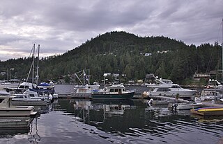
<span class="mw-page-title-main">Stein Valley Nlaka'pamux Heritage Park</span> British Columbia provincial park

The Stein Valley Nlaka’pamux Heritage Park is located near Lytton, British Columbia. The park was established in 1995. The park is co-managed, operated, and planned through a partnership between the Lytton First Nation and the government of British Columbia. The park provides recreational opportunities and cultural heritage activities, and features a number of pictographs.

<span class="mw-page-title-main">Air pollution in British Columbia</span>

Air pollution is a concern in British Columbia, Canada because of its effects on health and visibility. Air quality is influenced in British Columbia (BC) by numerous mountain ranges and valleys, which complicate atmospheric pollution dispersion and can lead to high concentrations of pollutants such as particulate matter from wood smoke.

<span class="mw-page-title-main">Denman Island</span> Island of the Northern Gulf Islands in British Columbia, Canada

Denman Island,, is one of the Northern Gulf Islands and part of the Comox Valley Regional District of British Columbia, Canada. It is a member of the Islands Trust group of islands and is home to a small community of 1391 year-round residents.

<span class="mw-page-title-main">Howe Sound</span> Sound in British Columbia, Canada

Howe Sound is a roughly triangular sound, that joins a network of fjords situated immediately northwest of Vancouver, British Columbia, Canada. It was designated as a UNESCO Biosphere Reserve in 2021.

<span class="mw-page-title-main">Desolation Sound</span> Sound in Discovery Islands, British Columbia

Desolation Sound is a deep water sound at the northern end of the Salish Sea and of the Sunshine Coast in British Columbia, Canada.

<span class="mw-page-title-main">Broughton Archipelago Provincial Park</span> Provincial park in British Columbia, Canada

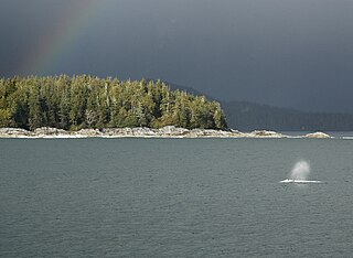
Broughton Archipelago Provincial Park is the largest marine provincial park located in British Columbia, Canada. The park is located in the Queen Charlotte Strait around 30 km east of Port McNeill, a town situated on Vancouver Island. In terms of its functions, the park offers tourism opportunities such as kayaking and whale watching, preserves a wide array of wildlife including many at-risk species, and has a long history of use by First Nation peoples.

<span class="mw-page-title-main">Brooks Peninsula Provincial Park</span> Provincial park in British Columbia, Canada

Parts of this article have been adapted from the BC Parks website.

<span class="mw-page-title-main">Carmanah Walbran Provincial Park</span> Provincial park on Vancouver Island in British Columbia, Canada

Carmanah Walbran Provincial Park, originally Carmanah Pacific Provincial Park, is a remote wilderness park located inside traditional Ditidaht First Nation ancestral territory. The park covers a land area of 16,450 ha (63.5 sq mi) immediately adjacent to Pacific Rim National Park Reserve's West Coast Trail on the south-western, coastal terrain of Vancouver Island. The provincial park comprises the entire drainage of Carmanah Creek, and a good portion of the lower Walbran River drainage, both of which independently empty into the Pacific Ocean. The park is named after the Anglicized diitiid?aatx word kwaabaaduw7aa7tx, or Carmanah, meaning "thus far upstream" and John Thomas Walbran, a colonial explorer and ship's captain. Access to the park is by gravel logging road from Port Alberni, Lake Cowichan, or Port Renfrew.

<span class="mw-page-title-main">Salish Sea</span> Marginal sea in British Columbia and Washington state

The Salish Sea is a marginal sea of the Pacific Ocean located in the Canadian province of British Columbia and the U.S. state of Washington. It includes the Strait of Georgia, the Strait of Juan de Fuca, Puget Sound, and an intricate network of connecting channels and adjoining waterways.

The Western Canada Wilderness Committee is a non-profit environmental education organization that aims to protect Canada's wild spaces and species. Paul George, along with Richard Krieger, were the founding directors, and formed the Wilderness Committee in the province of British Columbia in 1980. It now has a membership of over 30,000 people with its head office in Vancouver and field offices in Victoria, British Columbia; Winnipeg, Manitoba; and Toronto, Ontario.

<span class="mw-page-title-main">Savary Island</span>

Savary Island or Áyhus is an island in British Columbia, Canada. Located in the northern part of the Strait of Georgia, it is 144 kilometres (89 mi) northwest of Vancouver. It is approximately 0.8-1.5 km wide and 7.5 kilometres (4.7 mi) long. It has a permanent population of about 100, expanding to perhaps 2,000 or more in the summer months. Savary Island lies within the traditional territory of the Tla'amin Nation.

<span class="mw-page-title-main">Cortes Island</span> Island of the Discovery Islands in British Columbia, Canada

Cortes Island is an island in the Discovery Islands archipelago on the coast of British Columbia, Canada. The island is 25 km (16 mi) long, 13 km (8 mi) wide, and 130 km2 (50 sq mi) in area. It has a population of 1,035 permanent residents. Cortes Island lies within Electoral Area B of the Strathcona Regional District, which provides water and sewage systems, fire protection, land use planning, parks, recreation, and emergency response.

<span class="mw-page-title-main">Lund, British Columbia</span> Unincorporated community Tlaamin Land in British Columbia, Canada

Lund is a small craft harbour and unincorporated village on Tla'amin land in qathet Regional District, British Columbia, Canada. It is along the northern part of the Salish Sea on the mainland BC coast. The main landmark in the village is the Lund Hotel, established in 1905. By boat from Lund, the Copeland Islands and Desolation Sound, are nearby. Lund is home to many shops and services including a general store, a restaurant overlooking the water, kayak and adventure tourism stores, and Nancy's Bakery, a favourite of locals and tourists.

Malahat First Nation is a Coast Salish First Nations community of W̱SÁNEĆ representing approximately 350 members with two reserve lands located on the western shore of Saanich Inlet, Vancouver Island in British Columbia, Canada. The Malahat First Nation is one of many nations within the Coastal Salish group that live on their traditional lands. The Coastal Salish are Indigenous to the Northwest mainland, coast, and islands. The Malahat First Nation is a member nation of the Naut'sa mawt Tribal Council and was the ninth First Nation in Canada to be certified by the First Nations Financial Management Board. The ancestral languages of Malahat Nation are Hul̓q̓umín̓um̓ and SENĆOŦEN. The Hul̓q̓umín̓um̓ or Halkomelem language is spoken in Washington State and British Columbia and is within the Coastal Salish language family. Currently it is being revitalized, as it is mainly spoken by elders in the community. The Chief of Malahat Nation is George Harry. George served on the council for four years before being elected as Chief on June 10, 2019.

<span class="mw-page-title-main">Clayoquot protests</span>

The Clayoquot protests, also called the War in the Woods, were a series of blockades related to clearcutting in Clayoquot Sound, British Columbia. They culminated in mid-1993, when 856 people were arrested. The blockades in the summer of 1993 against logging of the temperate rainforest were the largest act of civil disobedience in Canadian history until the 2021 Fairy Creek blockades.

Grace Harbour is a harbour and traditional village site of the Tla'amin peoples in the South Coast of British Columbia, located near Desolation Sound on the south side of the Gifford Peninsula opposite the Malaspina Peninsula to the southwest. Along with the Gifford Peninsula, it is part of Desolation Sound Marine Provincial Park. Kahkaykay Indian Reserve No. 6 was located on the west side of the harbour but as of 2011 is now fee-simple land as a result of the Sliammon Treaty. at 50°02′58″N124°45′21″W The headland at the southwest corner of the harbour is similarly named from the name of the ancient village at this site, Kakaekae Point, at 50°02′32″N124°45′56″W

Scott Islands Marine National Wildlife Area is a National Wildlife Area off the northwestern tip of Vancouver Island in the Canadian province of British Columbia. Covering an area of 11,570.65 km2 (4,467.45 sq mi), it is the second largest protected area in British Columbia after Offshore Pacific Seamounts and Vents Closure and is the largest national wildlife area in Canada.

<span class="mw-page-title-main">Skwelwil'em Squamish Estuary Wildlife Management Area</span> Wildlife Management Area in British Columbia, Canada

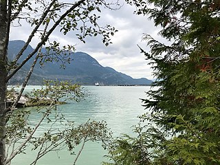
The Skwelwil'em Squamish Estuary Wildlife Management Area is a wildlife management area on the south coast of British Columbia. It was established in 2007 for the management of fish species as well as terrestrial wildlife. The wildlife management area is on the traditional territory of Squamish Nation, which is involved in management of the area. The freshwater of the Squamish River mixes with the saltwater of Howe Sound, resulting in a varied ecosystem containing different habitats that support an abundance of wildlife. It also provides natural flood control for the Squamish town sites.

<span class="mw-page-title-main">Gwaxdlala/Nalaxdlala (Lull/Hoeya) Marine Refuge</span> Marine refuge in British Columbia, Canada

The Gwaxdlala/Nalaxdlala (Lull/Hoeya) Marine Refuge is located in Knight Bay on the Central Coast of British Columbia and encompasses Lull Bay, Hoeya Sound and their corresponding watersheds. This Marine Refuge was created in partnership by the Mamalilikulla First Nation and the British Columbia Provincial Government. It was officially established on November 29, 2021, by the Mamalilikulla First Nation. The Lull/Hoeya Marine Refuge was created with the purpose of protecting biodiversity, endangered species, Indigenous culture and heritage, in an area with unique physical geography and oceanography.

References

  1. "Desolation Sound Marine Park". Protected Planet. Retrieved 2020-09-16.
  2. A Dreamspeaker Cruising Guide, Volume 2, Second Edition, Anne & Laurence Yeadon-Jones, 2006
  3. 1 2 Exploring the South Coast of British Columbia, Third Edition, Don Douglass & Reanne Hemingway-Douglass, 2009
  4. 1 2 3 4 5 6 7 8 9 10 11 Clapperton, Jonathan (2012). "Desolate Viewscapes: Sliammon First Nation, Desolation Sound Marine Park and Environmental Narratives". Environment and History. 18 (4): 529–559. doi:10.3197/096734012X13466893037107. ISSN   0967-3407. JSTOR   41714190.
  5. 1 2 "First Nations Health Authority Environmental Contaminants Program" (PDF).
  6. 1 2 3 4 5 6 7 8 9 "Management Plan for Desolation Sound and Copeland Islands Marine Parks and Tux'wnech Okeover Arm Provincial Park (February 2008)" (PDF).
  7. Desolation Sound Marine Provincial Park
  8. 1 2 "Forget the name. Desolation Sound is Canada's best-kept secret". Travel. 2023-09-22. Retrieved 2023-10-11.
  9. "Aquatic Report Catalogue". a100.gov.bc.ca. Retrieved 2023-10-11.
  10. "BirdLife Data Zone". datazone.birdlife.org. Retrieved 2023-10-28.
  11. Environment Canada (2014). Recovery Strategy for the Marbled Murrelet (Brachyramphus marmoratus) in Canada. Species at Risk Act Recovery Strategy Series. Ottawa: Environment Canada. ISBN   978-1-100-24310-8
  12. "The importance of British Columbia's Eelgrass – BC Parks Blog". 2022-06-08. Retrieved 2023-10-28.
  13. 1 2 3 4 5 6 7 "Management Plan for Desolation Sound and Copeland Islands Marine Parks and Tux'wnech Okeover Arm Provincial Park (February 2008)" (PDF).