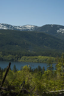
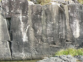
Arrow Lakes Provincial Park is a provincial park in British Columbia, Canada.

Copeland Islands Marine Provincial Park is a provincial park in British Columbia, Canada, located in Desolation Sound to the northwest of Lund on the northern Sunshine Coast off the west coast of the Malaspina Peninsula.
Columbia Lake Provincial Park is a provincial park in British Columbia, Canada, located on the northeast shore of Columbia Lake south of the town of Invermere. The park was established in 1988, comprising approximately 260 hectares. Its boundary was expanded in 2004, the total now comprising approximately 290 hectares, 275 hectares of which is upland, 15 hectares of which is foreshore.
Dahl Lake Provincial Park is a provincial park in British Columbia, Canada. It was established on October 22, 1981, and is currently 1,583 ha in size.

Fossli Provincial Park is a provincial park in British Columbia, Canada, located on Stirling Arm of Sproat Lake on Vancouver Island. The 52-hectare park, west of Port Alberni, is accessible by water or private logging road. It has few services, but has a 30-minute hiking trail to an old homestead site. The homestead belonged to Helen and Armour Ford, who donated the land for the park to the province in 1974. Saint Andrew's Creek runs through the park, and is a fall spawning ground for coho salmon.
Hitchie Creek Provincial Park is a provincial park in the Canadian province of British Columbia, west of the north end of Nitinat Lake on the west coast of Vancouver Island, north-east of Bamfield.

Horne Lake Caves Provincial Park is a provincial park on Vancouver Island in British Columbia, Canada. Its principal function is the protection, management, and recreational use of several caves collectively known as the Horne Lake Caves.
Inland Lake Provincial Park is a provincial park in British Columbia, Canada, located on the southeast side of Powell Lake, just to the northeast of the city of Powell River in that province's northern Sunshine Coast region. Inland Lake is located between the south end of Powell Lake (W) and Haslam Lake (E).

Jedediah Island Marine Provincial Park is a provincial park in British Columbia, Canada. It is an island that is 243 hectares in size. Anyone is free to camp on Jedediah island; however, it is only accessible by boat. The nearest access is from Lasqueti Island.
Kluskoil Lake Provincial Park is a provincial park in British Columbia, Canada, located on the West Road River downstream from the Euchiniko Lakes.

Little Qualicum Falls Provincial Park is a provincial park in British Columbia, Canada, on central Vancouver Island, that encompasses the entire southern shore of Cameron Lake. The Island Rail Corridor line to Port Alberni passes through the park.
Muscovite Lakes Provincial Park is a provincial park in British Columbia, Canada. It is located on the western shore of Lake Williston, 125 km north of Mackenzie.
Uncha Mountain Red Hills Provincial Park is a provincial park in British Columbia, Canada, comprising two parcels of land on the north and south shores of Francois Lake. Total area of the park is 9,421 hectares.
Schoolhouse Lake Provincial Park, formerly known as Lang Lake Provincial Park, is a provincial park in British Columbia, Canada.
Sowchea Bay Provincial Park is a provincial park in central British Columbia, Canada. It is on Stuart Lake, west of Prince George. The park is 13 hectares in area. It is a busy destination for boaters and anglers, with a single lane concrete boat launch available with limited parking.

Sproat Lake Provincial Park is a provincial park near Port Alberni in British Columbia, Canada's Vancouver Island. Its name derives from a lake named after 19th century entrepreneur and colonial official Gilbert Malcolm Sproat.

Sugarbowl-Grizzly Den Provincial Park and Protected Area is a provincial park in British Columbia, Canada.

Stamp River Provincial Park is a provincial park in British Columbia, Canada. The 327-hectare park is located 14 km north of Port Alberni on Vancouver Island. There are 23 camping spaces and 2 km of trails within the park along the Stamp River, named for Edward Stamp, a sawmill pioneer in the Alberni Valley.
Stuart River Provincial Park is a provincial park in British Columbia, Canada. It is located in two sections north and northwest of Vanderhoofalong the Stuart River southeast of Stuart Lake and the city of Fort St. James. The upper section is located at 54°13′20″N124°00′00″W and comprises c.7391 ha. while the lower, eastern section is centred at 54°03′00″N123°37′00″W and comprises c.3390 ha. and is within the Greater Prince George area. The upper site, which is located around the confluence of the Stuart and Nechako Rivers, includes the site of Chinlac, a Dakelh village whose inhabitants were massacred and enslaved by the Tsilhqot'in of Anahim Lake c. 1745.
Three Sisters Lake Provincial Park is a provincial park in British Columbia, Canada, located 35 km southeast of Prince George and northeast of the community of Hixon. In addition the three lakes which are the parks namesake the park protects a unique canyon feature on Government Creek.


