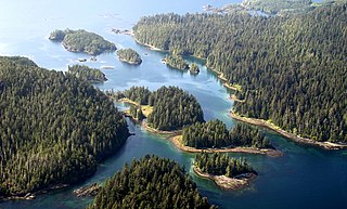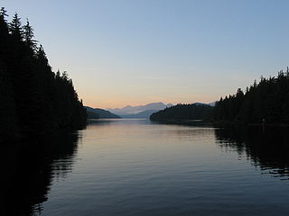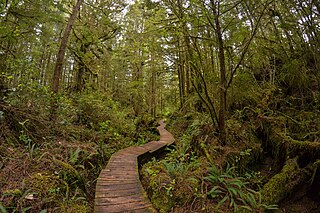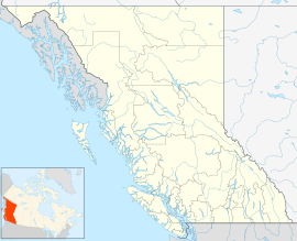
Big Bunsby Marine Provincial Park is a provincial park on the west coast of northern Vancouver Island in British Columbia, Canada, to the southeast of the Brooks Peninsula in Checleset Bay. It is accessible only by boat.

Vargas Island Provincial Park is a provincial park in British Columbia, Canada, comprising the west side of the island of the same name, which is located west of Meares Island and northwest of the resort community of Tofino in the Clayoquot Sound region of the West Coast of Vancouver Island, British Columbia, Canada. The park was created as part of the Clayoquot Land-Use Decision on July 13, 1995 and contains 5,805 hectares, 1,543 hectares of it being upland and 4,262 hectares being foreshore. Also located on Vargas Island, on its north side, is Epper Passage Provincial Park.

Codville Lagoon Marine Provincial Park is a provincial park in British Columbia, Canada, located on the southwest end of King Island. The park was created in 1965 because it is a significant site to the Heiltsuk People. This park, which is approximately 755 ha. in area, has an unmaintained trail to Sagar Lake which has a red sand beach. Created in 1992, it was expanded in 1995 by the incorporation of the former Sugar Lake Provincial Park.
Dawley Passage Provincial Park is a provincial park in British Columbia, Canada, located at the south end of Fortune Channel, which lies between Meares Island and the mainland of Vancouver Island just south. The park is to the north of the resort town of Tofino and is accessible by boat only. It was created on July 13, 1995 as part of the Clayoquot Land-Use Decision and contains 154 ha, .
Epper Passage Provincial Park is a provincial park in British Columbia, Canada, located on the north side of Vargas Island in the Clayoquot Sound region of the West Coast of Vancouver Island, British Columbia, Canada. Also on Vargas Island is Vargas Island Provincial Park. Other provincial parks nearby are Flores Island Marine Provincial Park, Gibson Marine Provincial Park, Maquinna Marine Provincial Park, Sydney Inlet Provincial Park, Dawley Passage Provincial Park and Hesquiat Peninsula Provincial Park. The park was created as part of the Clayoquot Land-Use Decision on July 13, 1995 and contains approximately 306 ha.
Fillongley Provincial Park is a provincial park in British Columbia, Canada, located on the east side of Denman Island, southeast of Courtenay, British Columbia, and facing Georgia Strait.

Flores Island Marine Provincial Park, also known as Flores Island Provincial Park, is a provincial park in British Columbia, Canada, located on the island of the same name in the central Clayoquot Sound region of the West Coast of Vancouver Island, British Columbia, Canada. The park contains 7113 ha. and was created on July 13, 1995, as part of the Clayoqout Land-Use Decision. Gibson Marine Provincial Park, which was created in 1967, adjoins it to the southeast. Sulphur Passage Provincial Park is off the northeast coast of Flores Island, surrounding Obstruction Island.

Gibson Marine Provincial Park is a provincial park in British Columbia, Canada, located on the southeast end of Flores Island in the central Clayoquot Sound region of Vancouver Island. The park was created on 13 November 1967. It contains approximately 143 hectares and is adjacent to Flores Island Provincial Park.
Hardy Island Marine Provincial Park is a provincial park located near the southern tip of the Hardy Island in British Columbia, Canada. The park as created by BC Parks on 6 March 1992 to protect local flora and fauna. The park itself becomes a small island during high tide.

Kitson Island Marine Provincial Park is a provincial park protecting all 45 hectares of Kitson Island and Kitson Islet. The park is located within the asserted traditional territory of the Tsimshian and Metlakatla First Nation, at the mouth of the Skeena River in British Columbia, Canada.

Klewnuggit Inlet Marine Provincial Park is a provincial park in British Columbia, Canada, located on the east side of Grenville Channel, 100 kilometres (62 mi) southeast of Prince Rupert, in the Range 4 Coast Land District.
Lanz and Cox Islands Provincial Park is a provincial park in British Columbia, Canada. It is located off Cape Scott on northern Vancouver Island.

Wakes Cove Provincial Park is a provincial park in the northeast corner of Valdes Island, located in the Gulf Islands in British Columbia, Canada. The park is only accessible by boat, and can be found on Marine Chart #3475 for further navigation details.

Maquinna Marine Provincial Park and Protected Area is a provincial park in British Columbia, Canada, located northwest of Tofino in the Clayoquot Sound region of the West Coast of Vancouver Island, protecting Ramsay Hot Springs, which is the name-source of the cove, settlement and former post office of Hot Springs Cove.
Wallace Island Marine Provincial Park is a provincial park in the Gulf Islands of British Columbia, Canada. The park includes almost all 72 hectares of Wallace Island. Land on the northern side of Princess Cove extending north towards Chivers is private. This long, thin island lies in Trincomali Channel south-west of Galiano Island, and about 2 km (1.2 mi) northeast of Saltspring Island. There are a few hiking trails, and camping is permitted in designated areas.
Weymer Creek Provincial Park, formerly Weymer Creek Karst Provincial Park, is a provincial park located on the west coast of Vancouver Island in British Columbia, Canada, just southeast of the community of Tahsis in the region of Nootka Sound. Its most important feature is its karst topography and some of the deepest caves in Canada. Caving is currently not permitted in the park and visitors to the area are requested to practice "no trace" camping.

Penrose Island Marine Provincial Park is a provincial park in the Central Coast region of British Columbia, Canada, located on the north side of the entrance to Rivers Inlet, 86 km north of Port Hardy at the south end of Fitz Hugh Sound. Comprising 1,079 hectares of marine area and 934 hectares of land area, the park is accessible by boat only and entrance to its anchorages are on its eastern side, the western being exposed to the open ocean. Exploration by dinghy and kayak are popular with visitors, as are nature viewing, scuba diving and exploring the islands many beaches and adjoining islets. The nearest supply centre for fuel and food is at the community of Rivers Inlet.
Spectacle Lake Provincial Park is a provincial park in British Columbia, Canada, comprising c. 54 ha. and located southeast of Shawnigan Lake on southern Vancouver Island.

Tantalus Provincial Park is a provincial park located in the Tantalus Range overlooking Squamish Valley in British Columbia, Canada. It was established on December 19, 1998 to protect a large area of pristine alpine wilderness.
Scott Islands Marine National Wildlife Area is a National Wildlife Area off the northwestern tip of Vancouver Island in British Columbia, Canada. Covering an area of 11,570.65 km (7,189.67 mi), it is the second largest protected area in British Columbia after Offshore Pacific Seamounts and Vents Closure and is the largest national wildlife area in Canada.


