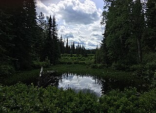
Alice Lake Provincial Park is a provincial park in British Columbia, Canada.
Arrow Lakes Provincial Park is a provincial park in British Columbia, Canada.
Bobtail Mountain Provincial Park is a provincial park in British Columbia, Canada. It was established on June 29, 2000, under the Protected Areas of British Columbia Act.
Big Creek Provincial Park is a provincial park in British Columbia, Canada.

Cowichan River Provincial Park is a provincial park on Vancouver Island in British Columbia, Canada. It includes the Cowichan River in a 750-hectare area stretching almost 20 kilometres, from the village of Lake Cowichan to Glenora, just south of Duncan. Its paths are part of the Trans Canada Trail
Clendinning Provincial Park is a provincial park in British Columbia, Canada. It surrounds the drainage of Clendinning Creek, which is a tributary of the Elaho River. Its name is shared by the Clendinning Range, of which Mount Clendinning is the highest summit.

Eskers Provincial Park is a provincial park in British Columbia, Canada. The park comprises roughly 4,044 hectares and was created in 1987. Located west of Nukko Lake, which lies northwest of the city of Prince George, it protects an area of the 40-kilometre (25 mi) Stuart River Eskers Complex. Eskers are winding ridges of gravel formed by the glaciers which once covered the British Columbia Interior.
Finger-Tatuk Provincial Park is a provincial park in British Columbia, Canada. Established in 1999, it covers 17,151 hectares and includes Finger Lake and Tatuk Lake, as well as several smaller lakes and archaeological sites once used by Dakelh (Carrier) First Nations peoples. The lakes are known for rainbow trout and kokanee salmon, and each of the two larger lakes has a resort.
François Lake Provincial Park is a provincial park in British Columbia, Canada, located at the east end of Francois Lake. Total park area is 7,214 hectares. It is about 12 km off BC Highway 16, southwest of the town of Fraser Lake. There is no potable water at the site so campers should bring their own.
Kluskoil Lake Provincial Park is a provincial park in British Columbia, Canada, located on the West Road River downstream from the Euchiniko Lakes.
Little Andrews Bay Marine Provincial Park is a provincial park in British Columbia, Canada, located on Ootsa Lake in the Nechako Country in that province's Central Interior. It is 102 ha. in size.
Nazko Lake Provincial Park is a provincial park in British Columbia, Canada. It is located at Nazko Lake on the Nazko River.
Uncha Mountain Red Hills Provincial Park is a provincial park in British Columbia, Canada, comprising two parcels of land on the north and south shores of Francois Lake. Total area of the park is 9,421 hectares.
Sechelt Inlets Marine Provincial Park is a provincial park in British Columbia, Canada, at various locations on Sechelt Inlet, Salmon Inlet and Narrows Inlet, near Sechelt. Established initially as a recreation area in 1980, it was converted to a park in 1999, containing approximately 140 hectares.

The Spruce Lake Protected Area, formerly known variously as the Southern Chilcotin Mountains Provincial Park, Southern Chilcotins, and also as South Chilcotin Provincial Park, is a 71,347-hectare Protected Area in the British Columbia provincial parks system, approximately 200 km north of Vancouver. The area had been the subject of an ongoing preservationist controversy since the 1930s. In 2007, its status as a provincial park was downgraded to protected area.

Sugarbowl-Grizzly Den Provincial Park and Protected Area is a provincial park in British Columbia, Canada.
Stuart River Provincial Park is a provincial park in British Columbia, Canada. It is located in two sections north and northwest of Vanderhoof along the Stuart River southeast of Stuart Lake and the city of Fort St. James. The upper section is located at 54°13′20″N124°00′00″W and comprises c.7391 ha. while the lower, eastern section is centred at 54°03′00″N123°37′00″W and comprises c.3390 ha. and is within the Greater Prince George area. The upper site, which is located around the confluence of the Stuart and Nechako Rivers, includes the site of Chinlac, a Dakelh village whose inhabitants were massacred and enslaved by the Tsilhqot'in of Anahim Lake c. 1745.
Three Sisters Lake Provincial Park is a provincial park in British Columbia, Canada, located 35 km southeast of Prince George and northeast of the community of Hixon. In addition the three lakes which are the parks namesake the park protects a unique canyon feature on Government Creek.
The Artificial Reef Society of British Columbia (ARSBC) is a registered non-profit society based in Vancouver, British Columbia (BC), and is a registered tax-deductible charity in Canada.
Little Mac Ski Hill, known as Little Mac, is a community-operated ski area adjacent to Mackenzie, British Columbia, Canada in the northern Rocky Mountain Trench. The area has one tow lift and vertical differential of 90 m (295 ft). The longest run is 210 m (689 ft). In addition to downhill skiing, the hill also has areas for tobogganing and snowboarding. The hill itself is connected to John Dahl Regional Park which features groomed cross-country ski trails and eventually connects to the Mackenzie Recreation Centre. In 2021 an outdoor ice rink was opened in the park and was open to members of the public to use. Though not directly part of the ski area, there are an additional 32 km (20 mi) of groomed and lit cross-country ski trails immediately accessible from the town of Mackenzie, with three specially built warming huts.


