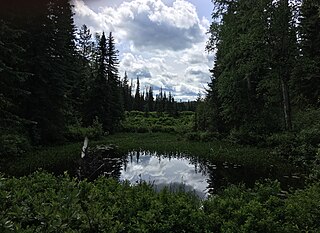
Arrow Lakes Provincial Park is a provincial park in British Columbia, Canada.

Bellhouse Provincial Park is a provincial park in the southern Gulf Islands of British Columbia, Canada. It is located in the Sturdies Bay area of southeastern Galiano Island. It is on land donated by Thorney Bellhouse many in 1964, and is noted for its spring wild flowers, notably fawn lilies and chocolate lilies, as well as views of snow-capped mountains and abundant marine life.
Big Creek Provincial Park is a provincial park in British Columbia, Canada.

Drumbeg Provincial Park is a provincial park on Gabriola Island in British Columbia, Canada.
Downing Provincial Park is a provincial park in British Columbia, Canada, created when Mr. and Mrs. Clair Downing donated their half mile of lake frontage property on Kelly Lake. The park's size, including the 97 acres (0.39 km2) donated by the Downings, is 156 ha. It is located adjacent to the British Columbia Railway line and the Pavilion Mountain Road about 30 km west of Clinton, at the junction with the road to Jesmond and Kostering.
Dahl Lake Provincial Park is a provincial park in British Columbia, Canada. It was established on October 22, 1981, and is currently 1,583 ha in size.

Eskers Provincial Park is a provincial park in British Columbia, Canada. The park comprises roughly 4,044 hectares and was created in 1987. Located west of Nukko Lake, which lies northwest of the city of Prince George, it protects an area of the 40-kilometre (25 mi) Stuart River Eskers Complex. Eskers are winding ridges of gravel formed by the glaciers which once covered the British Columbia Interior.
Erg Mountain Provincial Park is a provincial park in British Columbia, Canada.

French Beach Provincial Park is a provincial park in British Columbia, Canada.
Kluskoil Lake Provincial Park is a provincial park in British Columbia, Canada, located on the West Road River downstream from the Euchiniko Lakes.

Mount Elphinstone Provincial Park is a provincial park in British Columbia, Canada. Located near Mount Elphinstone, the park is on the west side of Howe Sound and north of the town of Gibsons and near the community of Roberts Creek. Created in 2000, the park is approximately 141 hectares in size.
Princess Louisa Marine Provincial Park is a provincial park in British Columbia, Canada surrounding Princess Louisa Inlet.
Roberts Creek Provincial Park is a provincial park in British Columbia, Canada, located northwest of the community of Roberts Creek, between Gibsons and Sechelt. First created in 1947 with an area of 100 acres (0.40 km2), it was modified in size in 2000 to approximately 40 ha.

Ruckle Provincial Park is a provincial park on Salt Spring Island, British Columbia, Canada. It has the largest provincial campground on the Gulf Islands. Partly protected by the park is a historic sheep farm founded by the Ruckle family.
Sargeant Bay Provincial Park, is a provincial park in British Columbia, Canada, located just west of the community of Sechelt on the southern Sunshine Coast. Created in 1990 at 57 ha. in size, the park was expanded to approximately 146 ha. in 1997.

Simson Provincial Park is a provincial park in British Columbia, Canada.
Spipiyus Provincial Park is a 2,979 hectare provincial park in British Columbia, Canada. Also known as the Caren Range, Spipiyus Park is north of Halfmoon Bay on the Sechelt Peninsula. It protects pockets of old-growth forest, prime habitat for the marbled murrelet. There are hiking trails that lead to Mount Hallowell with views of the islands and fjords of Pender Harbour, the Strait of Georgia and Vancouver Island.

Sugarbowl-Grizzly Den Provincial Park and Protected Area is a provincial park in British Columbia, Canada.

Tetrahedron Provincial Park is a provincial park in British Columbia, Canada, located northeast of Sechelt in the Sunshine Coast area of the province. The park was created in 1995. Its highest point is Tetrahedron Peak, at 1727 metres. It also contains Panther Peak, and Mt. Steele
Carcajou Pass is a mountain pass on the Continental Divide and British Columbia–Alberta boundary at the north end of Mount Robson Provincial Park. On the Alberta side lies the northwestern part of Jasper National Park. Carcajou is the French word for "wolverine".


