Arrow Lakes Provincial Park is a provincial park in British Columbia, Canada.

Cherryville is an unincorporated community in the foothills of the Monashee Mountains in British Columbia with a population of approximately 930. It is located 22 kilometres (14 mi) east of Lumby, along Highway 6.
Bonaparte Provincial Park is an 11,811 hectare provincial park in British Columbia, Canada. It is located within the Bonaparte Plateau.
Victor Lake Provincial Park is a provincial park in British Columbia, Canada, located southwest of Revelstoke to the north of Three Valley Lake. It has been closed for several decades due to vandalism.
Echo Lake Provincial Park is a provincial park in British Columbia, Canada, located south-east of Lumby in the Okanagan Highlands, to the south of BC Highway 6.
Flat Lake Provincial Park is a provincial park in British Columbia, Canada. It features a number of interconnected lakes referred to as the "Davis Lake Chain" by locals. The park is located southwest of the municipalities of 100 Mile House and Lone Butte.
Gladstone Provincial Park is a provincial park in British Columbia, Canada, surrounding and north of the north end of Christina Lake in that province's Boundary Country.
Kingfisher Creek Provincial Park is a provincial park in British Columbia, Canada located 15 km southeast of Sicamous and west of Mabel Lake in the Monashee Mountains. The park is 440 hectares and was created to enhance the viability of the Kingfisher Creek Ecological Preserve.

Lockhart Beach Provincial Park is a provincial park Located 40 km north of Creston, British Columbia, Canada, on BC Highway 3A. "This park and the adjacent Lockhart Creek Provincial Park extend 3 hectares, from the sunny shores of Kootenay Lake to the headwaters of Lockhart Creek. "This small park provides the only easy access to public camping along the south arm of Kootenay Lake. An 18-site campground and day-use area are located near a sand and fine gravel beach."
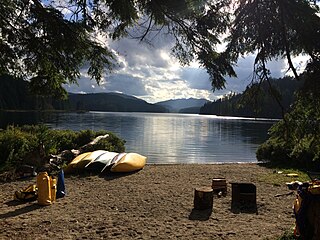
Mabel Lake Provincial Park is a provincial park in the Monashee Mountains of British Columbia, Canada, located on the east side of Mabel Lake, which is part of the Shuswap River system. Created on December 21, 1972, at approximately 182 hectares, the park was expanded in 2000 to approximately 187 hectares.
Main Lake Provincial Park is a provincial park on Quadra Island in British Columbia, Canada. Established in 1996 as Main Lakes Chain Park and renamed and expanded in 1997, the park encompasses a large wilderness area of six lakes with many diverse animal, bird and plant species. Opportunities for visitor observation and outdoor recreation include wilderness camping, canoeing, kayaking and hiking. Main Lake, Village Bay Lake and Mine Lake are connected by narrow, shallow marshes. Clear Lake, Stramberg Lake and Little Main Lake are accessible by hiking or rough portage.

Monck Provincial Park is a provincial park in British Columbia, Canada, located at Nicola Lake near the town of Merritt. The park's campground is one of those which accepts reservations. Activities including fishing, camping and hiking. Natural features other than Nicola Lake include lava beds associated with the Chilcotin Group.
Shuswap Lake Marine Provincial Park is a provincial park in British Columbia, Canada, comprising 894 ha. The Park has a variety of amenities including boat launch ramps, picnic areas, and 27 campsites around the perimeter of Shuswap Lake. The lake's name and that of the surrounding Shuswap Country is from the Shuswap people (Secwepemc), the most northern of the Salishan speaking people.
Skookumchuck Rapids Provincial Park is a provincial park in British Columbia, Canada, located on the Shuswap River just below the outlet of Mabel Lake. This park was established as a result of the Okanagan-Shuswap Land and Resource Management Plan.
There are several lakes named Mud Lake within the Canadian province of Saskatchewan.
The Lytton First Nation, a First Nations band government, has its headquarters at Lytton in the Fraser Canyon region of the Canadian province of British Columbia. While it is the largest of all Nlaka'pamux bands, unlike all other governments of the Nlaka'pamux (Thompson) people, it is not a member of any of the three Nlaka'pamux tribal councils, which are the Nicola Tribal Association, the Fraser Canyon Indian Administration and the Nlaka'pamux Nation Tribal Council.
The Gold Range is a subrange of the Monashee Mountains in the southern British Columbia Interior. This range originally applied to all of the Monashees between the Arrow Lakes and the Okanagan but today only applies to a narrow stretch of the Monashee Mountains' eastern flank adjoining Upper Arrow Lake, west of the upper Shuswap River.
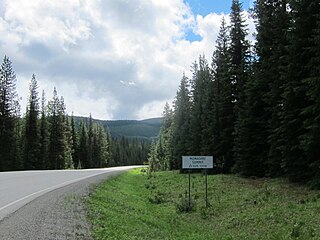
Monashee Pass, 1,189 m (3,901 ft), is a mountain pass in the Monashee Mountains of the Southern Interior of British Columbia, Canada. Located southeast of Cherryville, the pass is used by British Columbia Highway 6 connecting Vernon to Nakusp on Arrow Lake, and beyond to the cities of the West Kootenay. It is the "prominence col" for Big White Mountain, which is the highest mountain to its southwest.
The Sawtooth Range is a subrange of the Shuswap Highland area of the central Monashee Mountains in the Southern Interior of British Columbia, Canada. It is located between Mabel Lake (W) and Sugar Lake (E) and bounded on the south by the upper Shuswap River. Its northern boundary is just south of the Three Valley Gap area of Eagle Pass, which is the route of the Canadian Pacific Railway mainline and the Trans-Canada Highway. To the east, across the uppermost Shuswap River above Sugar Lake, is the Gold Range of the main spine of the Monashees, to which it is connected by the col of Joss Pass. To the west, it is adjoined by the rest of the Shuswap Highland, of which it is a part and is an intermediary mountainous plateau between the Monashees and the northeastern Thompson Plateau.
Joss Pass, 1345 m (4413 ft), is a mountain pass in the central Monashee Mountains of the Southern Interior of British Columbia, Canada. Located just south of the Three Valley Gap area of Eagle Pass, which is the route of the Trans-Canada Highway and the mainline of the Canadian Pacific Railway. It forms the divide between the headwaters of the Shuswap River and those of its eventual tributary Wap Creek, which joins the Shuswap via Mabel Lake. It forms the prominence col for Tsuius Mountain, the highest mountain of the Sawtooth Range, which is part of the Shuswap Highland. It is located just east of Joss Mountain, which is the northernmost peak of the Sawtooths.


