
Arbutus Grove Provincial Park is a 22 hectare provincial park located on Vancouver Island in British Columbia, Canada. It was established on 21 July 1966 to protect a representative strand of Arbutus tree.

Tsʼilʔos Provincial Park is a provincial park in British Columbia, Canada. Tsʼilʔos is the official BC Parks designation for this provincial park, though sometimes it is written as "Ts'il-os", "Ts'yl-os", or "Tsylos". The "ʔ" in the name represents a glottal stop.
Duffey Lake Provincial Park is a provincial park in British Columbia, Canada, located at the lake of the same name, which lies along BC Highway 99 just east of the summit of Cayoosh Pass. The lake's inflow and outflow are Cayoosh Creek. The park's highest point is Mount Rohr at the westernmost boundary.
Davis Lake Provincial Park is a 185 acres (0.75 km2) park in British Columbia, Canada, established as a protected provincial park in October 1963. It is located east of the southern end of Stave Lake, northeast of Mission, British Columbia, approximately 18 km north on Sylvester Rd from BC Highway 7. There are campgrounds and beaches at the south end of the lake, access is walk-in only via a 1 km unmaintained gravel road.

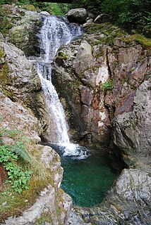
Englishman River Falls Provincial Park is a provincial park in British Columbia, Canada. It is located west of Parksville and borders the small community of Errington on Vancouver Island.
Kakwa Provincial Park and Protected Area is a 170,890 ha provincial park in northeastern British Columbia, Canada. There are significant amounts of fish fossils there. The tallest mountains are Mount Sir Alexander and Mount Ida. Fishing in Kakwa Lake is permitted. Snowmobiling is permitted on trails, meadows, and along mountain sides.

Little Qualicum Falls Provincial Park is a provincial park in British Columbia, Canada, on central Vancouver Island, that encompasses the entire southern shore of Cameron Lake.

Maquinna Marine Provincial Park and Protected Area is a provincial park in British Columbia, Canada, located northwest of Tofino in the Clayoquot Sound region of the West Coast of Vancouver Island, protecting Ramsay Hot Springs, which is the name-source of the cove, settlement and former post office of Hot Springs Cove.

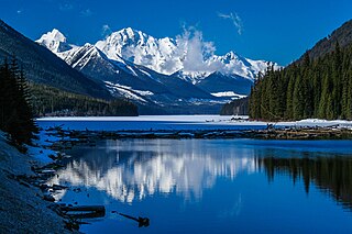
Mount Assiniboine Provincial Park is a provincial park in British Columbia, Canada, located around Mount Assiniboine.
Mount Edziza Provincial Park is a provincial park located in the northern portion of Kitimat-Stikine Regional District in British Columbia, Canada. It was established on 27 July 1972 to protect the volcanic landscape of Mount Edziza and the surrounding Tahltan Highland.
Mount Fernie Provincial Park is a provincial park located just west of the town of Fernie in British Columbia, Canada. It was established on May 4, 1959 to protect the ecology of the lower Lizard River while providing recreational opportunities for local residents and visitors alike. The park is named after Mount Fernie, a prominent peak located north of the park.

Mount Maxwell Provincial Park is a provincial park in the Gulf Islands of British Columbia, Canada. It is located on Burgoyne Bay and the Sansum Narrows on the western shores of Saltspring Island.

Myra-Bellevue Provincial Park is a provincial park in British Columbia, Canada, located in the Okanagan Highland east of Kelowna. It was established to protect the full elevational range of the North Okanagan Basin and North Okanagan Highlands ecosections.
Weymer Creek Provincial Park, formerly Weymer Creek Karst Provincial Park, is a provincial park located on the west coast of Vancouver Island in British Columbia, Canada, just southeast of the community of Tahsis in the region of Nootka Sound. Its most important feature is its karst topography and some of the deepest caves in Canada. Caving is currently not permitted in the park and visitors to the area are requested to practice "no trace" camping.

The Purcell Wilderness Conservancy is a provincial park in British Columbia, Canada. It was established in 1974, and encompasses six large drainages in the Purcell Mountains in the southeast of the province. It contains high peaks, alpine meadows and ridges, deep creek and river valleys, and hot springs at Dewar Creek.
Santa Gertrudis-Boca del Infierno Provincial Park, legally Santa-Boca Provincial Park, is a provincial park on Nootka Island in British Columbia, Canada. It was established on 30 April 1996 to protect and Santa Gertrudis Cove and Boca del Infierno Bay, which are located on the southeastern shore of Nootka Island.
Spatsizi Headwaters Provincial Park is a provincial park in the Stikine Region of British Columbia, Canada. It was established on January 25, 2001 to protect the headwaters of the Spatsizi River while providing recreational facilities for visitors.

Spider Lake Provincial Park is a provincial park located on Vancouver Island in British Columbia, Canada. It was established on June 18, 1981 to protect the ecological integrity of the lake and to provide day use visitors with recreational facilities.
Sustut Provincial Park and Protected Area is a provincial park in British Columbia, Canada, located on the east side of the Sustut River and above the Bear River. Established by order-in-council in 2001, the park has an area of 75,037 ha. The park protects the Hogem Ranges and the Connelly Range and is in the traditional territories of the Tsay Keh Dene First Nation and the Gitxsan First Nation.
Mount Geoffrey Regional Nature Park is regional park in British Columbia, Canada, located on Hornby Island. It covers an area of 303 hectares, including the 330-metre (1,080 ft) summit of Mount Geoffrey, the highest point on the island.

