The Stave River is a tributary of the Fraser, joining it at the boundary between the municipalities of Maple Ridge and Mission, about 35 kilometres (22 mi) east of Vancouver, British Columbia, Canada, in the Central Fraser Valley region.
Bugaboo Provincial Park is a provincial park in British Columbia, Canada, located in the central Purcell Mountains.

Canim Beach Provincial Park is a provincial park in British Columbia, Canada, located at the southwest end of Canim Lake in the Interlakes District of the South Cariboo region, adjacent to the Secwepemc Indian reserve community of Canim Lake, British Columbia just northeast of 100 Mile House. The park was established by Order-in-Council in 1956 and expanded by later legislation in 2000 and 2004 to total a current approximate of 8.2 hectares, 3.6 hectares of upland and 4.6 hectares of foreshore.

Quatsino Provincial Park is a provincial park in British Columbia, Canada, located on Quatsino Sound on northern Vancouver Island. The park was established July 12, 1995 and is 654 hectares in size. The park is 50 kilometres (31 mi) west of Port Hardy, British Columbia and is accessible by rough logging roads or by boat. Quatsino is on a popular kayaking route.
Clendinning Provincial Park is a provincial park in British Columbia, Canada. It surrounds the drainage of Clendinning Creek, which is a tributary of the Elaho River. Its name is shared by the Clendinning Range, of which Mount Clendinning is the highest summit.
Francis Point Provincial Park is a provincial park in British Columbia, Canada, located on the southwest end of the Francis Peninsula, south of the community of Pender Harbour on the west side of the Sechelt Peninsula in the Sunshine Coast region. Established in 2004, the park is 83 ha. in size, 74 ha. of it upland, the other 9 ha. foreshore.
Kootenay Lake Provincial Park is a provincial park in British Columbia, Canada. It encompasses five widely dispersed parks around Kootenay Lake: Kootenay Lake Provincial Park, Kootenay Lake Provincial Park, Kootenay Lake Provincial Park, Kootenay Lake Provincial Park, and Kootenay Lake Provincial Park.
Kianuko Provincial Park is a provincial park in British Columbia, Canada.

Lockhart Beach Provincial Park is a provincial park Located 40 km north of Creston, British Columbia, Canada, on BC Highway 3A. "This park and the adjacent Lockhart Creek Provincial Park extend 3 hectares, from the sunny shores of Kootenay Lake to the headwaters of Lockhart Creek. "This small park provides the only easy access to public camping along the south arm of Kootenay Lake. An 18-site campground and day-use area are located near a sand and fine gravel beach."
Lockhart Creek Provincial Park is a provincial park in British Columbia, Canada, located adjacent to Lockhart Beach Provincial Park, 40 km north of Creston, British Columbia on the east shore of Kootenay Lake.

Pilot Bay Provincial Park is a provincial park in British Columbia, Canada.
Ryan Provincial Park is a provincial park in British Columbia, Canada.
St. Mary's Alpine Provincial Park is a provincial park in British Columbia, Canada. According to the Canadian Ministry of the Environment:
St. Mary’s Alpine Park is a wilderness paradise for the experienced backcountry traveller. Numerous lakes and tarns are tucked against rugged granite cliffs and surrounded by tundra and lingering snowfields. Seven creeks drain the lakes, resulting in numerous waterfalls and cataracts, some as much as 150 metres in height. Experienced hikers, willing to expend considerable effort in bushwhacking and route finding should visit this protected area where few, if any, people will be encountered.
Imtan is a village in As Suwaydā' Governorate, southern Syria. Imtan is located 37 km south-east of the city of As Suwaydā', 1189 meters above sea level in the southern part of Jabal el Druze. According to the Syria Central Bureau of Statistics (CBS), Imtan had a population of 2,495 in the 2004 census.
China Beach is a beach on the west coast of Vancouver Island, British Columbia, Canada, southeast of the town of Port Renfrew. The name is derived from the former name of Uglow Creek, formerly known as China Creek. The beach was formerly the name of a provincial park, now rescinded. It was amalgamated with two other parks in 1996 to establish Juan de Fuca Provincial Park.
The Choquette River is a tributary of the Stikine River, flowing west into that river just north of its confluence with the Iskut. The river is named for Alexander "Buck" Choquette, discoverer of the strike which launched the Stikine Gold Rush and the first non-native settler in the region, who operated a store near here and also for a while the Hudson'a Bay Company post and border station at Stikine, then named Boundary. The Choquette Glacier, at the head of the river and its source, and Mount Choquette are nearby; Mount Johnny in the same region is named for one of Choquette's many sons.

Daugmale Parish is an administrative territorial entity of Ķekava Municipality, Latvia. It was an administrative unit of Riga District. The administrative center is Daugmale village. The territory of Daugmale Parish is defined by law as a part of the region of Semigallia.
Yale First Nation is a First Nations government located at Yale, British Columbia. Yale has 16 distinct reserves stretching from near Sawmill Creek to American Creek, with the most southern reserve situated at Ruby Creek in the District of Kent.
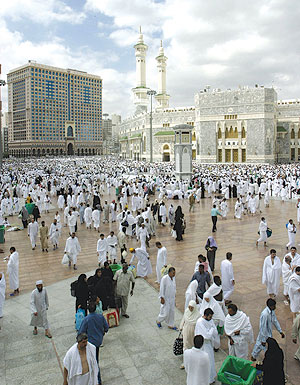
Mecca features a hot desert climate. Mecca retains its hot temperature in winter, which can range from 18 °C (64 °F) at night to 30 °C (86 °F) in the day. Summer temperatures are extremely hot, often being over 40 °C (104 °F) during the day, dropping to 30 °C (86 °F) at night. Rain usually falls in Mecca in small amounts between November and January. The rainfall, as scant as it is, also presents the threat of flooding and has been a danger since the earliest times. According to Al-Kurdī, there had been 89 historic floods by 1965, including several in the period. In the last century the most severe one occurred in 1941. Since then, dams have been constructed to ameliorate the problem.

