Boundary Creek Provincial Park is a provincial park in British Columbia, Canada located south of Greenwood BC in that province's Boundary Country, adjacent to BC Highway 3. The eponymous Boundary Creek flows through the park.
Victor Lake Provincial Park is a provincial park in British Columbia, Canada, located southwest of Revelstoke to the north of Three Valley Lake. It has been closed for several decades due to vandalism.
Christina Lake Provincial Park is a provincial park in British Columbia, Canada. The lake it's on, Christina Lake, is renowned as the warmest lake in Canada.
Echo Lake Provincial Park is a provincial park in British Columbia, Canada, located south-east of Lumby in the Okanagan Highlands, to the south of BC Highway 6.
English Lake Provincial Park is a provincial park in British Columbia, Canada. Located near Revelstoke, British Columbia, English Lake Provincial Park has an area of 337 hectares.
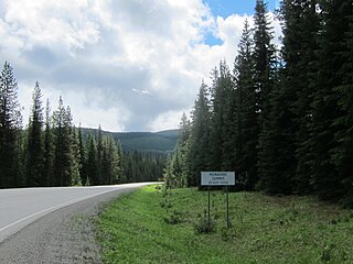
Granby Provincial Park is a provincial park in British Columbia, Canada. It is located north of Grand Forks and contains the northern portion of the Granby River. The park is 411.56 km2 in size.
Kingfisher Creek Provincial Park is a provincial park in British Columbia, Canada located 15 km southeast of Sicamous and west of Mabel Lake in the Monashee Mountains. The park is 440 hectares and was created to enhance the viability of the Kingfisher Creek Ecological Preserve.

Little Qualicum Falls Provincial Park is a provincial park in British Columbia, Canada, on central Vancouver Island, that encompasses the entire southern shore of Cameron Lake. The Island Rail Corridor line to Port Alberni passes through the park.
Mabel Lake Provincial Park is a provincial park in the Monashee Mountains of British Columbia, Canada, located on the east side of Mabel Lake, which is part of the Shuswap River system. Created on December 21, 1972, at approximately 182 hectares, the park was expanded in 2000 to approximately 187 hectares.
McDonald Creek Provincial Park is a provincial park in British Columbia, Canada which located 10 km south of Nakusp along Highway 6 in the Arrow Lakes region. The 468-hectare park is bisected by Upper Arrow Lake and provides beaches, a boat launch, and 73 camping spaces on the eastern shore of the reservoir. Formerly a homesteading site, the area was set aside for recreation in 1982. In 2014, the campground underwent an upgrade, including the installation of a new services including showers and additional camping spaces.

Monashee Provincial Park is a provincial park located just outside of Cherryville, British Columbia, Canada. It is located in the central Monashee Mountains between the Arrow Lakes and the upper Shuswap River drainage, just east of Sugar Lake. It is a remote grizzly habitat that is a walk-in only. Mount Fosthall is the highest peak in the area and can be hiked in a day. In addition to hiking and alpinism other activities include fishing.
Norbury Lake Provincial Park is a 97-hectare (240-acre) provincial park in British Columbia, Canada.

Roberts Memorial Provincial Park is a 14 ha provincial park in British Columbia, Canada, located 15 km south of Nanaimo.
Syringa Park is a provincial park on the east shore of Lower Arrow Lake in the West Kootenay region of southeastern British Columbia. At the foot of the Norns Range, Tulip Creek passes through the centre, and Syringa Creek is closer to the southeastern boundary. The park is about 19 kilometres (12 mi) west of Castlegar via Broadwater Rd.
Skookumchuck Rapids Provincial Park is a provincial park in British Columbia, Canada, located on the Shuswap River just below the outlet of Mabel Lake. This park was established as a result of the Okanagan-Shuswap Land and Resource Management Plan.

Sugarbowl-Grizzly Den Provincial Park and Protected Area is a provincial park in British Columbia, Canada.
The Gold Range is a subrange of the Monashee Mountains in the southern British Columbia Interior. This range originally applied to all of the Monashees between the Arrow Lakes and the Okanagan but today only applies to a narrow stretch of the Monashee Mountains' eastern flank adjoining Upper Arrow Lake, west of the upper Shuswap River.
The Whatshan River is a tributary of the Columbia River in the West Kootenay region of southeastern British Columbia. The river's drainage basin is approximately 390 square kilometres (150 sq mi) in area.
Monashee Pass, 1,189 m (3,901 ft), is a mountain pass in the Monashee Mountains of the Southern Interior of British Columbia, Canada. Located southeast of Cherryville, the pass is used by British Columbia Highway 6 connecting Vernon to Nakusp on Arrow Lake, and beyond to the cities of the West Kootenay. It is the "prominence col" for Big White Mountain, which is the highest mountain to its southwest.

